


Summary
San Jacinto, officially the Municipality of San Jacinto (Pangasinan: Baley na San Jacinto; Ilocano: Ili ti San Jacinto; Tagalog: Bayan ng San Jacinto), is a 3rd class municipality in the province of Pangasinan, Philippines. According to the 2020 census, it has a population of 44,351 people.[4]
San Jacinto | |
|---|---|
| Municipality of San Jacinto | |
 Public market | |
 Seal | |
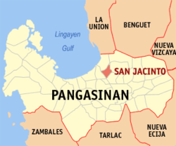 Map of Pangasinan with San Jacinto highlighted | |
OpenStreetMap .mw-parser-output .locmap .od{position:absolute}.mw-parser-output .locmap .id{position:absolute;line-height:0}.mw-parser-output .locmap .l0{font-size:0;position:absolute}.mw-parser-output .locmap .pv{line-height:110%;position:absolute;text-align:center}.mw-parser-output .locmap .pl{line-height:110%;position:absolute;top:-0.75em;text-align:right}.mw-parser-output .locmap .pr{line-height:110%;position:absolute;top:-0.75em;text-align:left}.mw-parser-output .locmap .pv>div{display:inline;padding:1px}.mw-parser-output .locmap .pl>div{display:inline;padding:1px;float:right}.mw-parser-output .locmap .pr>div{display:inline;padding:1px;float:left}html.skin-theme-clientpref-night .mw-parser-output .od,html.skin-theme-clientpref-night .mw-parser-output .od .pv>div,html.skin-theme-clientpref-night .mw-parser-output .od .pl>div,html.skin-theme-clientpref-night .mw-parser-output .od .pr>div{background:#000;color:#fff}html.skin-theme-clientpref-night .mw-parser-output .locmap{filter:grayscale(0.6)}@media(prefers-color-scheme:dark){html.skin-theme-clientpref-os .mw-parser-output .locmap{filter:grayscale(0.6)}html.skin-theme-clientpref-os .mw-parser-output .od,html.skin-theme-clientpref-os .mw-parser-output .od .pv>div,html.skin-theme-clientpref-os .mw-parser-output .od .pl>div,html.skin-theme-clientpref-os .mw-parser-output .od .pr>div{background:#000;color:#fff}}  San Jacinto Location within the Philippines | |
| Coordinates: 16°04′21″N 120°26′28″E / 16.0725°N 120.44111°E | |
| Country | Philippines |
| Region | Ilocos Region |
| Province | Pangasinan |
| District | 4th district |
| Founded | 1598 |
| Named for | St. Hyacinth of Poland |
| Barangays | 19 (see Barangays)[1] |
| Government | |
| • Type | Sangguniang Bayan |
| • Mayor | Leo de Vera |
| • Vice Mayor | Robert O. de Vera |
| • Representative | Christopher P. de Venecia |
| • Municipal Council | Members |
| • Electorate | 28,464 voters (2022) |
| Area | |
| • Total | 44.18 km2 (17.06 sq mi) |
| Elevation | 14 m (46 ft) |
| Highest elevation | 101 m (331 ft) |
| Lowest elevation | 0 m (0 ft) |
| Population (2020 census)[4] | |
| • Total | 44,351 |
| • Density | 1,000/km2 (2,600/sq mi) |
| • Households | 10,348 |
| Economy | |
| • Income class | 3rd municipal income class |
| • Poverty incidence | 13.33 |
| • Revenue | ₱ 145.4 million (2020) |
| • Assets | ₱ 321.3 million (2020) |
| • Expenditure | ₱ 107.8 million (2020) |
| • Liabilities | ₱ 36.18 million (2020) |
| Service provider | |
| • Electricity | Central Pangasinan Electric Cooperative (CENPELCO) |
| Time zone | UTC+8 (PST) |
| ZIP code | 2431 |
| PSGC | 015534000 |
| IDD : area code | +63 (0)75 |
| Native languages | Pangasinan Ilocano Tagalog |
San Jacinto is 26 kilometres (16 mi) from Lingayen and 208 kilometres (129 mi) from Manila.
Etymology edit
Padre Herminigildo Milgar founded the town on August 17, 1598, which was named after Hyacinth of Poland, canonized on April 17, 1594, by Pope Clement VIII.
History edit
San Jacinto became a Municipality in 1601, one of the oldest towns in Pangasinan.[6]
Geography edit
Barangays edit
San Jacinto is politically subdivided into 19 barangays. Each barangay consists of puroks and some have sitios.
- Awai
- Bolo
- Capaoay (Poblacion East)
- Casibong
- Imelda (Decrito)
- Guibel
- Labney
- Magsaysay (Capay)
- Lobong
- Macayug
- Bagong Pag-asa
- San Guillermo (Poblacion West)
- San Jose
- San Juan
- San Roque
- San Vicente
- Santa Cruz
- Santa Maria
- Santo Tomas
Climate edit
| Climate data for San Jacinto, Pangasinan | |||||||||||||
|---|---|---|---|---|---|---|---|---|---|---|---|---|---|
| Month | Jan | Feb | Mar | Apr | May | Jun | Jul | Aug | Sep | Oct | Nov | Dec | Year |
| Mean daily maximum °C (°F) | 31 (88) |
31 (88) |
33 (91) |
34 (93) |
34 (93) |
33 (91) |
32 (90) |
31 (88) |
31 (88) |
32 (90) |
31 (88) |
31 (88) |
32 (90) |
| Mean daily minimum °C (°F) | 21 (70) |
21 (70) |
23 (73) |
25 (77) |
25 (77) |
25 (77) |
25 (77) |
24 (75) |
24 (75) |
24 (75) |
23 (73) |
22 (72) |
24 (74) |
| Average precipitation mm (inches) | 4.3 (0.17) |
19.1 (0.75) |
27.3 (1.07) |
45.2 (1.78) |
153.3 (6.04) |
271.3 (10.68) |
411.1 (16.19) |
532 (20.9) |
364.4 (14.35) |
182.5 (7.19) |
56.3 (2.22) |
24.4 (0.96) |
2,091.2 (82.3) |
| Average rainy days | 3 | 2 | 3 | 5 | 14 | 17 | 22 | 23 | 21 | 13 | 7 | 4 | 134 |
| Source: World Weather Online[7] | |||||||||||||
Demographics edit
| Year | Pop. | ±% p.a. |
|---|---|---|
| 1903 | 5,014 | — |
| 1918 | 6,714 | +1.97% |
| 1939 | 7,853 | +0.75% |
| 1948 | 10,313 | +3.07% |
| 1960 | 13,384 | +2.20% |
| 1970 | 16,583 | +2.16% |
| 1975 | 18,722 | +2.46% |
| 1980 | 20,612 | +1.94% |
| 1990 | 25,722 | +2.24% |
| 1995 | 28,416 | +1.88% |
| 2000 | 32,758 | +3.10% |
| 2007 | 35,591 | +1.15% |
| 2010 | 37,737 | +2.15% |
| 2015 | 40,848 | +1.52% |
| 2020 | 44,351 | +1.63% |
| Source: Philippine Statistics Authority[8][9][10][11] | ||
Religion edit
Parish Church of St. Hyacinth edit

The 1590 Parish Church of St. Hyacinth (Vicariate of Santo Tomas de Aquino, San Jacinto, 2431 Pangasinan, 23,628 Catholics, Feast day, August 17, Parish Priests are Rev. Fr. Victor Embuido)[12] is under the jurisdiction of the Roman Catholic Archdiocese of Lingayen-Dagupan,[13] Roman Catholic Diocese of Urdaneta (Vicariate III: Queen of the Most Holy Rosary).[14][15][16] Its Vicar Forane is Rev. Fr. Genaro A. Herramia.[17]
Father Diego Aduarte accounts that the 1898 Pueblo of San Jacinto existed by virtue of the Dominican capitular acts of 1604 statement that the Ilocanos settled at San Jacinto.[12][18][19]
In 1699, it was granted a resident vicar but later annexed to Manaoag or Mangaldan. As early as 1598, San Jacinto church existed, but in 1719 the 1653 new church was burned paving for the construction of a new one in 1731 whose façade and tower were destroyed by the 1848 and 1892 earthquakes.[15]
Saint Hyacinth of Poland (Hyacinth), (b. ca. 1185 in Kamień Śląski (Ger. Groß Stein) near Opole (Ger. Oppeln), Upper Silesia – d. 15 August 1257) was a Doctor of Sacred Studies and a secular priest, he worked to reform women's monasteries in his native Poland.
Economy edit
The main source of livelihood of the residents include agriculture, construction, poultry, dressing plant, cornhusk weaving, sand and gravel crushing plant and bag-and basket-making. 4th District Rep. Gina de Venecia initiated the Bayong and Corn–Husk Development Project fashioning these waste products into luxurious bags & baskets, and moccasins.
From Manila, you can reach San Jacinto, Pangasinan in 2 hours and 36 minutes without traffic via North Luzon Expressway in the distance of 204 km.
San Jacinto corn husks bayongs under the Jaime Ongpin Foundation replaced plastic bags due to environmental concerns of San Jacinto Weavers Association led by its president, Sixto Aquino. The town Memorandum of Agreement (MOA) granted resident trainings on Basic Bayong Weaving; Dyeing Raw Materials, Skills Upgrading, and Intensive Product Design & Innovations.[27]
Government edit
San Jacinto, belonging to the fourth congressional district of the province of Pangasinan, is governed by a mayor designated as its local chief executive and by a municipal council as its legislative body in accordance with the Local Government Code. The mayor, vice mayor, and the councilors are elected directly by the people through an election which is being held every three years.
The San Jacinto Town hall was constructed from 1959 to 1963. In 2012, it began its (unfinished) renovation.
The Chief Executive of San Jacinto is its Municipal Mayor, Roberto O. Vera with his Municipal Vice Mayor, Hilario de Guzman, jr., with 8 Sangguniang Bayan Councilors who hold offices at the Municipal Town Hall and Legislative Office/Session hall.[29][30]
Elected officials edit
| Position | Name |
|---|---|
| Congressman | Christopher George Martin P. de Venecia |
| Mayor | Leo F. de Vera |
| Vice-Mayor | Robert O. de Vera |
| Councilors | Madison O. Ellasus |
| Virginia B. Zarate | |
| Manuel C. Ogoy | |
| Samuel V. Abaoag | |
| Eva P. Solomon | |
| Virgilio B. Calizo Jr. | |
| Sean Alexis D. Cardozo | |
| Wilfredo M. Barcel |
Education edit
- San Jacinto National High School
- Lobong National High School
- San Jacinto Catholic School (private)
Gallery edit
-
 Town hall (with statue of former President Ramon Magsaysay)
 -
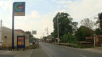 Main road (Barangay Guibel, viewed towards Poblacion)
 -
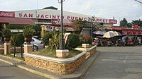 San Jacinto Public Market
 -
 San Jacinto Sports Complex
 -
 Mayor' Gate


References edit
- ^ "Municipalities". Quezon City, Philippines: Department of the Interior and Local Government. Archived from the original on 15 January 2013. Retrieved 26 November 2012.
- ^ Municipality of San Jacinto | (DILG)
- ^ "2015 Census of Population, Report No. 3 – Population, Land Area, and Population Density" (PDF). Philippine Statistics Authority. Quezon City, Philippines. August 2016. ISSN 0117-1453. Archived (PDF) from the original on May 25, 2021. Retrieved July 16, 2021.
- ^ a b Census of Population (2020). "Region I (Ilocos Region)". Total Population by Province, City, Municipality and Barangay. Philippine Statistics Authority. Retrieved 8 July 2021.
- ^ "PSA Releases the 2018 Municipal and City Level Poverty Estimates". Philippine Statistics Authority. 15 December 2021. Retrieved 22 January 2022.
- ^ "San Jacinto | The Official Website of the Province of Pangasinan and its People". pangasinan.gov.ph. Province of Pangasinan. Retrieved 2 June 2017.
- ^ "San Jacinto, Pangasinan: Average Temperatures and Rainfall". World Weather Online. Retrieved 31 October 2015.
- ^ Census of Population (2015). "Region I (Ilocos Region)". Total Population by Province, City, Municipality and Barangay. Philippine Statistics Authority. Retrieved 20 June 2016.
- ^ Census of Population and Housing (2010). "Region I (Ilocos Region)" (PDF). Total Population by Province, City, Municipality and Barangay. National Statistics Office. Retrieved 29 June 2016.
- ^ Censuses of Population (1903–2007). "Region I (Ilocos Region)". Table 1. Population Enumerated in Various Censuses by Province/Highly Urbanized City: 1903 to 2007. National Statistics Office.
{{cite encyclopedia}}: CS1 maint: numeric names: authors list (link) - ^ "Province of Pangasinan". Municipality Population Data. Local Water Utilities Administration Research Division. Retrieved 17 December 2016.
- ^ a b "Vicariate of Sto. Tomas de Aquino". Archived from the original on 2018-07-25.
- ^ "Home". rcald.org. Archived from the original on 2011-09-03.
- ^ "List of Parishes of the Roman Catholic Diocese of Urdaneta | Philippine Churches". Archived from the original on 2014-10-06. Retrieved 2014-10-06.
- ^ a b "Capital of Pangasinan: All Churches in Pangasinan". 18 February 2008.
- ^ "UCA News".
- ^ "Archdiocese of Lingayen-Dagupan". www.claretianpublications.com. Archived from the original on 2014-02-02.
- ^ "Cathedral of Our Lady of the Immaculate Conception".
- ^ "Diocese of Urdaneta". www.cbcponline.net. Archived from the original on 2004-03-27.
- ^ "Poverty incidence (PI):". Philippine Statistics Authority. Retrieved December 28, 2020.
- ^ "Estimation of Local Poverty in the Philippines" (PDF). Philippine Statistics Authority. 29 November 2005.
- ^ "2003 City and Municipal Level Poverty Estimates" (PDF). Philippine Statistics Authority. 23 March 2009.
- ^ "City and Municipal Level Poverty Estimates; 2006 and 2009" (PDF). Philippine Statistics Authority. 3 August 2012.
- ^ "2012 Municipal and City Level Poverty Estimates" (PDF). Philippine Statistics Authority. 31 May 2016.
- ^ "Municipal and City Level Small Area Poverty Estimates; 2009, 2012 and 2015". Philippine Statistics Authority. 10 July 2019.
- ^ "PSA Releases the 2018 Municipal and City Level Poverty Estimates". Philippine Statistics Authority. 15 December 2021. Retrieved 22 January 2022.
- ^ "San Jacinto bayongs eyed as an alternative | Sunday Punch". Archived from the original on 2013-01-31. Retrieved 2012-12-21.
- ^ "Tilapia fingerlings dispersal in San Jacinto | the Official Website of the Province of Pangasinan and its People". Archived from the original on 2016-03-04. Retrieved 2012-12-21.
- ^ "List of Mayors: Information about the list of Mayors in the Philippines". pinas.ph. Philippine Information, Networks, Ads and Services. Retrieved 2 June 2017.
- ^ "2013 Candidates in San Jacinto | List of Candidates for San Jacinto, Pangasinan | Know Your Candidates". www.know-your-candidates.com. Retrieved 2 June 2017.
- ^ "2019 National and Local Elections" (PDF). Commission on Elections. Retrieved March 7, 2022.
External links edit
- San Jacinto Profile at PhilAtlas.com
- Municipal Profile at the National Competitiveness Council of the Philippines
- San Jacinto at the Pangasinan Government Website
- Local Governance Performance Management System
- Philippine Standard Geographic Code
- Philippine Census Information