


Summary
San Jon (/ˌsæn ˈhoʊn/ is a village in Quay County, New Mexico, United States. The population was 216 at the 2010 census.
San Jon, New Mexico | |
|---|---|
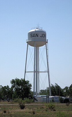 Water tower in San Jon | |
 Location of San Jon, New Mexico | |
 San Jon, New Mexico Location in the United States | |
| Coordinates: 35°6′27″N 103°19′49″W / 35.10750°N 103.33028°W | |
| Country | |
| State | |
| County | Quay |
| Area | |
| • Total | 2.93 sq mi (7.58 km2) |
| • Land | 2.93 sq mi (7.58 km2) |
| • Water | 0.00 sq mi (0.00 km2) |
| Elevation | 4,032 ft (1,229 m) |
| Population | |
| • Total | 195 |
| • Density | 66.60/sq mi (25.71/km2) |
| Time zone | UTC-7 (Mountain (MST)) |
| • Summer (DST) | UTC-6 (MDT) |
| ZIP codes | 88411, 88434 |
| Area code | 575 |
| FIPS code | 35-68150 |
| GNIS feature ID | 0894426 |
History edit
The village was founded in 1902 and grew after the arrival of the railroad in 1904. It was once an important local commercial center and stop on U.S. Route 66 and home to numerous tourist-oriented businesses, such as gasoline service stations, cafes and motels. However, when Interstate 40 bypassed the village in 1981, the local economy went into a decline, leading most of those businesses to shut down. Today, only one motel is still in operation and all of the gas stations and dining establishments are centered around the I-40 interchange on the north side of town. Some former establishments were The Old Route 66 Truck and Auto Parts garage, Smith's Café, and the Circle M Motel.[3]
Geography edit
San Jon is located at 35°6′27″N 103°19′49″W / 35.10750°N 103.33028°W (35.107614, -103.330396).[4]
According to the United States Census Bureau, the village has a total area of 2.6 square miles (6.7 km2), all land.
The village is located on I-40 at New Mexico State Highway 469 and is east of Tucumcari.
-
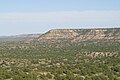 Northern escarpment of the Llano Estacado, located 14 km south of San Jon, Eastern New Mexico
 -
 Road cut south of San Jon on New Mexico State Highway 469 as it crosses the caprock escarpment at the northern edge of the Llano Estacado.
 -
 View of San Jon, looking north from the caprock escarpment of the Llano Estacado
 -
 The lone motel of San Jon, established in 1946.


Climate edit
According to the Köppen Climate Classification system, San Jon has a cold semi-arid climate, abbreviated "BSk" on climate maps. The hottest temperature recorded in San Jon was 111 °F (43.9 °C) on July 11, 2020 and July 13, 2020, while the coldest temperature recorded was −20 °F (−28.9 °C) on January 1, 1919.[5]
| Climate data for San Jon, New Mexico, 1991–2020 normals, extremes 1907–2021 | |||||||||||||
|---|---|---|---|---|---|---|---|---|---|---|---|---|---|
| Month | Jan | Feb | Mar | Apr | May | Jun | Jul | Aug | Sep | Oct | Nov | Dec | Year |
| Record high °F (°C) | 83 (28) |
86 (30) |
91 (33) |
98 (37) |
104 (40) |
110 (43) |
111 (44) |
108 (42) |
105 (41) |
98 (37) |
91 (33) |
80 (27) |
111 (44) |
| Mean maximum °F (°C) | 71.8 (22.1) |
76.2 (24.6) |
83.8 (28.8) |
88.5 (31.4) |
95.9 (35.5) |
103.1 (39.5) |
102.9 (39.4) |
100.8 (38.2) |
96.9 (36.1) |
89.9 (32.2) |
80.7 (27.1) |
72.6 (22.6) |
105.1 (40.6) |
| Mean daily maximum °F (°C) | 54.9 (12.7) |
59.4 (15.2) |
67.5 (19.7) |
75.2 (24.0) |
83.9 (28.8) |
93.4 (34.1) |
95.3 (35.2) |
93.3 (34.1) |
86.8 (30.4) |
75.9 (24.4) |
64.1 (17.8) |
54.5 (12.5) |
75.3 (24.1) |
| Daily mean °F (°C) | 40.2 (4.6) |
43.9 (6.6) |
51.6 (10.9) |
59.2 (15.1) |
68.3 (20.2) |
77.7 (25.4) |
81.0 (27.2) |
79.2 (26.2) |
72.3 (22.4) |
60.7 (15.9) |
49.1 (9.5) |
40.3 (4.6) |
60.3 (15.7) |
| Mean daily minimum °F (°C) | 25.5 (−3.6) |
28.4 (−2.0) |
35.6 (2.0) |
43.2 (6.2) |
52.6 (11.4) |
62.1 (16.7) |
66.6 (19.2) |
65.2 (18.4) |
57.9 (14.4) |
45.4 (7.4) |
34.2 (1.2) |
26.0 (−3.3) |
45.2 (7.3) |
| Mean minimum °F (°C) | 8.9 (−12.8) |
11.8 (−11.2) |
17.6 (−8.0) |
26.8 (−2.9) |
36.6 (2.6) |
50.6 (10.3) |
58.4 (14.7) |
56.9 (13.8) |
43.1 (6.2) |
27.9 (−2.3) |
16.7 (−8.5) |
7.7 (−13.5) |
3.9 (−15.6) |
| Record low °F (°C) | −20 (−29) |
−19 (−28) |
−9 (−23) |
8 (−13) |
21 (−6) |
35 (2) |
48 (9) |
45 (7) |
30 (−1) |
11 (−12) |
−5 (−21) |
−15 (−26) |
−20 (−29) |
| Average precipitation inches (mm) | 0.66 (17) |
0.43 (11) |
1.09 (28) |
1.09 (28) |
1.77 (45) |
2.14 (54) |
2.69 (68) |
2.42 (61) |
1.40 (36) |
1.73 (44) |
0.72 (18) |
0.82 (21) |
16.96 (431) |
| Average snowfall inches (cm) | 4.3 (11) |
1.8 (4.6) |
2.1 (5.3) |
0.9 (2.3) |
0.1 (0.25) |
0.0 (0.0) |
0.0 (0.0) |
0.0 (0.0) |
0.0 (0.0) |
0.5 (1.3) |
2.0 (5.1) |
5.4 (14) |
17.1 (43.85) |
| Average precipitation days (≥ 0.01 in) | 2.7 | 2.4 | 3.2 | 3.2 | 4.7 | 6.1 | 6.7 | 7.2 | 4.6 | 3.8 | 2.7 | 3.4 | 50.7 |
| Average snowy days (≥ 0.1 in) | 1.4 | 1.0 | 0.6 | 0.4 | 0.0 | 0.0 | 0.0 | 0.0 | 0.0 | 0.2 | 0.7 | 2.1 | 6.4 |
| Source 1: NOAA[6] | |||||||||||||
| Source 2: National Weather Service[5] | |||||||||||||
Demographics edit
| Census | Pop. | Note | %± |
|---|---|---|---|
| 1950 | 362 | — | |
| 1960 | 411 | 13.5% | |
| 1970 | 308 | −25.1% | |
| 1980 | 341 | 10.7% | |
| 1990 | 277 | −18.8% | |
| 2000 | 306 | 10.5% | |
| 2010 | 216 | −29.4% | |
| 2020 | 195 | −9.7% | |
| U.S. Decennial Census[7][2] | |||
As of the census[8] of 2000, there were 306 people, 118 households, and 82 families residing in the village. The population density was 116.5 inhabitants per square mile (45.0/km2). There were 133 housing units at an average density of 50.6 per square mile (19.5/km2). The racial makeup of the village was 87.91% White, 1.63% Native American, 6.54% from other races, and 3.92% from two or more races. Hispanic or Latino of any race were 32.03% of the population.
There were 118 households, out of which 37.3% had children under the age of 18 living with them, 56.8% were married couples living together, 12.7% had a female householder with no husband present, and 29.7% were non-families. 28.0% of all households were made up of individuals, and 14.4% had someone living alone who was 65 years of age or older. The average household size was 2.59 and the average family size was 3.24.
In the village, the population was spread out, with 30.7% under the age of 18, 5.9% from 18 to 24, 24.5% from 25 to 44, 21.9% from 45 to 64, and 17.0% who were 65 years of age or older. The median age was 36 years. For every 100 females, there were 74.9 males. For every 100 females age 18 and over, there were 78.2 males.
The median income for a household in the village was $22,917, and the median income for a family was $27,000. Males had a median income of $30,000 versus $16,607 for females. The per capita income for the village was $11,592. About 14.3% of families and 16.8% of the population were below the poverty line, including 26.7% of those under the age of eighteen and 13.6% of those 65 or over.
References edit
- ^ "ArcGIS REST Services Directory". United States Census Bureau. Retrieved October 12, 2022.
- ^ a b "Census Population API". United States Census Bureau. Retrieved October 12, 2022.
- ^ Hinkley, Jim (2011). Ghost Towns of Route 66. Minneapolis: Voyageur Press. pp. 94, 98–99. ISBN 978-0-7603-3843-8.
- ^ "US Gazetteer files: 2010, 2000, and 1990". United States Census Bureau. February 12, 2011. Retrieved April 23, 2011.
- ^ a b "NOAA Online Weather Data – NWS Albuquerque". National Weather Service. Retrieved May 7, 2023.
- ^ "U.S. Climate Normals Quick Access – Station: San Jon, NM". National Oceanic and Atmospheric Administration. Retrieved May 7, 2023.
- ^ "Census of Population and Housing". Census.gov. Retrieved June 4, 2015.
- ^ "U.S. Census website". United States Census Bureau. Retrieved January 31, 2008.
External links edit
- Old San Jon