


Summary
San Jose, officially the Municipality of San Jose (Tagalog: Bayan ng San Jose), is a 1st class municipality in the province of Batangas, Philippines. According to the 2020 census, it has a population of 79,868 people.[4]
San Jose | |
|---|---|
| Municipality of San Jose | |
  From Top: Town Proper, Welcome Landmark | |
 Flag  Seal | |
| Nickname: Egg Basket of the Philippines[1] | |
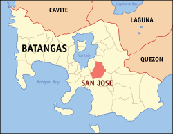 Map of Batangas with San Jose highlighted | |
OpenStreetMap .mw-parser-output .locmap .od{position:absolute}.mw-parser-output .locmap .id{position:absolute;line-height:0}.mw-parser-output .locmap .l0{font-size:0;position:absolute}.mw-parser-output .locmap .pv{line-height:110%;position:absolute;text-align:center}.mw-parser-output .locmap .pl{line-height:110%;position:absolute;top:-0.75em;text-align:right}.mw-parser-output .locmap .pr{line-height:110%;position:absolute;top:-0.75em;text-align:left}.mw-parser-output .locmap .pv>div{display:inline;padding:1px}.mw-parser-output .locmap .pl>div{display:inline;padding:1px;float:right}.mw-parser-output .locmap .pr>div{display:inline;padding:1px;float:left}html.skin-theme-clientpref-night .mw-parser-output .od,html.skin-theme-clientpref-night .mw-parser-output .od .pv>div,html.skin-theme-clientpref-night .mw-parser-output .od .pl>div,html.skin-theme-clientpref-night .mw-parser-output .od .pr>div{background:#000;color:#fff}html.skin-theme-clientpref-night .mw-parser-output .locmap{filter:grayscale(0.6)}@media(prefers-color-scheme:dark){html.skin-theme-clientpref-os .mw-parser-output .locmap{filter:grayscale(0.6)}html.skin-theme-clientpref-os .mw-parser-output .od,html.skin-theme-clientpref-os .mw-parser-output .od .pv>div,html.skin-theme-clientpref-os .mw-parser-output .od .pl>div,html.skin-theme-clientpref-os .mw-parser-output .od .pr>div{background:#000;color:#fff}}  San Jose Location within the Philippines | |
| Coordinates: 13°52′38″N 121°06′18″E / 13.8772°N 121.105°E | |
| Country | Philippines |
| Region | Calabarzon |
| Province | Batangas |
| District | 4th district |
| Founded | April 26, 1765 |
| Named for | Saint Joseph |
| Barangays | 33 (see Barangays) |
| Government | |
| • Type | Sangguniang Bayan |
| • Mayor | Valentino R. Patron |
| • Vice Mayor | Renji A. Arcilla |
| • Representative | Lianda B. Bolilia |
| • Municipal Council | Members |
| • Electorate | 53,450 voters (2022) |
| Area | |
| • Total | 53.29 km2 (20.58 sq mi) |
| Elevation | 191 m (627 ft) |
| Highest elevation | 947 m (3,107 ft) |
| Lowest elevation | 5 m (16 ft) |
| Population (2020 census)[4] | |
| • Total | 79,868 |
| • Density | 1,500/km2 (3,900/sq mi) |
| • Households | 20,518 |
| Economy | |
| • Income class | 1st municipal income class |
| • Poverty incidence | 9.24 |
| • Revenue | ₱ 280.9 million (2020) |
| • Assets | ₱ 906.7 million (2020) |
| • Expenditure | ₱ 241.3 million (2020) |
| • Liabilities | ₱ 129.1 million (2020) |
| Service provider | |
| • Electricity | Batangas 2 Electric Cooperative (BATELEC 2) |
| Time zone | UTC+8 (PST) |
| ZIP code | 4227 |
| PSGC | 041022000 |
| IDD : area code | +63 (0)43 |
| Native languages | Tagalog |
The municipality is bounded in the north and north-east by Lipa, east by Ibaan, south by Batangas City and San Pascual, and west by Cuenca and Alitagtag.
History edit
The Aetas were the first inhabitants of the place. They started clearing some portions of the wilderness especially in areas near the riverbanks. Several groups of settlers then drove this Aetas to the hinterlands and permanently occupied the place. They named it “Malaquing Tubig” which literally translates to "big river" referring to body of water that cuts through the central portion of their early settlement.
The Spaniards then colonized the Philippines in 1565. Bauan was established in 1596 as an ecclesiastical unit administered by the order of Saint Agustin with Malaquing Tubig as one of the barrios under its jurisdiction.
Human population of Malaquing Tubig started to grow and in 1754, Taal Volcano erupted destroying the original Bauan. And before its actual site could have been selected, Malaking Tubig was separated from Bauan. The recognized leaders of Malaquing Tubig then petitioned to the Spanish authorities for the creation of that place as a pueblo which was granted to them on April 26, 1765.
Established on April 26, 1765, as the town of San José de Malaquing Tubig, it once formed part of Bauan, and in the new town's establishment, it originally included the land that now makes up the Municipality of Cuenca.
Geography edit
San Jose is located at 13°52′38″N 121°06′18″E / 13.8772°N 121.105°E.
According to the Philippine Statistics Authority, the municipality has a land area of 53.29 square kilometres (20.58 sq mi) [6] constituting 1.71% of the 3,119.75-square-kilometre- (1,204.54 sq mi) total area of Batangas.
San Jose is 15 kilometres (9.3 mi) from Batangas City and 90 kilometres (56 mi) from Manila.
Barangays edit
San Jose is politically subdivided into 33 barangays.[7] Each barangay consists of puroks and some have sitios.
| PSGC | Barangay | Population | ±% p.a. | |||
|---|---|---|---|---|---|---|
| 2020[4] | 2010[8] | |||||
| 041022001 | Aguila | 3.3% | 2,664 | 2,364 | 1.20% | |
| 041022002 | Anus | 1.4% | 1,150 | 959 | 1.83% | |
| 041022003 | Aya | 4.4% | 3,548 | 3,181 | 1.10% | |
| 041022004 | Bagong Pook | 1.4% | 1,079 | 926 | 1.54% | |
| 041022005 | Balagtasin | 4.4% | 3,553 | 3,257 | 0.87% | |
| 041022006 | Balagtasin I | 1.8% | 1,399 | 1,297 | 0.76% | |
| 041022007 | Banaybanay I | 8.0% | 6,418 | 5,742 | 1.12% | |
| 041022008 | Banaybanay II | 5.2% | 4,135 | 3,679 | 1.18% | |
| 041022009 | Bigain I | 2.9% | 2,327 | 2,129 | 0.89% | |
| 041022010 | Bigain II | 1.5% | 1,180 | 1,094 | 0.76% | |
| 041022011 | Calansayan | 5.3% | 4,214 | 3,795 | 1.05% | |
| 041022012 | Dagatan | 3.5% | 2,822 | 2,385 | 1.70% | |
| 041022013 | Don Luis | 2.4% | 1,951 | 1,748 | 1.10% | |
| 041022014 | Galamay‑Amo | 7.1% | 5,702 | 4,986 | 1.35% | |
| 041022015 | Lalayat | 3.1% | 2,462 | 2,226 | 1.01% | |
| 041022016 | Lapolapo I | 2.4% | 1,892 | 1,689 | 1.14% | |
| 041022017 | Lapolapo II | 2.9% | 2,345 | 2,130 | 0.97% | |
| 041022018 | Lepute | 1.0% | 807 | 755 | 0.67% | |
| 041022019 | Lumil | 3.9% | 3,119 | 2,800 | 1.08% | |
| 041022020 | Natunuan | 2.2% | 1,787 | 1,620 | 0.99% | |
| 041022021 | Palanca | 2.4% | 1,878 | 1,741 | 0.76% | |
| 041022022 | Pinagtung‑Ulan | 5.5% | 4,398 | 3,989 | 0.98% | |
| 041022023 | Poblacion Barangay I | 0.3% | 228 | 278 | −1.96% | |
| 041022024 | Poblacion Barangay II | 0.6% | 491 | 502 | −0.22% | |
| 041022025 | Poblacion Barangay III | 0.3% | 279 | 318 | −1.30% | |
| 041022026 | Poblacion Barangay IV | 0.4% | 339 | 385 | −1.26% | |
| 041022027 | Sabang | 2.0% | 1,592 | 1,237 | 2.55% | |
| 041022028 | Salaban | 2.0% | 1,583 | 1,322 | 1.82% | |
| 041022029 | Santo Cristo | 3.5% | 2,762 | 2,477 | 1.09% | |
| 041022030 | Mojon‑Tampoy | 2.9% | 2,355 | 1,860 | 2.39% | |
| 041022031 | Taysan | 4.6% | 3,654 | 3,090 | 1.69% | |
| 041022032 | Tugtug | 2.2% | 1,765 | 1,554 | 1.28% | |
| 041022033 | Bigain South | 1.4% | 1,093 | 1,002 | 0.87% | |
| Total | 79,868 | 68,517 | 1.54% | |||
Climate edit
| Climate data for San Jose, Batangas | |||||||||||||
|---|---|---|---|---|---|---|---|---|---|---|---|---|---|
| Month | Jan | Feb | Mar | Apr | May | Jun | Jul | Aug | Sep | Oct | Nov | Dec | Year |
| Mean daily maximum °C (°F) | 27 (81) |
28 (82) |
30 (86) |
31 (88) |
30 (86) |
29 (84) |
28 (82) |
27 (81) |
27 (81) |
28 (82) |
28 (82) |
27 (81) |
28 (83) |
| Mean daily minimum °C (°F) | 18 (64) |
18 (64) |
19 (66) |
21 (70) |
23 (73) |
23 (73) |
23 (73) |
23 (73) |
23 (73) |
21 (70) |
20 (68) |
19 (66) |
21 (69) |
| Average precipitation mm (inches) | 11 (0.4) |
13 (0.5) |
14 (0.6) |
32 (1.3) |
101 (4.0) |
142 (5.6) |
208 (8.2) |
187 (7.4) |
175 (6.9) |
131 (5.2) |
68 (2.7) |
39 (1.5) |
1,121 (44.3) |
| Average rainy days | 5.2 | 5.0 | 7.4 | 11.5 | 19.8 | 23.5 | 27.0 | 25.9 | 25.2 | 23.2 | 15.5 | 8.3 | 197.5 |
| Source: Meteoblue[9] | |||||||||||||
Demographics edit
| Year | Pop. | ±% p.a. |
|---|---|---|
| 1903 | 8,996 | — |
| 1918 | 11,074 | +1.40% |
| 1939 | 12,197 | +0.46% |
| 1948 | 14,645 | +2.05% |
| 1960 | 18,675 | +2.05% |
| 1970 | 24,450 | +2.73% |
| 1975 | 25,757 | +1.05% |
| 1980 | 28,743 | +2.22% |
| 1990 | 38,680 | +3.01% |
| 1995 | 43,886 | +2.39% |
| 2000 | 51,965 | +3.69% |
| 2007 | 61,307 | +2.31% |
| 2010 | 68,517 | +4.13% |
| 2015 | 76,971 | +2.24% |
| 2020 | 79,868 | +0.73% |
| Source: Philippine Statistics Authority[10][8][11][12] | ||
In the 2020 census, San Jose had a population of 79,868.[4] The population density was 1,500 inhabitants per square kilometre (3,900/sq mi).
Economy edit
San Jose is well known for growing good varieties of coffee, lanzones, and black pepper. It is where a great number of poultry and piggery animals are grown and sold, especially to Metro Manila, where it supplies a significant percentage of poultry products.[1] Most of the San Jose workforce is either directly or indirectly involved in farming. There are also numerous feedmill corporations within its jurisdiction which include WhiteGold, Everlast, Busilac, Wincom, New Golden Mix.
Government edit
List of former Municipal Executives edit

Although currently called "Mayor", the Municipal Executive of San Jose has held other names including Gobernadorcillo which means "Governor" during the Spanish Period.
- Ignacio de los Santos (1767)
- Juan Bautista (1768)
- Juan Enrico (1769)
- Juan Masilang (1770)
- Jose Antonio (1771)
- Luis Isidro (1772 )
- Jose de la Cruz (1773)
- Ignacio de Mercado (1774)
- Domingo de los Santos (1775)
- Juan Magonza (1776)
- Miguel de los Santos (1777)
- Francisco Domingo (1778)
- Laureano Marquez (1779)
- Policarpio Kaponpon (1780)
- Francisco Aguila (1781)
- Antonio Robles (1782)
- Felipe Aguila (1783)
- Nicolas de los Santos (1784)
- Lorenzo Quizon (1785)
- Agustin Aguila (1786)
- Gabriel de Mercado (1787)
- Pedro Umali (1788)
- Domingo Dimaculangan (1789)
- Lucio Hernandez (1790)
- Bernardo Umali (1791)
- Ignacio de la Cruz (1792)
- Agustin de la Cruz (1793)
- Laureano Bautista (1794)
- Pascual Madlangbayan (1795)
- Martin Marquez (1796)
- Gregorio Morales (1797)
- Andres de Leon (1798)
- Diego Robles (1799)
- Hilario Mandigma (1800)
- Gregorio Leionardo (1801)
- Victoriano Isidro (1802)
- Pablo de los Santos (1803)
- Fulgencio Quizon (1804)
- Cristobal de los Santos (1805)
- Juan Tecson (1806)
- Nicolas Lopez (1807)
- Jose de la Cruz (1808)
- Mariano Tiburcio (1809)
- Jose Bautista (1810)
- Valentin Mercado (1811)
- Remigio Dimaculangan (1812)
- Tomas Quizon (1813)
- Cosme Bautista (1814)
- Santiago Castillo (1815)
- Apolinario Aguila (1816)
- Juan de la Cruz (1817)
- Patricio Virtucio (1818)
- Joaquin Enrico (1819)
- Francisco Quizon (1820)
- Juan Mercado (1821)
- Jose Marquez (1822)
- Martin de los Santos (1822)
- Manuel Mercado (1823)
- Bernabe Virtucio (1823)
- Timoteo Tiburcio (1824)
- Florentino Mendoza (1824)
- Juan Mendoza (1825)
- Hilario Aguila (1826)
- Lucas Hernandez (1827)
- Vicente Isidro (1828)
- Juan Quizon (1829)
- Carlos Mercado (1830)
- Esteban de la Cruz (1831)
- Bernardino Hernandez (1832)
- Geronimo Marquez (1833)
- Juan Marquez (1834)
- Hilario Aguila (1835)
- Felipe Aguila (1836)
- Agustin Quizon (1837)
- Vicente Bautista (1838)
- Romualdo de Ocampo (1839)
- Fernando de los Santos (1840)
- Jose de Villa (1841)
- Hilario Aguila (1842)
- Hilario Aguila (1843)
- Vicente Umali (1844)
- Segundo Leonardo (1845)
- Agaton Hernandez (1846)
- Pedro Quizon (1847)
- Juan Macalinga (1848)
- Julian Mitra (1849)
- Braulio de Luna (1850)
- Juan Javier (1851)
- Manuel Aguila (1852)
- Pascual Aguila (1853)
- Laureano Hernandez (1854)
- Ubaldo Hernandez (1855)
- Jose Ona y Gana (1856)
- Antonio Magpantay (1857)
- Manuel de Luna (1858)
- Francisco de Luna (1859)
- Bonifacio Robles (1860)
- Roman Ona y Ramos (1861)
- Pascual Aguila (1862)
- Nicolas de Villa (1863–64)
- Briccio Makalintal (1865–68)
- Camilio Aguila (1869–70)
- Baltazar Mercado (1871–72)
- Basilio Gozos (1873–74)
- Telesforo Hernandez (1875–76)
- Jorge Umali (1877–78)
- Simon Lopez (1879–80)
- Baltazar Mercado (1881–82)
- Andres Umali (1883–84)
- Isidro Marquez (1885–86)
- Remigio Aguila (1887–88)
- Rafael de Luna (1889)
- Ventura Aguila (1890–91)
- Salvador Aguila (1892–94)
- Juan Oblea (1895–1896)
- Ambrosio Makalintal (1897–98)
- Rafael de Luna (1899)
- Fernando Aguila (1900)
- Ambrosio Makalintal 1901-2
- Agaton Marquez (1903)
- Fernando Aguila (1904–5)
- Roman Kalalo (1906–7)
- Fernando Aguila (1908–9)
- Mariano de Villa (1910–11)
- Fernando Aguila (1912–14)
- Manuel Makalintal (1915)
- Fernando Aguila (1916)
- Paterno Aguila (1917–18)
- Vitaliano Luna (1919–21)
- Manuel Makalintal (1922–24)
- Daniel Luna (1925–27)
- Jose de Villa (1928–30)
- Fernando Aguila (1931–37)
- Vitaliano Luna (1938–40)
- Fernando Aguila (1941)
- Roman Kalalo (1942)
- Venancio Q. Remo (1943-45)
- Timoteo Alday (1946–47)
- Bonifacio Masilungan (1948–58)
- Primo Vergara (1959)
- Miguel Ambal Sr. (1960–63)
- Leonardo Ona Sr. (1964–67)
- Miguel Ambal Sr. (1968–72)
- Vicente Briones Kalalo (1972–1986)
- Edgardo Umali (1986–1987)
- Antonio Alday (1988–1992)
- Edgardo Umali (1992–2001)
- Ruben Guce (2001–2010)
- Entiquio Briones (2010–2016)
- Valentino Patron (2016–present)
Tourism edit

The Shrine of Saint Joseph the Patriarch located in the town proper is a popular Catholic pilgrimage site. It was once built with cogon and bamboo by Augustinian friars around 1788. The present structure was built on 1812 under the supervision of a botanist Fr. Manuel Blanco. It has single-aisled interior which offers an unobstructed view of the large main altar. The altar is massive, with six rounded columns encircling the image of Saint Joseph. Outside a multi-tiered belfry stands which was built in the latter part of the 19th century; a bridge offers passage to the church over the Malaquing Tubig River.
San Jose is also home to the Oblates of Saint Joseph Mission and its Minor Seminary, founded by the Saint Joseph Marello. The Oblates were the first Italian congregation to send missionaries to the Philippines. San Jose became their first foreign mission, and is the center of the Vicariate X of the Archdiocese of Lipa.
San Jose celebrates Sinuam Festival every 25th day of April to commemorate its founding anniversary and to thank its patron for the good performance of the main business in the town which is Poultry.
Notable personalities edit
- Querube C. Makalintal – Chief Justice of The Supreme Court (1973–1976), Speaker of the Batasang Pambansa (1978–1984) and Solicitor General (1954).
- Jose C. Aguila – Division Superintendent of Schools (Abra, Nueva Vizcaya, La Union, Laguna, Pampanga, Batangas and Iloilo), first Filipino principal of Ilocos Norte National High School, Military Governor of Nueva Vizcaya in 1942 (Lt. Col. in the Fil-Am Guerilla Unit, USAFFE), served as a municipal treasurer in retirement. Assigned many San Jose residents to teaching posts in the various provinces he administered as superintendent for over twenty years.[citation needed]
References edit
- ^ a b Baconguis, Rowena T. (July 2007). "Extension Delivery System in a Layer and Swine-Based Farming Community: The Case of San Jose, Batangas" (PDF). Philippine Institute for Development Studies. Retrieved 10 December 2016.
- ^ Municipality of San Jose | (DILG)
- ^ "2015 Census of Population, Report No. 3 – Population, Land Area, and Population Density" (PDF). Philippine Statistics Authority. Quezon City, Philippines. August 2016. ISSN 0117-1453. Archived (PDF) from the original on May 25, 2021. Retrieved July 16, 2021.
- ^ a b c d Census of Population (2020). "Region IV-A (Calabarzon)". Total Population by Province, City, Municipality and Barangay. Philippine Statistics Authority. Retrieved 8 July 2021.
- ^ "PSA Releases the 2018 Municipal and City Level Poverty Estimates". Philippine Statistics Authority. 15 December 2021. Retrieved 22 January 2022.
- ^ "Province: Batangas". PSGC Interactive. Quezon City, Philippines: Philippine Statistics Authority. Retrieved 12 November 2016.
- ^ "Municipal: San Jose, Batangas". PSGC Interactive. Quezon City, Philippines: Philippine Statistics Authority. Retrieved 8 January 2016.
- ^ a b Census of Population and Housing (2010). "Region IV-A (Calabarzon)" (PDF). Total Population by Province, City, Municipality and Barangay. National Statistics Office. Retrieved 29 June 2016.
- ^ "San Jose: Average Temperatures and Rainfall". Meteoblue. Retrieved 5 May 2020.
- ^ Census of Population (2015). "Region IV-A (Calabarzon)". Total Population by Province, City, Municipality and Barangay. Philippine Statistics Authority. Retrieved 20 June 2016.
- ^ Censuses of Population (1903–2007). "Region IV-A (Calabarzon)". Table 1. Population Enumerated in Various Censuses by Province/Highly Urbanized City: 1903 to 2007. National Statistics Office.
{{cite encyclopedia}}: CS1 maint: numeric names: authors list (link) - ^ "Province of Batangas". Municipality Population Data. Local Water Utilities Administration Research Division. Retrieved 17 December 2016.
- ^ "Poverty incidence (PI):". Philippine Statistics Authority. Retrieved December 28, 2020.
- ^ "Estimation of Local Poverty in the Philippines" (PDF). Philippine Statistics Authority. 29 November 2005.
- ^ "2003 City and Municipal Level Poverty Estimates" (PDF). Philippine Statistics Authority. 23 March 2009.
- ^ "City and Municipal Level Poverty Estimates; 2006 and 2009" (PDF). Philippine Statistics Authority. 3 August 2012.
- ^ "2012 Municipal and City Level Poverty Estimates" (PDF). Philippine Statistics Authority. 31 May 2016.
- ^ "Municipal and City Level Small Area Poverty Estimates; 2009, 2012 and 2015". Philippine Statistics Authority. 10 July 2019.
- ^ "PSA Releases the 2018 Municipal and City Level Poverty Estimates". Philippine Statistics Authority. 15 December 2021. Retrieved 22 January 2022.
External links edit
- Philippine Standard Geographic Code
- . New International Encyclopedia. 1905.