


Summary
San Mateo Peak is the unofficially named 3,591-foot (1,095 m) peak, at the western end of the ridge running west then northwest from Elsinore Peak to Morrell Canyon, south and west of the Morrell Potrero in the Elsinore Mountains of the Santa Ana Mountain Range. The peak name was given by Sierra Club Lower Peaks Committee Guide, originally named by Ken Croker who for 20 years maintained trails in the Santa Ana Mountains with volunteers from the Sierra Club.[3] It remains officially nameless despite being the highest summit in the Elsinore Mountains, higher than Elsinore Peak, at 3536 ft., the highest named peak in those mountains.[2]
| San Mateo Peak | |
|---|---|
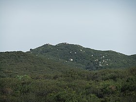 San Mateo Peak seen from the northeast at Morgan Trail-head. | |
| Highest point | |
| Elevation | 3,591 ft (1,095 m)[1][2] |
| Listing | Sierra Club, Lower Peaks Committee[1] |
| Coordinates | 33°36′47″N 117°22′44″W / 33.61306°N 117.37889°W[2] |
| Geography | |
 San Mateo Peak Location in California | |
| Location | Riverside County, California, U.S. |
| Parent range | Elsinore Mountains, Santa Ana Mountain Range |
| Topo map | USGS Sitton Peak, CA |
| Geology | |
| Mountain type | Granitic |
| Climbing | |
| Easiest route | Hike class 1[1] |
San Mateo Creek has its source at an elevation of 2800 feet, in the canyon on the western face of this peak.[4][5] A fork of Morrell Canyon Creek, a tributary of San Juan Creek, has its source on the northeast face of this peak as do several arroyos descending to the west from the peak into that same creek. An unnamed arroyo, also tributary to San Mateo Creek has its source on the southwest face of ridge descending to the south from this peak.
References edit
- ^ a b c "Lower Peaks Committee List". Angeles Chapter, Sierra Club. Retrieved 2014-03-05.
- ^ a b c USGS Map Name: Sitton Peak, CA Map Center, N33° 36' 47" W117° 22' 44". from topoquest.com. Retrieved 2013-04-20.
- ^ Lower Peaks Committee, Angeles Club, Sierra Club, Sierra Club Lower Peaks Committee Guide, 2009 edition, Lower Peaks Committee, Fullerton, 2009
- ^ USGS Map Name: Sitton Peak, CA. from topoquest.com. Retrieved 2013-04-16.
- ^ Wood, Beatrice Dawson (1913). Gazetteer of Surface Waters of California. Washington: U.S. Government Printing Office. p. 190.
External links edit
- "Bob's Trip Reports; San Mateo Peak, Elsinore Peak, Sitton Peak, Boy Scout Peak". www.snwburd.com.
- "San Mateo Peak". www.snwburd.com.