


Summary
San Nicolas, officially the Municipality of San Nicolas (Pangasinan: Baley na San Nicolas; Ilocano: Ili ti San Nicolas; Tagalog: Bayan ng San Nicolas), is a landlocked, 1st class municipality in the province of Pangasinan, Philippines. According to the 2020 census, it has a population of 39,778 people.[3]
San Nicolas | |
|---|---|
| Municipality of San Nicolas | |
 Municipal Hall | |
 Flag  Seal | |
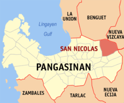 Map of Pangasinan with San Nicolas highlighted | |
OpenStreetMap .mw-parser-output .locmap .od{position:absolute}.mw-parser-output .locmap .id{position:absolute;line-height:0}.mw-parser-output .locmap .l0{font-size:0;position:absolute}.mw-parser-output .locmap .pv{line-height:110%;position:absolute;text-align:center}.mw-parser-output .locmap .pl{line-height:110%;position:absolute;top:-0.75em;text-align:right}.mw-parser-output .locmap .pr{line-height:110%;position:absolute;top:-0.75em;text-align:left}.mw-parser-output .locmap .pv>div{display:inline;padding:1px}.mw-parser-output .locmap .pl>div{display:inline;padding:1px;float:right}.mw-parser-output .locmap .pr>div{display:inline;padding:1px;float:left}html.skin-theme-clientpref-night .mw-parser-output .od,html.skin-theme-clientpref-night .mw-parser-output .od .pv>div,html.skin-theme-clientpref-night .mw-parser-output .od .pl>div,html.skin-theme-clientpref-night .mw-parser-output .od .pr>div{background:#000;color:#fff}html.skin-theme-clientpref-night .mw-parser-output .locmap{filter:grayscale(0.6)}@media(prefers-color-scheme:dark){html.skin-theme-clientpref-os .mw-parser-output .locmap{filter:grayscale(0.6)}html.skin-theme-clientpref-os .mw-parser-output .od,html.skin-theme-clientpref-os .mw-parser-output .od .pv>div,html.skin-theme-clientpref-os .mw-parser-output .od .pl>div,html.skin-theme-clientpref-os .mw-parser-output .od .pr>div{background:#000;color:#fff}}  San Nicolas Location within the Philippines | |
| Coordinates: 16°04′12″N 120°45′55″E / 16.07°N 120.76528°E | |
| Country | Philippines |
| Region | Ilocos Region |
| Province | Pangasinan |
| District | 6th district |
| Founded | 1610 |
| Named for | St. Nicholas of Tolentino |
| Barangays | 33 (see Barangays) |
| Government | |
| • Type | Sangguniang Bayan |
| • Mayor | Dr. Alicia Primicias-Enriquez |
| • Vice Mayor | Alvin O. Bravo |
| • Representative | Tyrone D. Agabas |
| • Municipal Council | Members |
| • Electorate | 26,993 voters (2022) |
| Area | |
| • Total | 210.20 km2 (81.16 sq mi) |
| Elevation | 102 m (335 ft) |
| Highest elevation | 529 m (1,736 ft) |
| Lowest elevation | 54 m (177 ft) |
| Population (2020 census)[3] | |
| • Total | 39,778 |
| • Density | 190/km2 (490/sq mi) |
| • Households | 9,891 |
| Economy | |
| • Income class | 1st municipal income class |
| • Poverty incidence | 12.87 |
| • Revenue | ₱ 177.3 million (2020) |
| • Assets | ₱ 326.9 million (2020) |
| • Expenditure | ₱ 180.9 million (2020) |
| • Liabilities | ₱ 147.6 million (2020) |
| Service provider | |
| • Electricity | Pangasinan 3 Electric Cooperative (PANELCO 3) |
| Time zone | UTC+8 (PST) |
| ZIP code | 2447 |
| PSGC | 015536000 |
| IDD : area code | +63 (0)75 |
| Native languages | Pangasinan Ilocano Kallahan Tagalog |
| Website | https://sannicolaspangasinan.gov.ph |
History edit
Spanish Period edit
The historical narrative elucidates the pre-colonial landscape of the Upper Agno Valley and the Tierras de Montaños of Northern Luzon, which would later coalesce into the municipality of San Nicolas. Predating the Spanish incursion of the late 16th century, indigenous settlements punctuated the expanse of what is contemporarily recognized as San Nicolas. Noteworthy among these early communities were Ambayabang (Balungao), overseen by the legendary native chief Cayon Dagarag, Maliongliong (Mallilion), which subsequently accommodated the Dominican mission of San Josef in 1732, and Apsay (Agpay), presently renowned for its eco-tourism offerings, all discernible in cartographic records dating as far back as 1625.
The organic evolution of these settlements, particularly Ambayabang and Maliongliong, towards greater interaction and integration with Spanish colonial forces, constituted the embryonic stages of San Nicolas' formation. Crucially, the establishment of religious missions emerged as the linchpin in this process. The alternating endeavors of Dominican and Augustinian missionaries, commencing in 1607, delineated two principal trajectories instrumental in shaping San Nicolas's genesis and subsequent trajectory, transitioning from an informal mission outpost to an autonomous pueblo nuevo by the 19th century.
The first of these trajectories emanated from the Dominican stronghold in central Pangasinan, extending northeastward through the foundation of the San Josef Mission in Maliongliong in 1732. Concurrently, the southeastern expansion of Augustinian missionary activity, originating from Ytuy and Baler in the Pampanga delta and Sierra Madre region, culminated in the establishment of the San Nicolas de Tolentino Mission in Ambayabang. Spearheaded by the youthful Augustinian friar Agustin Barriocanal in the late 1730s to early 1740s, this endeavor solidified the town's burgeoning identity.
Over time, these divergent trajectories converged, symbolizing the confluence of disparate historical currents that birthed San Nicolas as a distinct entity imbued with a narrative deserving of commemoration in the annals of fate and destiny.[5]
Ilocano Migration edit
During the latter part of the eighteenth century and the beginning of the nineteenth century, there was a significant migration of Ilocano families to Pangasinan, driven by factors such as rapid population growth and limited land availability for habitation and cultivation. Seeking better opportunities, many Ilocanos settled in the eastern and western parts of Pangasinan, attracted by the region's abundant natural resources, including gold, timber, and fertile land.
While Ilocano migration to the area likely began in the early to middle part of the 18th century, it wasn't until around 1800 that a substantial influx occurred. This migration, which included prominent families such as Nicolas Patrico and Isidra Sangalang, led to the establishment of a settlement near the San Nicolas de Tolentino mission. This settlement grew rapidly, eventually forming the foundation of the future town of San Nicolas.
The elevation of San Nicolas from a mission to a visita and then to a pueblo civil in 1810 marked a significant milestone in its history. With this elevation came the establishment of a civil government, including the appointment of a governadorcillo to oversee civil affairs. Bernardo Alimorong was appointed as the first governadorcillo, followed by a succession of individuals until 1817, when San Nicolas was transferred to the civil jurisdiction of Pangasinan.
The relocation of San Nicolas to Pangasinan brought about changes in its governance structure, including the introduction of democratic elements in the selection of town officials. In 1818, the town held its first election, with Nicolas Patricio y Mejia becoming the first elected governadorcillo. Under his leadership, the town experienced progress and stability, fostering unity among its diverse population.
By the mid-nineteenth century, San Nicolas had developed significant infrastructure, including a state house, a schoolhouse, and a growing population, qualifying it for elevation to a full-fledged pueblo parroco. This transformation reflects the dynamic social and political changes occurring in the region during this period, as San Nicolas emerged as a prominent center of governance and culture in Pangasinan.
In 1845, San Nicolas, having achieved notable progress in its financial and infrastructural development, sought to elevate its status from a "pueblo visita" to a "pueblo parroco." Led by the governadorcillo Don Domingo Basilio, the petition for this elevation was submitted to the insular government in Manila. After endorsement by the Alcalde Mayor and approval by the bishop of Nueva Segovia, the petition was deemed meritorious by finance officials in Manila.
Governor General Narciso Claveria y Zaldua issued the Royal Decree on June 18, 1846, officially granting San Nicolas spiritual separation from its mother parish of Tayug, thereby solidifying its status as a separate and independent Catholic Parish. This decree, bearing ecclesiastical credence, marked San Nicolas's formal elevation to a "pueblo parroco" and, by extension, affirmed its status as a civil township. Don Mateo Miranda served as the incumbent governadorcillo at the time of this royal decree, with P. Jose Manso appointed as the first curate by the Dominican Province to oversee the newly-elevated Catholic community.
However, despite its newfound independence in ecclesiastical matters, San Nicolas continued to experience jurisdictional shifts between civil provinces. In 1851, along with Tayug, it was separated from Pangasinan and incorporated into the province of Nueva Ecija. This move was part of a larger plan by the Spanish central government to create a new province, Nueva Cuenca, which ultimately did not materialize. San Nicolas's inclusion in Nueva Ecija was primarily based on its historical ecclesiastical ties to Tayug and its status as an Augustinian parish.
Efforts to return San Nicolas to Pangasinan's civil jurisdiction were pursued, culminating in a successful petition in 1863. Gobernadorcillos Don Raymundo Sumaguing of San Nicolas and Don Julio de Tolosa of Tayug spearheaded this endeavor, leading to San Nicolas's permanent inclusion in the province of Pangasinan.[5]
American Period edit
A convent was constructed later which were made of stone masonry. But all these structures together with the schoolhouse and tribunal were again burned down in the Philippine-American war of 1899.[6]
Famine gripped in 1872 and by the turn of the 20th century, Cholera epidemic strikes, in 1901 and 1902; Plague of small fox in 1905; havoc of influenza in 1918 and 1919 and the most devastating flood in 1935.[6]
Japanese Period edit
During the Japanese Occupation and the American Liberation in the Philippines. The town was the base of operations of the fightingest [sic] guerilla organizations. The Battle of Villaverde Trail was fought between the Japanese Imperial Forces under the command of Lt. General Tomoyuki Yamashita and the famed US Army 32nd Infantry Division's 127th Infantry Regiment Under the command of Maj. Gen William H. Gill, aided by Filipino guerillas and Igorot men. The men of the 32nd Infantry Division advanced along the Villaverde Trail beginning on January 30, 1945. Igorot laborers were employed to carry supplies and evacuate wounded as the rough terrain on the trail made it impossible for vehicles to support the battle. Victory for the town was attained in January 26, 1945.[6]
In 119 days of almost constant fighting, the 32nd lost 1,051 killed, 3,201 wounded, 14 missing---4,266 in all. The division killed 9,000 Japanese soldiers and took 50 prisoners.[6]
Recent Period edit
Today, San Nicolas has developed to be the second largest in land area, at 5,035 square kilometers , among the forty seven (47) Pangasinan towns and cities, next only to nearby Umingan. With the enactment of the Barrio Charter, its eight original barrios have since multiplied into 33 barangays.[7]
San Nicolas was elevated from a fifth class to a fourth class municipality in 1993 during the incumbency of Hon. Conrado B. Rodrigo, Jr., as Municipal Mayor.[7]
In the year 2005, it was again elevated to a second class municipality and in 2008, by way of its revenue share from the San Roque Power Corporation (SRPC), it was finally got elevated to a first class municipality, all under the administration of Municipal Mayor Leoncio S. Saldivar lll respectively.Like the countless natural resources flourishing in the whole province of Pangasinan, San Nicolas is also gifted and endowed with natural wealth[7]
Boundary Dispute edit
The Pangasinan Provincial Board, in its first out-of-town session held in Barangay Malico on March 20, 2023, declared the said village as the "Barangay Summer Capital of Pangasinan" upon request by the municipal council through Resolution 88-2020 two years prior; a move that "strengthen the position and consolidate and reinforce the claim of barangay Malico as a territory of Pangasinan."[8] Malico, situated upland and is home to some Kalanguya families, is the subject of an ongoing ownership dispute with neighboring Santa Fe, Nueva Vizcaya. In September 2022, the Nueva Vizcaya Provincial Board, in their special session in the said village, passed a resolution urging San Nicolas officials to refrain from carrying out government projects.[9] (See § Barangays)
During the Second World War, Malico was used as a military base of the Japanese Imperial Army; and battles in 1945 led to heavy casualties among Japanese and American soldiers, as well as Filipino residents. A memorial for them was built at the Salacsac Pass.[8]
Geography edit
San Nicolas is located in north-eastern part of Pangasinan. It is the only town that borders Nueva Vizcaya, Benguet and Nueva Ecija. It borders Tayug, Pangasinan to the south, San Manuel, Pangasinan to the west, Santa Fe, Nueva Vizcaya to its northeast, Itogon, Benguet to the north and Natividad, Pangasinan and Carranglan, Nueva Ecija to its southeast.[10]
The Total land area of the municipality is 23, 481 hectares. Wherein about 72% were consist of mountainous, forested and barren lands. It represents 4.3% of the provincial land area of 536,920 hectares.[10]
Agricultural land have been cultivated for crop production is 4,694 hectares and about 4,934 hectares are irrigated by gravity type of irrigation which 31 barangays have been enjoying.[relevant?]
The Municipality of San Nicolas is one of the 48 towns and cities of Pangasinan. It is located in the easternmost part of the province and bounded on the north by the municipality of Itogon, Benguet; on the east by the Municipality of Santa Fe, Nueva Vizcaya; on the south by the Municipalities of Tayug and Natividad; and on the west by the Agno River serving as a natural existing boundary with the Municipality of San Manuel.[10]
It is accessible by land transportation through provincial and municipal roads. It is 40 kilometres (25 mi) to Urdaneta City, an urban center nearest to it; 85 kilometres (53 mi) to Lingayen, the Provincial Capital and about 201 kilometres (125 mi) away from of Manila.[10]
Typography edit
The southwestern portion of the municipality whose terrain is generally flat has an average elevation of 94.0 meters above sea level while the eastern portion, about 5.0 kilometers from the poblacion, starts to rise from 200.0 meters above sea level to a maximum of about 1000.0 meters above sea level.
The northeastern Caraballo Mountain has a slope that varies from 8-15%, 15-30% and 30-50%. The lowland which makes up about one-third of the municipal land area is relatively flat with 0-30% slope. The area occupied per slope category is as follows:
0-30%: 7,030 hectares
8-15%: 4,865 hectares
15-30%: 10,899 hectares
30-50%: 677 hectares
The three major rivers that traversed the municipality, namely: Agno River; Sabangan River; and Ambayoan River, flow from the northeastern Caraballo mountains face water drainage of the municipality
Soils[relevant?] edit
There are at least six types of soils in the municipality with total area of 23,481 hectares classified as
- Annam Clay Loam (98) - 17,101has.
- Umingan Silt (99) - 3,790has
- Riverwash (152) - 867has.
- San Manuel Fine Sandy Loam - 171has.
- Quingua Series (5) - 1,000has.
- San Manuel Silt Loam - 114has
Soil fertility description[relevant?] edit
According to data from the ecological profile of Pangasinan, soil fertility of the municipality is of indexes I, II, and III. About 17,796 hectares falls in Index I (very low fertility); 2,071 hectares under Index II (low fertility); and 3,614 hectares under Index III (moderate fertility).
Barangays edit
The Municipality of San Nicolas comprises thirty-three 33 barangays[a]. Each barangay consists of puroks and some have sitios.
Out of the 33 Barangays, only four are in Urban area (Casaratan, Nagkaysa, Poblacion East, Poblacion West), the rest belongs to the Rural areas.
- Bensican
- Cabitnongan
- Cabuloan
- Cacabugaoan
- Calanutian
- Calaocan
- Camangaan
- Camindoroan
- Casaratan
- Dalumpinas
- Fianza
- Lungao
- Malico[b]
- Malilion (Casantacruzan)
- Nagkaysa
- Nining
- Poblacion East
- Poblacion West
- Salingcob
- Salpad
- San Felipe East
- San Felipe West
- San Isidro
- San Jose
- San Rafael Centro
- San Rafael East
- San Rafael West
- San Roque
- Santa Maria East
- Santa Maria West
- Santo Tomas
- Siblot
- Sobol
Boundary Dispute edit
San Nicolas currently has a boundary dispute with Santa Fe, Nueva Vizcaya, in which Santa Fe claims the territory of barangay Malico.[11] The Nueva Vizcaya provincial board passed a resolution on September 21, 2022, urging San Nicolas officials to respect a memorandum of agreement between the National Mapping and Resource Information Authority (NAMRIA), Pangasinan, and Nueva Vizcaya about twenty years ago.[12] On the same day, the Nueva Vizcaya provincial board held a special session in Barangay Malico and issued a resolution requesting San Nicolas officials to refrain from building infrastructure projects within the barangay's boundaries. Said resolution also instructed San Nicolas officials to "respect the boundary" of Santa Fe as well as "the rights of the Kalanguya tribe and their ancestral domain rights. Santa Fe, Nueva Vizcaya is citing RA 8686 as the law that created Malico as one of its barangays."[13] Both municipalities in both provinces claim to have a barangay named Malico.[14]
Climate edit
The Climate of San Nicolas is divided into two seasons, the wet and dry season. The months of June to October are generally termed as the wet season, characterized by rainy days and occasional typhoons, while the days during the dry season of November to May are relatively hot and dry period.
| Climate data for San Nicolas, Pangasinan | |||||||||||||
|---|---|---|---|---|---|---|---|---|---|---|---|---|---|
| Month | Jan | Feb | Mar | Apr | May | Jun | Jul | Aug | Sep | Oct | Nov | Dec | Year |
| Mean daily maximum °C (°F) | 31 (88) |
31 (88) |
32 (90) |
34 (93) |
35 (95) |
34 (93) |
32 (90) |
32 (90) |
32 (90) |
32 (90) |
32 (90) |
31 (88) |
32 (90) |
| Mean daily minimum °C (°F) | 22 (72) |
22 (72) |
22 (72) |
24 (75) |
24 (75) |
24 (75) |
23 (73) |
23 (73) |
24 (75) |
23 (73) |
23 (73) |
22 (72) |
23 (73) |
| Average precipitation mm (inches) | 13.6 (0.54) |
10.4 (0.41) |
18.2 (0.72) |
15.7 (0.62) |
178.4 (7.02) |
227.9 (8.97) |
368 (14.5) |
306.6 (12.07) |
310.6 (12.23) |
215.7 (8.49) |
70.3 (2.77) |
31.1 (1.22) |
1,766.5 (69.56) |
| Average rainy days | 3 | 2 | 2 | 4 | 14 | 16 | 23 | 21 | 24 | 15 | 10 | 6 | 140 |
| Source: World Weather Online[15] | |||||||||||||
Demographics edit
| Year | Pop. | ±% p.a. |
|---|---|---|
| 1903 | 9,780 | — |
| 1918 | 12,628 | +1.72% |
| 1939 | 16,088 | +1.16% |
| 1948 | 18,218 | +1.39% |
| 1960 | 19,080 | +0.39% |
| 1970 | 21,687 | +1.29% |
| 1975 | 23,377 | +1.52% |
| 1980 | 23,243 | −0.11% |
| 1990 | 27,415 | +1.66% |
| 1995 | 29,058 | +1.10% |
| 2000 | 31,418 | +1.69% |
| 2007 | 33,419 | +0.86% |
| 2010 | 34,108 | +0.75% |
| 2015 | 35,574 | +0.80% |
| 2020 | 39,778 | +2.22% |
| Source: Philippine Statistics Authority[16][17][18][19] | ||
Economy edit
Government edit
Local government edit
San Nicolas, belonging to the sixth congressional district of the province of Pangasinan, is governed by a mayor designated as its local chief executive and by a municipal council as its legislative body in accordance with the Local Government Code. The mayor, vice mayor, and the councilors are elected directly by the people through an election which is being held every three years.
Elected officials edit
| Position | Name |
|---|---|
| Congressman | Marlyn P. Agabas |
| Governor | Ramon Guico III |
| Vice Governor | Mark Ronald Lambino |
| Board Member | Noel Bince |
| Board Member | Salvador Perez Jr. |
| Mayor | Alicia P. Enriquez |
| Vice-Mayor | Alvin O. Bravo |
| Councilors | Maricon Vindy A. Operaña |
| Francisco O. Bravo Jr. | |
| Jairus Thom Dulay | |
| Amorsolo Pulido | |
| Carpio Bibat | |
| Jose M. Serquiña Jr. | |
| Rosewill P. Descargar | |
| Leomar Saldivar |
