


Summary
Santa Teresita, officially the Municipality of Santa Teresita (Tagalog: Bayan ng Santa Teresita), is a 5th class municipality in the province of Batangas, Philippines. According to the 2020 census, it has a population of 21,559 people.[5]
Santa Teresita | |
|---|---|
| Municipality of Santa Teresita | |
 Street in Santa Teresita | |
 Seal | |
 Map of Batangas with Santa Teresita highlighted | |
OpenStreetMap .mw-parser-output .locmap .od{position:absolute}.mw-parser-output .locmap .id{position:absolute;line-height:0}.mw-parser-output .locmap .l0{font-size:0;position:absolute}.mw-parser-output .locmap .pv{line-height:110%;position:absolute;text-align:center}.mw-parser-output .locmap .pl{line-height:110%;position:absolute;top:-0.75em;text-align:right}.mw-parser-output .locmap .pr{line-height:110%;position:absolute;top:-0.75em;text-align:left}.mw-parser-output .locmap .pv>div{display:inline;padding:1px}.mw-parser-output .locmap .pl>div{display:inline;padding:1px;float:right}.mw-parser-output .locmap .pr>div{display:inline;padding:1px;float:left}html.skin-theme-clientpref-night .mw-parser-output .od,html.skin-theme-clientpref-night .mw-parser-output .od .pv>div,html.skin-theme-clientpref-night .mw-parser-output .od .pl>div,html.skin-theme-clientpref-night .mw-parser-output .od .pr>div{background:#000;color:#fff}html.skin-theme-clientpref-night .mw-parser-output .locmap{filter:grayscale(0.6)}@media(prefers-color-scheme:dark){html.skin-theme-clientpref-os .mw-parser-output .locmap{filter:grayscale(0.6)}html.skin-theme-clientpref-os .mw-parser-output .od,html.skin-theme-clientpref-os .mw-parser-output .od .pv>div,html.skin-theme-clientpref-os .mw-parser-output .od .pl>div,html.skin-theme-clientpref-os .mw-parser-output .od .pr>div{background:#000;color:#fff}}  Santa Teresita Location within the Philippines | |
| Coordinates: 13°51′59″N 120°58′53″E / 13.86639°N 120.98139°E | |
| Country | Philippines |
| Region | Calabarzon |
| Province | Batangas |
| District | 3rd district |
| Founded | December 28, 1961[1] |
| Named for | St. Therese of the Child Jesus[2] |
| Barangays | 17 (see Barangays) |
| Government | |
| • Type | Sangguniang Bayan |
| • Mayor | Norberto A. Segunial, Jr. |
| • Vice Mayor | Maria Aurea V. Segunial |
| • Representative | Ma. Theresa V. Collantes |
| • Municipal Council | Members |
| • Electorate | 13,699 voters (2022) |
| Area | |
| • Total | 16.30 km2 (6.29 sq mi) |
| Elevation | 83 m (272 ft) |
| Highest elevation | 234 m (768 ft) |
| Lowest elevation | 5 m (16 ft) |
| Population (2020 census)[5] | |
| • Total | 21,559 |
| • Density | 1,300/km2 (3,400/sq mi) |
| • Households | 5,547 |
| Economy | |
| • Income class | 5th municipal income class |
| • Poverty incidence | 10.75 |
| • Revenue | ₱ 97.19 million (2020) |
| • Assets | ₱ 260.7 million (2020) |
| • Expenditure | ₱ 76.9 million (2020) |
| • Liabilities | ₱ 50.33 million (2020) |
| Service provider | |
| • Electricity | Batangas 1 Electric Cooperative (BATELEC 1) |
| Time zone | UTC+8 (PST) |
| ZIP code | 4206 |
| PSGC | 041027000 |
| IDD : area code | +63 (0)43 |
| Native languages | Tagalog |
Etymology edit
Santa Teresita is derived from Spanish for its patron saint, Thérèse of Lisieux, who is also known as St. Therese of the Child Jesus and the Holy Face.[7]
History edit
On December 28, 1961, the barrios of Sambat, Sinipian, Bihis, Calayaan, Irukan and Cutang Cawayan from the municipality of Taal; Calumala, Tambo, Saimsim and Burol from the municipality of San Nicolas; and Pacifico and Sampa from the municipality of San Luis were separated and constituted into a new and separate municipality known as Santa Teresita, by virtue of Executive Order No. 454 signed by President Carlos P. Garcia.[1] Ireneo Aquino was appointed as its first municipal mayor, serving until June 1962. In 1971, barangay Antipolo was established as a separate barangay out of barangay Sinipian, as well as barangay Cuta East, which was separated from barangay Cutang Cawayan.[8]
Geography edit
Santa Teresita is located at 13°51′59″N 120°58′53″E / 13.86639°N 120.98139°E along the southern lakeshore area of Taal Lake. Its boundaries are San Nicolas in the north, San Luis on the south, Taal on the west and Taal Lake on the northeast.
According to the Philippine Statistics Authority, the municipality has a land area of 16.30 square kilometers (6.29 sq mi) [9] constituting 0.52% of the 3,119.75-square-kilometer (1,204.54 sq mi) total area of Batangas.
Santa Teresita is 17 kilometers (11 mi) from Batangas City and 122 kilometers (76 mi) from Manila.
Barangays edit
Santa Teresita is politically subdivided into 17 barangays.[10] Each barangay consists of puroks and some have sitios.
Currently, there are 3 barangays which are classified as urban.
| PSGC | Barangay | Population | ±% p.a. | |||
|---|---|---|---|---|---|---|
| 2020[5] | 2010[11] | |||||
| 041027001 | Antipolo | 3.6% | 768 | 696 | 0.99% | |
| 041027002 | Bihis | 7.3% | 1,584 | 1,373 | 1.44% | |
| 041027003 | Burol | 3.1% | 667 | 454 | 3.92% | |
| 041027004 | Calayaan | 9.6% | 2,060 | 1,902 | 0.80% | |
| 041027005 | Calumala | 6.2% | 1,346 | 1,289 | 0.43% | |
| 041027006 | Cuta East | 5.5% | 1,185 | 991 | 1.80% | |
| 041027007 | Cutang Cawayan | 3.4% | 733 | 510 | 3.69% | |
| 041027008 | Irukan | 3.0% | 637 | 598 | 0.63% | |
| 041027009 | Pacifico | 9.0% | 1,945 | 1,680 | 1.48% | |
| 041027010 | Poblacion I | 7.7% | 1,662 | 1,483 | 1.15% | |
| 041027012 | Saimsim | 12.7% | 2,730 | 1,910 | 3.64% | |
| 041027013 | Sampa | 6.0% | 1,295 | 1,172 | 1.00% | |
| 041027014 | Sinipian | 4.2% | 898 | 705 | 2.45% | |
| 041027015 | Tambo Ibaba | 4.5% | 976 | 683 | 3.63% | |
| 041027016 | Tambo Ilaya | 4.3% | 920 | 580 | 4.72% | |
| 041027017 | Poblacion II | 5.5% | 1,180 | 986 | 1.81% | |
| 041027018 | Poblacion III | 2.5% | 541 | 403 | 2.99% | |
| Total | 21,559 | 17,415 | 2.16% | |||
Climate edit
| Climate data for Santa Teresita, Batangas | |||||||||||||
|---|---|---|---|---|---|---|---|---|---|---|---|---|---|
| Month | Jan | Feb | Mar | Apr | May | Jun | Jul | Aug | Sep | Oct | Nov | Dec | Year |
| Mean daily maximum °C (°F) | 28 (82) |
29 (84) |
30 (86) |
32 (90) |
31 (88) |
29 (84) |
28 (82) |
28 (82) |
28 (82) |
28 (82) |
28 (82) |
28 (82) |
29 (84) |
| Mean daily minimum °C (°F) | 19 (66) |
19 (66) |
20 (68) |
21 (70) |
23 (73) |
23 (73) |
23 (73) |
23 (73) |
23 (73) |
22 (72) |
21 (70) |
20 (68) |
21 (70) |
| Average precipitation mm (inches) | 11 (0.4) |
13 (0.5) |
14 (0.6) |
32 (1.3) |
101 (4.0) |
142 (5.6) |
208 (8.2) |
187 (7.4) |
175 (6.9) |
131 (5.2) |
68 (2.7) |
39 (1.5) |
1,121 (44.3) |
| Average rainy days | 5.2 | 5.0 | 7.4 | 11.5 | 19.8 | 23.5 | 27.0 | 25.9 | 25.2 | 23.2 | 15.5 | 8.3 | 197.5 |
| Source: Meteoblue[12] | |||||||||||||
Demographics edit
| Year | Pop. | ±% p.a. |
|---|---|---|
| 1970 | 9,336 | — |
| 1975 | 10,087 | +1.56% |
| 1980 | 11,134 | +1.99% |
| 1990 | 12,005 | +0.76% |
| 1995 | 14,017 | +2.95% |
| 2000 | 14,074 | +0.09% |
| 2007 | 16,891 | +2.55% |
| 2010 | 17,415 | +1.12% |
| 2015 | 21,127 | +3.75% |
| 2020 | 21,559 | +0.40% |
| Source: Philippine Statistics Authority[13][11][14][15] | ||
In the 2020 census, Santa Teresita had a population of 21,559.[5] The population density was 1,300 inhabitants per square kilometre (3,400/sq mi).
Economy edit
Gallery edit
-
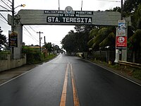 Welcome arch
 -
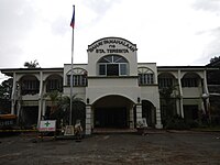 Old municipal hall
 -
 Downtown
 -
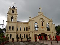 Archdiocesan Shrine of Saint Therese of the Child Jesus and of the Holy Face


References edit
- ^ a b Executive Order No. 454, s. 1961 (28 December 1961), "Creating the Municipality of Sta. Teresita in the Province of Batangas", Official Gazette of the Republic of the Philippines
- ^ "Sta. Teresita". Department of the Interior and Local Government Region IV-A CALABARZON. Retrieved August 30, 2020.
- ^ Municipality of Santa Teresita | (DILG)
- ^ "2015 Census of Population, Report No. 3 – Population, Land Area, and Population Density" (PDF). Philippine Statistics Authority. Quezon City, Philippines. August 2016. ISSN 0117-1453. Archived (PDF) from the original on May 25, 2021. Retrieved July 16, 2021.
- ^ a b c d Census of Population (2020). "Region IV-A (Calabarzon)". Total Population by Province, City, Municipality and Barangay. Philippine Statistics Authority. Retrieved 8 July 2021.
- ^ "PSA Releases the 2018 Municipal and City Level Poverty Estimates". Philippine Statistics Authority. 15 December 2021. Retrieved 22 January 2022.
- ^ Presidential Proclamation No. 1396, s. 2007 (27 September 2007), "Declaring Monday, October 1, 2007, as Special (Non-working) Day in the Municipality of Sta. Teresita, Province of Batangas", Official Gazette of the Republic of the Philippines, retrieved July 12, 2023
- ^ "History". Municipality of Sta. Teresita. Retrieved January 21, 2022.
- ^ "Province: Batangas". PSGC Interactive. Quezon City, Philippines: Philippine Statistics Authority. Retrieved 12 November 2016.
- ^ "Municipal: Santa Teresita, Batangas". PSGC Interactive. Quezon City, Philippines: Philippine Statistics Authority. Retrieved 8 January 2016.
- ^ a b Census of Population and Housing (2010). "Region IV-A (Calabarzon)" (PDF). Total Population by Province, City, Municipality and Barangay. National Statistics Office. Retrieved 29 June 2016.
- ^ "Santa Teresita: Average Temperatures and Rainfall". Meteoblue. Retrieved 5 May 2020.
- ^ Census of Population (2015). "Region IV-A (Calabarzon)". Total Population by Province, City, Municipality and Barangay. Philippine Statistics Authority. Retrieved 20 June 2016.
- ^ Censuses of Population (1903–2007). "Region IV-A (Calabarzon)". Table 1. Population Enumerated in Various Censuses by Province/Highly Urbanized City: 1903 to 2007. National Statistics Office.
{{cite encyclopedia}}: CS1 maint: numeric names: authors list (link) - ^ "Province of Batangas". Municipality Population Data. Local Water Utilities Administration Research Division. Retrieved 17 December 2016.
- ^ "Poverty incidence (PI):". Philippine Statistics Authority. Retrieved December 28, 2020.
- ^ "Estimation of Local Poverty in the Philippines" (PDF). Philippine Statistics Authority. 29 November 2005.
- ^ "2003 City and Municipal Level Poverty Estimates" (PDF). Philippine Statistics Authority. 23 March 2009.
- ^ "City and Municipal Level Poverty Estimates; 2006 and 2009" (PDF). Philippine Statistics Authority. 3 August 2012.
- ^ "2012 Municipal and City Level Poverty Estimates" (PDF). Philippine Statistics Authority. 31 May 2016.
- ^ "Municipal and City Level Small Area Poverty Estimates; 2009, 2012 and 2015". Philippine Statistics Authority. 10 July 2019.
- ^ "PSA Releases the 2018 Municipal and City Level Poverty Estimates". Philippine Statistics Authority. 15 December 2021. Retrieved 22 January 2022.
External links edit
- Philippine Standard Geographic Code