
KNOWPIA
WELCOME TO KNOWPIA

Saquarema 
Summary
Saquarema (Portuguese pronunciation: [sɐkwɐˈɾẽmɐ]) is a municipality located in the Brazilian state of Rio de Janeiro. Its population is 90,583 (2020) and its area is 353,566 km2.[3] It is located almost 73 km east of Rio de Janeiro.[4] It was known as Brazil's surfing capital.
Saquarema | |
|---|---|
| Municipality of Saquarema | |
 Flag  Seal | |
| Nickname: Capital Nacional do Surfing | |
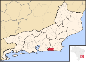 Location in Rio de Janeiro | |
| Coordinates: 22°55′12″S 42°30′36″W / 22.92000°S 42.51000°W | |
| Country | |
| Region | Southeast |
| State | |
| Government | |
| • Mayor | Manoela Peres (UNIÃO) |
| Area | |
| • Total | 356.566 km2 (137.671 sq mi) |
| Elevation | 2 m (7 ft) |
| Population (2020)[1] | |
| • Total | 90,583 |
| • Density | 250/km2 (660/sq mi) |
| Time zone | UTC−3 (BRT) |
| HDI (2010) | 0.709 – high[2] |
| Website | saquarema |


During the mid-19th century, the Conservative Party and its leaders were known as "Saquarema" because of their base of support here.
The Surfing Capital edit
Saquarema, through its beaches, especially Itaúna Beach, is known as the Brazilian capital of surfing for its perfect waves and indescribable beauty and strength. In the 70's, Saquarema hosted the longing surfing festivals and in 2017, Saquarema became part of the world surfing circuit, with WSL.
References edit
- ^ IBGE 2020
- ^ "Archived copy" (PDF). United Nations Development Programme (UNDP). Archived from the original (PDF) on July 8, 2014. Retrieved August 1, 2013.
{{cite web}}: CS1 maint: archived copy as title (link) - ^ IBGE - [1]
- ^ Danny Palmerlee, South America on a Shoestring (Lonely Planet, 2007: ISBN 1-74104-443-X ), p. 300.
External links edit
- Saquarema's town hall
- SaquaOnline - Unofficial website