


Summary
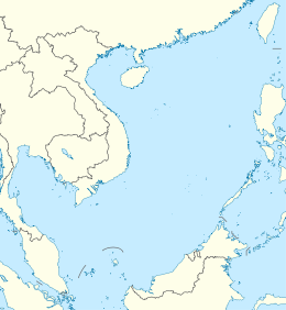
Scarborough Shoal, also known as Bajo de Masinloc ("Masinloc shoal" in Spanish),[3][4] Huangyan Island (Mandarin Chinese: 黄岩岛; pinyin: Huáng Yán Dǎo; lit. 'yellow rock island'),[5] Minzhu Jiao (Mandarin Chinese: 民主礁; lit. 'Democracy Reef') and Panatag Shoal (Filipino: Buhanginan ng Panatag, lit. 'serene sandbank'),[6] are two skerries (rocks[a]) located between Macclesfield Bank to the west and Luzon to the east. Luzon is 220 kilometres (119 nmi) away and the nearest landmass.[7] The atoll is a disputed territory claimed by the Republic of the Philippines through the 1734 Velarde map, while the People's Republic of China and the Republic of China (Taiwan) claim it through the disputed[8] nine-dash line (originally an eleven-dash line which included waters in the Gulf of Tonkin[9]). The atoll's status is often discussed in conjunction with other territorial disputes in the South China Sea such as those involving the Spratly Islands, and the 2012 Scarborough Shoal standoff. It was administered by the Philippines as part of its Zambales province, until 2012, when a standoff was initiated by China through the use of warships against fishing boats, resulting in effective capture by the Chinese maritime forces.[10][11]
| Disputed atoll | |
|---|---|
 Landsat 7 image of Scarborough Shoal in 2000 | |
 Scarborough Shoal  Scarborough Shoal | |
| Other names |
|
| Geography | |
| Location | South China Sea |
| Coordinates | 15°11′N 117°46′E / 15.183°N 117.767°E |
| Total islands | 2 islets with many reefs |
| Major islands | 1 |
| Highest elevation | 1.8 m (5.9 ft) |
| Highest point | South Rock |
| Administration | |
| Province | Hainan |
| Prefecture-level city | Sansha |
| District | Xisha |
| Claimed by | |
| Municipality District | Kaohsiung Cijin[1][2] |
| Province | Zambales |
| Municipality | Masinloc |
| Demographics | |
| Population | 0 |
In 2013, the Philippines solely filed an international case against China in the arbitration court in The Hague, Netherlands. In 2016, the court declared that China's so-called nine-dash line claim in the entire South China Sea was invalid,[8] while upholding the sovereign rights of the Philippines in the area.[12] China rejected the court's decision, sending more warships to the Scarborough Shoal and the Spratly Islands,[13] while a multitude of nations backed the Tribunal's ruling including the claimants to the area such as Malaysia, the Philippines, and Vietnam.[14][15]
The atoll was named by Captain Philip D'Auvergne, whose East India Company East Indiaman Scarborough grounded on one of the rocks on 12 September 1784, before sailing on to China,[16][17] although it already had a Spanish name recorded in the 1734 Velarde map of Spanish Philippines.[18]
Geography edit
Scarborough Shoal forms a triangle-shaped chain of reefs and rocks with a perimeter of 46 km (29 mi). It covers an area of 150 km2 (58 sq mi), including an inner lagoon. The atolls' highest point, South Rock, is 1.8 m (5 ft 11 in) above sea-level at high tide. Located north of South Rock is a channel, approximately 370 m (1,214 ft) wide and 9–11 m (30–36 ft) deep, leading into the lagoon. Several other coral rocks encircle the lagoon, forming a large atoll.[6]
The atoll is about 198 km (123 mi) west of Subic Bay. The 5,000–6,000 m (16,000–20,000 ft) deep Manila Trench lies between the atoll and the Philippine island of Luzon to the east. The nearest point of land is in Palauig, Zambales on Luzon island, 220 km (119 nmi) due east.[7]
History edit


Scarborough Shoal is named after a British merchant ship, the 'Scarborough' which was wrecked on the feature on 12 September 1748.[20] A number of countries have made historic claims of the use of Scarborough Shoal. China has stated that a 1279 Yuan dynasty map and subsequent surveys by the royal astronomer Guo Shoujing carried out during Kublai Khan's reign established that Scarborough Shoal were used since the thirteenth century by Chinese fishermen.[21][22] In an article from 18 February 1980, the Beijing Review stated that Guo Shoujing built an observatory in the Paracel Islands, not Scarborough Shoal.[23]
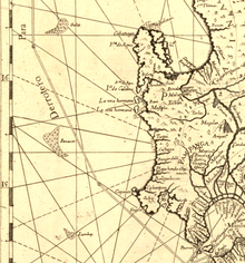
During the Spanish period of the Philippines, a 1734 map was made, which the Philippines believes Galit, Panacot, Lumbay close to the Luzon coast were features under complete sovereignty of Spanish Philippines, and also believes Panacot is Scarborough Shoal.[24][25][26] The atolls' current name was chosen by Captain Philip D'Auvergne, whose East India Company East Indiaman Scarborough briefly grounded on one of the rocks on 12 September 1748, before sailing on to China.[16][17] In 1771, Jean Baptiste Nicholas D. D'Apre de Mannevillette published map of the China Sea which includes Scarborough Shoal, along with Galit, Panacot, and Lumbay which are close to the Luzon coast.[27]
As early as 1937 to 1938, the Commonwealth of the Philippines laid claim to Scarborough Shoal.[28] The Philippine government conducted an oceanographic survey in 1957, and in 1965, the Philippine flag was raised in the area.[29]
When China built their facilities on Mischief Reef within the Philippine EEZ in 1995, then National Security Advisor Jose T. Almonte pushed for the establishment of a lighthouse on Scarborough Shoal to bolster the Philippine claim. The parts of the lighthouse had been fabricated on the mainland Philippines but, according to Almontre, the project was scuttled for internal political reasons and to avoid antagonizing the Chinese.[30]
The 2012 Scarborough Shoal standoff between China and the Philippines led to a situation where access to the atoll was restricted by the People's Republic of China.[31][32] The expected intervention of the United States to protect its ally through an existing mutual defence treaty did not commence after the United States indirectly stated that it does not recognise any nation's sovereignty over Scarborough Shoal, leading to strained ties between the Philippines and the United States.[citation needed] In January 2013, the Philippines formally initiated arbitration proceedings against China's claim on the territories within the "nine-dash line" that includes Spratly Islands and Scarborough Shoal, which it said is "unlawful" under the United Nations Convention on the Law of the Sea (UNCLOS).[33][34] An arbitration tribunal was constituted under Annex VII of UNCLOS and it was decided in July 2013 that the Permanent Court of Arbitration (PCA) would function as registry and provide administrative duties in the proceedings.[35]
On 12 July 2016, the arbitrators of the tribunal of PCA ruled in favor of the Philippines on most of her submissions.. They concluded in the decision that there was no evidence that China had historically exercised exclusive control over the waters or resources, hence there was "no legal basis for China to claim historic rights" over the nine-dash line.[36] Accordingly, the PCA tribunal decision is ruled as final and non-appealable by either country.[37][38] The tribunal also criticised China's land reclamation projects and its construction of artificial islands in the Spratly Islands, saying that it had caused "severe harm to the coral reef environment".[39] It also characterised Taiping Island and other features of the Spratly Islands as "rocks" under UNCLOS, and therefore are not entitled to a 200 nautical mile exclusive economic zone.[40] China however rejected the ruling, calling it "ill-founded".[41] In 2019, Taiwan also rejected the ruling.[42]
In late 2016, following meetings between the Philippine president Duterte and his PRC counterparts, the PRC "verbally" allowed Filipino fishermen to access the atoll for fishing, sparking criticism as "allowing" would mean China is implying that it owns the territory.[43] In January 2018, it was revealed that for every 3,000 pesos' worth of fish catch by Filipino fisherfolk, China took them in exchange for "two bottles of mineral water" worth 20 pesos.[44] On 14 June 2018, China's destruction of Scarborough Shoal's reefs surged to an extent which they became visible via satellites, as confirmed by the University of the Philippines Diliman.[45]
Land reclamation and other activities in the surrounding area edit
A March 2016 article by the CSIS Asia Maritime transparency Initiative said that satellite imagery had shown no signs of any land reclamation, dredging or construction activities in Scarborough shoal and the only vessels present were a Chinese civilian ship anchored within the mouth of the lagoon, which has been typical for several years, and two Filipino trimaran-type fishing ships outside the shoal.[46] However, according to the then U.S. chief of naval operations Admiral John Richardson that did not mean that Chinese ships had not performed surveys in preparation for reclamation.[47]
In September 2016 during the ASEAN summit, the Philippine government produced photos that it said showed fresh PRC construction activity at the atoll. A US administration official questioned the Philippines' claim, saying the United States had not detected any unusual activity at Scarborough Shoal.[48]
Also in September 2016, the New York Times reported that PRC activities at the Shoal continued in the form of naval patrols and hydrographic surveys.[49]
In March 2017 the mayor of Sansha City said China was to begin preparatory work for an environmental monitoring station on Scarborough Shoal.[50]
PRC activities in and around the Scarborough Shoal have drawn criticism from US officials.[50] In March 2017 U.S. Senators Marco Rubio and Ben Cardin introduced the South China Sea and East China Sea Sanctions Act which would impose sanctions for Chinese entities and people helping to build South and East China Sea projects.[50]
In June 2019 the Philippine Coast Guard (PCG) spotted a Chinese People's Liberation Army Navy warship, alongside two China Coast Guard vessels, and two Chinese maritime militia vessels near the shoal.[51]
In September 2019, Antonio Carpio, a former Chief Justice of the Supreme Court of the Philippines, said that China would try to reclaim the Scarborough Shoal within Philippine President Rodrigo Duterte's term before it signs the Asean-China Code of Conduct because Duterte had said that Beijing could not be stopped from building because it was too powerful.[52][53]
Academic Jay Batongbacal said that the visiting forces agreement between the Philippines and the United States deterred the transformation of Scarborough Shoal by the PRC into an artificial island, saying, "Scarborough Shoal is the only piece left in the puzzle that they're trying to build. They can now completely exclude other countries from the South China Sea militarily if they're able to put into place all of these military bases."[53]
On September 26, 2023, the PCG announced that they conducted an operation to remove the floating barrier installed by CCG officers near the shoal in the southeast.[54][55] A new floating barrier was deployed in 2024.[56]
Sovereignty dispute edit
Claims by China and Taiwan edit

The People's Republic of China and Taiwan (Republic of China) claim that Chinese people discovered the atoll centuries ago and that there is a long history of Chinese fishing activity in the area. The atoll lies within the nine-dash line drawn by China on maps marking its claim to islands and relevant waters consistent with United Nations Convention on the Law of the Sea (UNCLOS) within the South China Sea.[57] An article published in May 2012 in the PLA Daily states that Chinese astronomer Guo Shoujing went to the island in 1279, under the Yuan dynasty, as part of an empire-wide survey called "Measurement of the Four Seas" (四海測驗).[58] In 1979 historical geographer Han Zhenhua (韩振华) was among the first scholars to claim that the point called "Nanhai" (literally, "South Sea") in that astronomical survey referred to Scarborough Shoal.[59] In 1980 during a conflict with Vietnam for sovereignty over the Paracel Islands (Xisha Islands), however, the Chinese government issued an official document claiming that "Nanhai" in the 1279 survey was located in the Paracels.[60] Historical geographer Niu Zhongxun defended this view in several articles.[61] In 1990, a historian called Zeng Zhaoxuan (曾昭璇) argued instead that the Nanhai measuring point was located in Central Vietnam.[62] Historian of astronomy Chen Meidong (陈美东) and historian of Chinese science Nathan Sivin have since agreed with Zeng's position in their respective books about Guo Shoujing.[63][64] a 2019 article in the publication Maritime Issues suggested that a common fishing ground for China, Vietnam and the Philippines as the best option to avoid deterioration of the conflict.[65]
Legend:
![]() Black:Yongxing Island (seat of Sansha)
Black:Yongxing Island (seat of Sansha)
![]() Red:Chigua Reef
Red:Chigua Reef
![]() Green:Dongmen Reef
Green:Dongmen Reef
![]() Yellow:Huangyan Island
Yellow:Huangyan Island
![]() Red:Huayang Reef
Red:Huayang Reef
![]() Blue:Meiji Reef
Blue:Meiji Reef
![]() Blue:Nanxun Reef
Blue:Nanxun Reef
![]() Black:Zhongjian Island
Black:Zhongjian Island
![]() Green:Yongshu Reef
Green:Yongshu Reef
In 1935, China, as the Republic of China (ROC), regarded the atoll as part of the Zhongsha Islands. That position has since been maintained by both the ROC, which now governs Taiwan, and the People's Republic of China (PRC).[66] In 1947 the atoll was given the name Minzhu Jiao (Chinese: 民主礁; lit. 'Democracy Reef'). In 1983 the People's Republic of China renamed it Huangyan Island with Minzhu Jiao reserved as a second name.[67] In 1956 Beijing protested Philippine remarks that the South China Sea islands in close proximity to Philippine territory should belong to the Philippines. China's Declaration on the territorial Sea, promulgated in 1958, says in part,
The breadth of the Territorial Sea of the People's Republic of China shall be twelve nautical miles. This applies to all territories of the People's Republic of China, including the Chinese mainland and its coastal islands, as well as Taiwan and its surrounding islands, the Penghu Islands, the Dongsha Islands, the Xisha Islands, the Zhongsha Islands, the Nansha Islands and all other islands belonging to China which are separated from the mainland and its coastal islands by the high seas.[68]
China reaffirmed its claim of sovereignty over the Zhongsha Islands in its 1992 Law on the territorial Sea and the Contiguous Zone. China claims all the islands, reefs, and shoals within a U-shaped line in the South China Sea drawn in 1947 as its territory. Scarborough Shoal lies within this area.[68]
China further asserted its claim shortly after the departure of the US Navy force from Subic, Zambales, Philippines. In the late 1970s, many scientific expedition activities organised by State Bureau of Surveying, National Earthquake Bureau and National Bureau of Oceanography were held in the atoll and around this area. In 1980, a stone marker reading "South China Sea Scientific Expedition" was installed on the South Rock, but was removed by the Philippines in 1997.[69]
Claim by the Philippines edit

The Philippines state that its assertion of sovereignty over the atoll is based on the juridical criteria established by public international law on the lawful methods for the acquisition of sovereignty. Among the criteria (effective occupation, cession, prescription, conquest, and accretion), the Philippine Department of Foreign Affairs (DFA) has asserted that the country exercised both effective occupation and effective jurisdiction over the atoll, which it terms Bajo de Masinloc, since its independence. Thus, it claims to have erected flags in some islands and a lighthouse which it reported to the International Maritime Organization. It also asserts that the Philippine and US Naval Forces have used it as impact range and that its Department of Environment and Natural Resources has conducted scientific, topographic and marine studies in the atoll, while Filipino fishermen regularly use it as fishing ground and have always considered it their own.[70]
The DFA also claims that the name Bajo de Masinloc (translated as "Masinloc shoal") itself identifies the atoll as a particular political subdivision of the Philippine Province of Zambales, known as Masinloc.[70] As basis, the Philippines cites the Island of Palmas Case, where the sovereignty of the island was adjudged by the international court in favour of the Netherlands because of its effective jurisdiction and control over the island despite the historic claim of Spain. Thus, the Philippines argues that the historic claim of China over the Scarborough Shoal still needs to be substantiated by a historic title, since a claim by itself is not among the internationally recognised legal basis for acquiring sovereignty over territory.
It also asserts that there is no indication that the international community has acquiesced to China's historical claim, and that the activity of fishing of private Chinese individuals, claimed to be a traditional exercise among these waters, does not constitute a sovereign act of the Chinese state.[71]
The Philippine government argues that since the legal basis of its claim is based on the international law on acquisition of sovereignty, the exclusive economic zone claim on the waters around Scarborough is different from the sovereignty exercised by the Philippines in the atoll.[70][72]
The Philippine government has proposed taking the dispute to the International Tribunal for the Law of the Sea (ITLOS) as provided in Part XV of the United Nations Convention on the Law of the Sea, but the Chinese government has rejected this, insisting on bilateral discussions.[73][74][75]
The Philippines also claims that as early as the Spanish colonisation of the Philippines, Filipino fishermen were already using the area as a traditional fishing ground and shelter during bad weather.[76]
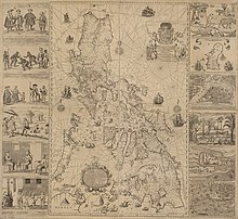
Several official Philippine maps published by Spain and United States in 18th and 20th centuries show Scarborough Shoal as Philippine territory. The 18th-century map "Carta hydrographica y chorographica de las Islas Filipinas" (1734) shows 3 atolls Galit, Panacot and Lumbay. The map also shows the shape of Lumbay as consistent with the current maps available as today. In 1792, another map drawn by the Malaspina expedition and published in 1808 in Madrid, Spain also showed Bajo de Masinloc as part of Philippine territory. The map showed the route of the Malaspina expedition to and around the atoll. It was reproduced in the Atlas of the 1939 Philippine Census, which was published in Manila a year later and predates the controversial 1947 Chinese South China Sea Claim Map that shows no Chinese name on it.[77] Another topographic map drawn in 1820 shows the atoll, named there as "Bajo Scarburo", as a constituent part of Sambalez (Zambales province).[78] During the 1900s, Mapa General, Islas Filipinas, Observatorio de Manila, and US Coast and Geodetic Survey Map include the Scarborough Shoal named as "Baju De Masinloc".[79] A map published in 1978 by the Philippine National Mapping and Resource Information Authority, however, did not indicate Scarborough Shoal as part of the Philippines.[80] Scholar Li Xiao Cong stated in his published paper that Panacot Shoal is not Scarborough Shoal, in the 1778 map "A chart of the China Sea and Philippine Islands with the Archipelagos of Felicia and Soloo", Scarborough shoal and 3 other shoals Galit, Panacot and Lumbay were all shown independently. Li also pointed out that the three shoals were also shown on Chinese maps which were published in 1717.[81]
In 1957, the Philippine government conducted an oceanographic survey of the area and together with the US Navy force based in then U.S. Naval Base Subic Bay in Zambales, used the area as an impact range for defence purposes. An 8.3-meter high flag pole flying a Philippine flag was raised in 1965. An iron tower that was to serve as a small lighthouse was also built and operated the same year.[82][83] In 1992, the Philippine Navy rehabilitated the lighthouse and reported it to the International Maritime Organization for publication in the List of Lights. As of 2009[update], the military-maintained lighthouse is non-operational.[84]

Historically, the Philippine boundary has been defined by its 3 treaties,[85][86] Treaty of Paris (1898), Treaty of Washington (1900) and "Convention regarding the boundary between the Philippine Archipelago and the State of North Borneo". Many analysts consider that the 1900 Treaty of Washington concerned only the islands of Sibutu and Cagayan de Sulu.,[87][88] but a point of view argued that Scarborough Shoal has been transferred to the United States based on the Treaty of Washington (1900),[89] ignoring the fact that the cession documents from the United States to the Philippines did not have any reference to the Scarborough Shoal.[90]
The DFA asserts that the basis of Philippine sovereignty and jurisdiction over the rock features of Bajo de Masinloc are not premised on the cession by Spain of the Philippine archipelago to the United States under the Treaty of Paris, and argues that the matter that the rock features of Bajo de Masinloc are not included or within the limits of the Treaty of Paris as alleged by China is therefore immaterial and of no consequence.[70][72]
Presidential Decree No. 1596 issued by President Ferdinand Marcos on 11 June 1978 asserted that islands designated as the Kalayaan Island Group and comprising most of the Spratly Islands are subject to the sovereignty of the Philippines,[91] and by virtue of the Presidential Decree No. 1599 issued on 11 June 1978 claimed an Exclusive Economic Zone up to 200 nautical miles (370 km) from the baselines from which their territorial sea is measured.[92]
The Philippines' bilateral dispute with China over the atoll began at the start of 1997 with Filipino naval ships preventing Chinese boats from approaching the atoll including at one point turning away a boat carrying ham radio operators and again.[6][93] On 5 June of that year, Domingo Siazon, who was then the Philippine Secretary of Foreign Affairs, testified in front of the Committee on Foreign Relations of the United States Senate that the Shoal was "a new issue on overlapping claims between the Philippines and China".[94]
In 2009, the Philippine Baselines Law of 2009 (RA 9522), principally authored by Antonio Trillanes[95] and sponsored by Senator Miriam Defensor Santiago, was enacted into law. The new law classified the Kalayaan Island Group and the Scarborough Shoal as a regime of islands under the Republic of the Philippines.[4][96]
Permanent Court of Arbitration tribunal ruling edit
In January 2013, the Philippines formally initiated arbitration proceedings against the PRC claim on the territories within the "nine-dash line" that include Scarborough Shoal, which the Philippines claimed is unlawful under the UNCLOS convention.[33] An arbitration tribunal was constituted under Annex VII of UNCLOS. It was decided in July 2013 that the Permanent Court of Arbitration (PCA) would function as registry and provide administrative duties in the proceedings.[35]
On 12 July 2016, the PCA tribunal ruled in favor of the Philippines on most of her submissions. In its decision, it concluded that there is no evidence that China had historically exercised exclusive control over the waters or resources, hence there was "no legal basis for China to claim historic rights" over the area within the nine-dash line.[97][37] The tribunal also judged that the PRC had caused "severe harm to the coral reef environment",[38] and that it had violated the Philippines' sovereign rights in its Exclusive Economic Zone by interfering with Philippine fishing and petroleum exploration by, for example, restricting the traditional fishing rights of Filipino fishermen at Scarborough Shoal.[39] The PRC rejected the ruling, calling it "ill-founded"". President of the People's Republic of China Xi Jinping stated that "China's territorial sovereignty and marine rights in the South China Sea will not be affected by the so-called Philippines South China Sea ruling in any way". Xi added that nevertheless, the PRC would still be "committed to resolving disputes" with its neighbours.[39][41] Numerous countries called on the international community to support the Tribunal ruling and positively acknowledge it. Among them were Australia, Belgium, Bosnia and Herzegovina, Bulgaria, Canada, Croatia, Cyprus, Czechia, Denmark, Estonia, Finland, France, Germany, Greece, Hungary, India, Ireland, Italy, Japan, Latvia, Lithuania, Luxembourg, Malta, Myanmar, the Netherlands, New Zealand, Poland, Portugal, Romania, Singapore, Slovakia, Slovenia, South Korea, Spain, Sweden, the United Kingdom, and the United States, as well as claimants to the area such as Malaysia, the Philippines, and Vietnam.[14][15]
See also edit
- China–Philippines relations
- List of territorial disputes
- South China Sea Islands
- West Philippine Sea
Other East Asian island disputes edit
- Kuril Islands dispute
- Liancourt Rocks dispute
- Okinotorishima, another smaller shoal with three skerries
- Paracel Islands
- Pratas Island and the Vereker Banks[citation needed]
- Senkaku Islands dispute
- Spratly Islands dispute
Notes edit
- ^ Often considered rocks because the other skerry's area during high-tide is negligible[citation needed]
References edit
- ^ Lin, Cheng-yi (19 February 2008). "Taiwan's Spratly Initiative in the South China Sea". Association for Asia Research. Archived from the original on 14 May 2011. Retrieved 6 March 2023.
- ^ "Ministry of Foreign Affairs of the Republic of China (Taiwan) reiterates its position on the South China Sea". Taiwan Ministry of Foreign Affairs. 7 July 2015.
- ^ "Philippine position on Bajo de Masinloc (Scarborough Shoal) and the waters within its vicinity". Official Gazette of the Republic of the Philippines. Department of Foreign Affairs. 18 April 2012. Retrieved 6 March 2023.
The name Bajo de Masinloc (translated as "under Masinloc") itself identifies the shoal as a particular political subdivision of the Philippine province of Zambales, known as Masinloc.
- ^ a b "Republic Act No. 9522". Philippine Supreme Court E-Library. Supreme Court of the Philippines. 12 March 2019. Archived from the original on 7 June 2019. Retrieved 7 June 2019.
- ^ Aning, Jerome (5 May 2012). "PH plane flies over Panatag Shoal". Philippine Daily Inquirer. Archived from the original on 26 February 2014. Retrieved 15 February 2014.
- ^ a b c Zou, Keyuan (1999). "Scarborough Reef: a new flashpoint in Sino-Philippine relations?" (PDF). IBRU Boundary & Security Bulletin, University of Durham. 7 (2): 11. Archived (PDF) from the original on 10 August 2013. Retrieved 15 February 2014.
- ^ a b Elleman, Bruce; Kotkin, Stephen; Schofield, Clive (18 December 2014). Beijing's Power and China's Borders: Twenty Neighbors in Asia. Routledge. ISBN 978-1-317-51564-7. Retrieved 12 May 2021.
- ^ a b Matikas Santos (12 July 2016). "China's 'nine-dash line, historic rights' invalid–tribunal". Philippine Daily Inquirer. Archived from the original on 13 July 2016. Retrieved 23 May 2020.
- ^ Shicun Wu (2013). Solving Disputes for Regional Cooperation and Development in the South China Sea: A Chinese Perspective. Elsevier Science. p. 79. ISBN 978-1-78063-355-8.
- ^ "Scarborough shoal standoff: A timeline". Philippine Daily Inquirer. 9 May 2012. Archived from the original on 23 April 2020. Retrieved 23 May 2020.
- ^ "TIMELINE: Skirmishes, standoffs, harassment in West Philippine Sea". Rappler. 12 June 2019. Archived from the original on 21 February 2020. Retrieved 23 May 2020.
- ^ "PRESS RELEASE—The South China Sea Arbitration" (PDF) (Press release). Permanent Court of Arbitration. 12 July 2016. Archived from the original (PDF) on 12 July 2016. Retrieved 22 January 2019.
- ^ "Courting trouble". The Economist. 16 July 2016. ISSN 0013-0613. Archived from the original on 17 June 2019. Retrieved 22 January 2019.
- ^ a b "Declaration by the High Representative on behalf of the EU on the Award rendered in the Arbitration between the Republic of the Philippines and the People's Republic of China" (Press release). Council of the European Union. 15 July 2016. Archived from the original on 9 February 2018.
- ^ a b "Arbitration Support Tracker". Asia Maritime Transparency Initiative. 16 June 2016. Archived from the original on 22 April 2020. Retrieved 23 May 2020.
- ^ a b W. Gilbert (1804) A New Nautical Directory for the East-India and China Navigation .., pp.480=482.
- ^ a b Joseph Huddart (1801). The Oriental Navigator, Or, New Directions for Sailing to and from the East Indies: Also for the Use of Ships Trading in the Indian and China Seas to New Holland, &c. &c. James Humphreys. p. 454. Archived from the original on 10 September 2017. Retrieved 28 February 2016.
- ^ a b "Ever heard of the 1734 Murillo Velarde map and why it should be renamed?". Rappler. 20 September 2019. Archived from the original on 27 September 2019. Retrieved 6 May 2020.
- ^ https://www.raremaps.com/gallery/detail/39979/a-chart-of-the-china-sea-inscribed-to-monsr-dapres-de-mann-dapres-de-mannevillette-dalrymple
- ^ James Horsburgh · 'India Directory, Or, Directions for Sailing to and from the East Indies, China, New Holland, Cape of Good Hope, Brazil, and the Interjacent Ports' 1817 p. 255
- ^ Arches II, Victor (28 April 2012). "It belongs to China". Manila Standard Today.
- ^ "Philippine Newspaper: "Huangyan Island belongs to China"". China Internet Information Center. 11 May 2012.
- ^ "China's Indisputable Sovereignty Over the Xisha and Nansha Islands", Beijing Review Issue 7, 18 February 1980 https://s3.documentcloud.org/documents/3009524/China-S-Indisputable-Sovereignty-Over-the-Xisha.pdf
- ^ Storms, Martijn; Cams, Mario; Demhardt, Imre Josef; Ormeling, Ferjan (13 May 2019). Mapping Asia: Cartographic Encounters Between East and West: Regional Symposium of the ICA Commission on the History of Cartography, 2017. Springer. p. 92. ISBN 978-3-319-90406-1. Retrieved 12 May 2021.
- ^ Vitug, Marites Dañguilan (21 November 2018). Rock Solid: How the Philippines Won Its Maritime Case against China. Ateneo de Manila University Press. ISBN 978-971-550-887-2. Retrieved 12 May 2021.
- ^ Li Xiaocong (2015). 从古地图看黄岩岛的归属 [Viewing the Ownership of Huangyan Island from Ancient Maps] (PDF). Journal of Nanjing University (Philosophy, Humanities and Social Sciences) (in Chinese) (4). Archived from the original (PDF) on 24 June 2016.
- ^ https://www.raremaps.com/gallery/detail/39979/a-chart-of-the-china-sea-inscribed-to-monsr-dapres-de-mann-dapres-de-mannevillette-dalrymple
- ^ Scheiber, Harry N.; Kraska, James; Kwon, Moon-Sang (24 July 2015). Science, Technology, and New Challenges to Ocean Law. BRILL. pp. 404–405. ISBN 978-90-04-29961-0. Retrieved 12 May 2021.
- ^ Rosen, Mark E. (August 2014). Philippine Claims in the South China Sea: A Legal Analysis (PDF). CNA. pp. 25–26. Archived from the original (PDF) on 9 December 2016. Retrieved 12 May 2021.
- ^ Sullivan, Michael (20 May 2016). "Could A Lighthouse Have Prevented South China Sea's Latest Flashpoint?". NPR.org. Retrieved 9 June 2021.
- ^ Southgate, Laura (8 May 2019). ASEAN Resistance to Sovereignty Violation: Interests, Balancing and the Role of the Vanguard State. Policy Press. p. 173. ISBN 978-1-5292-0220-5. Retrieved 12 May 2021.
- ^ Tordesillas, Ellen (21 January 2013). "Chinese 'occupation' of Bajo de Masinloc could reduce PH territorial waters by 38 percent". VERA Files. ABS-CBN News and Current Affairs. Archived from the original on 23 January 2013. Retrieved 15 February 2014.
- ^ a b "Timeline: South China Sea dispute". Financial Times. 12 July 2016. Archived from the original on 14 December 2016. Retrieved 13 July 2016.
- ^ Beech, Hannah (11 July 2016). "China's Global Reputation Hinges on Upcoming South China Sea Court Decision". TIME. Archived from the original on 13 July 2016. Retrieved 2 July 2018.
- ^ a b "Press Release: Arbitration between the Republic of the Philippines and the People's Republic of China: Arbitral Tribunal Establishes Rules of Procedure and Initial Timetable". PCA. 27 August 2013. Archived from the original on 21 July 2016. Retrieved 13 July 2016.
- ^ "Press Release: The South China Sea Arbitration (The Republic of the Philippines v. The People's Republic of China)" (PDF). PCA. 12 July 2016. Archived from the original (PDF) on 12 July 2016. Retrieved 13 July 2016.
- ^ a b "A UN-appointed tribunal dismisses China's claims in the South China Sea". The Economist. 12 July 2016. Archived from the original on 13 September 2017. Retrieved 11 September 2017.
- ^ a b Perez, Jane (12 July 2016). "Beijing's South China Sea Claims Rejected by Hague Tribunal". The New York Times. Archived from the original on 12 July 2016. Retrieved 3 March 2017.
- ^ a b c Tom Phillips; Oliver Holmes; Owen Bowcott (12 July 2016). "Beijing rejects tribunal's ruling in South China Sea case". The Guardian. Archived from the original on 12 July 2016. Retrieved 13 July 2016.
- ^ Chow, Jermyn (12 July 2016). "Taiwan rejects South China Sea ruling, says will deploy another navy vessel to Taiping". The Straits Times. Archived from the original on 17 June 2018. Retrieved 2 July 2018.
- ^ a b "South China Sea: Tribunal backs case against China brought by Philippines". BBC News. 12 July 2016. Archived from the original on 20 June 2018. Retrieved 21 June 2018.
- ^ Jun Mai; Shi Jiangtao (12 July 2016). "Taiwan-controlled Taiping Island is a rock, says international court in South China Sea ruling". South China Morning Post. Archived from the original on 15 July 2016. Retrieved 2 July 2018.
- ^ Krishnamoorthy, Nandini (9 February 2017). "South China Sea: Philippines sees Chinese attempt to build on reef near its coast". IBT International Business Times. Archived from the original on 9 February 2017. Retrieved 9 February 2017.
- ^ Randy V. Datu (14 June 2018). "2 bottles of water for P3,000 worth of fish in Panatag Shoal". Rappler. Archived from the original on 23 January 2019. Retrieved 22 January 2019.
- ^ "Destruction of Scarborough Shoal seen on Google Earth". philstar.com. Archived from the original on 17 April 2019. Retrieved 22 January 2019.
- ^ "Scarborough Contingency plan". www.amti.csis.org. CSIS maritime Transparency Initiative. 30 March 2016. Archived from the original on 11 February 2017. Retrieved 9 February 2017.
- ^ Poling, Gregory; Cooper, Zack (30 March 2016). "No reclamation so far on Scarborough Shoal". www.amti.csis.org. CSIS AMTI. Archived from the original on 11 February 2017. Retrieved 9 February 2017.
- ^ Malakunas, Karl; Abbugao, Martin (8 September 2016). "China under pressure at Asia summit over sea row". Yahoo News. Archived from the original on 8 September 2016. Retrieved 8 September 2016.
- ^ Perlez, Jane (5 September 2016). "New Chinese Vessels Seen Near Disputed Reef in South China Sea". NYT. Archived from the original on 6 September 2016. Retrieved 8 September 2016.
- ^ a b c "China to build on disputed shoal in South China Sea". Reuters. 17 March 2017.
- ^ Panda, Ankit (10 June 2019). "South China Sea: Philippine Coast Guard Spots PLAN Warship Off Scarborough Shoal". The Diplomat.
- ^ "Carpio: China to try to reclaim Scarborough Shoal before Duterte term ends". Philippine Daily Inquirer. 26 September 2019.
- ^ a b "Scarborough Shoal last 'piece' of China's militarization in disputed sea: analyst". ABS CBN. 10 February 2020.
- ^ https://asia.nikkei.com/Politics/International-relations/South-China-Sea/Philippines-dismantles-Chinese-floating-barrier-at-Scarborough-Shoal
- ^ "PCG: China installs floating barrier southeast of Bajo de Masinloc". 24 September 2023.
- ^ "Satellite images reveal PRC barrier at disputed atoll". taipeitimes.com. Taipei Times. Retrieved 26 February 2024.
- ^ Rosenberg, David, "Governing the South China Sea: From Freedom of the Seas to Ocean Enclosure Movements" Archived 20 August 2014 at the Wayback Machine, Harvard Asia Quarterly | The South China Sea "2013/02".
- ^ Luo, Zheng 罗铮; Lü, Desheng 吕德胜 (10 May 2012). "Six Irrefutable Proofs: Huangyan Island Belongs to China 六大铁证:黄岩岛属于中国 (in Chinese)". PLA Daily 解放军报. Archived from the original on 23 May 2012. Retrieved 22 May 2012. See under "Irrefutable proof 1: China discovered the Huangyuan Island long time ago" 铁证一:中国早发现黄岩岛.
- ^ Han, Zhenhua 韩振华 (1979). "The South Sea as Chinese National Territory in the Yuan-Era 'Measurement of the Four Seas' 元代《四海测验》中的中国疆宇之南海 (in Chinese)". Research on the South China Sea 南海问题研究. 1979. Archived from the original on 5 October 2013. Retrieved 22 May 2012. A rough English translation of this article can be found here Archived 25 June 2013 at the Wayback Machine.
- ^ China's Sovereignty Over the Xisha and Zhongsha Islands is Indisputable 中国对西沙群岛和南沙群岛的主权无可争辩 (in Chinese). Foreign Ministry of the People's Republic of China 中华人民共和国外交部. 30 January 1980. p. 6.. This document claims that "the Nanhai measuring point was 'where the pole star rises at 15 [ancient Chinese] degrees [above the horizon]', which should correspond to 14.47 [modern] degrees; adding a margin of error of about 1 degree, its location falls precisely on today's Xisha Islands" (南海这个测点'北极出地一十五度'应为北纬14度47分,加上一度左右的误差,其位置也正好在今西沙群岛), which shows that "the Xisha Islands were inside Chinese territory during the Yuan dynasty" (西沙群岛在元代是在中国的疆界之内).
- ^ See for instance Niu, Zhongxun (1998). "Investigation on the Geographical Location of Nanhai in the Yuan-Dynasty Survey of the Four Seas 元代四海测验中南海观测站地理位置考辨". Research on the Historical Geography of China's Frontiers 中国边疆史地研究. 1998 (2)..
- ^ Zeng, Zhaoxuan 曾昭旋 (1990). "The Yuan-Dynasty Survey of Nanhai was in Champa: Guo Shoujing Did not Go to the Zhongsha or Xisha to Measure Latitude 元代南海测验在林邑考--郭守敬未到西中沙测量纬度 (in Chinese)". Historical Research 历史研究. 1990 (5).. Among other evidence, Zeng cites a Chinese geologist who argues that the Scarborough Shoal was still submerged under water during the Yuan dynasty.
- ^ Chen, Meidong 陈美东 (2003). Critical Biography of Guo Shoujing 郭守敬评传. Nanjing: Nanjing University Press. pp. 78 and 201–4..
- ^ Sivin, Nathan (2009). Granting the Seasons: The Chinese Astronomical Reform of 1280. New York: Springer. pp. 577–79..
- ^ Granados, Ulises (22 December 2019). "Scarborough Shoal: Debunking Historical Myths".
- ^ Zou 2005, p. 63.
- ^ Zou 2005, p. 62.
- ^ a b Zou 2005, p. 64.
- ^ Chen Ruobing 陈若冰 (21 April 2012). 中国与菲律宾中沙黄岩岛之争 [The dispute between China and the Philippines over Zhongsha Huangyan Island] (in Chinese). Sohu News. Archived from the original on 21 April 2012. Retrieved 21 March 2014. English translation of original Chinese text available here Archived 30 April 2012 at the Wayback Machine.
- ^ a b c d Philippine Position on Bajo de Masinloc and the Waters Within its Vicinity Archived 26 April 2012 at the Wayback Machine (18 April 2012), The Department of Foreign Affairs of the Republic of the Philippines.
- ^ "Philippine Position on Bajo de Masinloc and the Waters Within its Vicinity". 18 April 2012. Archived from the original on 26 April 2012. Retrieved 19 April 2012.
- ^ a b PH sovereignty based on Unclos, principles of international law (20 April 2012), The Department of Foreign Affairs of the Republic of the Philippines (as reported by globalnation.inquirer.net Archived 19 April 2012 at the Wayback Machine).
- ^ "China deploys gunboat". Philippine Daily Inquirer. 20 April 2012. Archived from the original on 22 April 2012. Retrieved 20 April 2012.
- ^ Fr. Joaquin G. Bernas S. J. (22 April 2012). "Scarborough Shoal". Philippine Daily Inquirer. Archived from the original on 4 May 2012. Retrieved 14 May 2012.
- ^ PART XV: SETTLEMENT OF DISPUTES Archived 8 July 2017 at the Wayback Machine, UNITED NATIONS CONVENTION ON THE LAW OF THE SEA: AGREEMENT RELATING TO THE IMPLEMENTATION OF PART XI OF THE CONVENTION Archived 28 June 2017 at the Wayback Machine, The United Nations.
- ^ Zou 2005, pp. 64–65.
- ^ "The Manila Times – Trusted Since 1898". The Manila Times. Archived from the original on 9 July 2012. Retrieved 17 April 2012.
- ^ "Scarborough belongs to PH, old maps show". Philippine Daily Inquirer. 23 April 2012. Archived from the original on 23 April 2012. Retrieved 23 April 2012.
- ^ "In a Troubled Sea: Reed Bank, Kalayaan, Lumbay, Galit, and Panacot". Yahoo News Philippines. 28 March 2011. Archived from the original on 13 March 2013.
- ^ Zou 2005, p. 58
- ^ Li Xiaocong (2015). 从古地图看黄岩岛的归属 [Viewing the Ownership of Huangyan Island from Ancient Maps] (PDF). Journal of Nanjing University (Philosophy, Humanities and Social Sciences) (in Chinese) (4). Archived from the original (PDF) on 24 June 2016.
- ^ "In The Know: The Scarborough Shoal". Philippine Daily Inquirer. 12 April 2012. Archived from the original on 24 June 2012. Retrieved 12 June 2012.
- ^ What's become of the MMDA?, Philippine Star, 2 April 2008 [dead link]
- ^ COAST GUARD DISTRICT NATIONAL CAPITAL REGION – CENTRAL LUZON LIGHTSTATIONS (archived from the original on 16 January 2010)
- ^ Bautista, Lowell (2009). "The Philippine Treaty Limits and Territorial Water Claim in International Law". ro.uow.edu.au. Archived from the original on 23 January 2019. Retrieved 22 January 2019.
- ^ "Backgrounder: Facts about Philippines' illegal occupation of China's Nansha Islands – Xinhua | English.news.cn". Archived from the original on 8 August 2016. Retrieved 9 June 2016.
- ^ François-Xavier Bonnet (November 2012). Geopolitics of Scarborough Shoal (pdf) (Report). IRASEC. p. 12. Archived from the original on 4 March 2016. Retrieved 22 October 2015.
Many analysts consider, in a restrictive manner, that this treaty concerned only the islands of Sibutu and Cagayan de Sulu. In fact, the unique article of this treaty is open to all islands that belonged to the Philippines during the Spanish time but would be found, in the future, outside the limits of the Treaty of Paris. Among them were the two islands cited above.
- ^ Joaquin G. Bernas (1 January 1995). Foreign Relations in Constitutional Law. Rex Bookstore, Inc. pp. 42–. ISBN 978-971-23-1903-7. Archived from the original on 17 August 2017. Retrieved 6 October 2016.
- ^ "Maritime affairs expert separates facts from fiction on Scarborough Shoal". Philippine Daily Inquirer. 6 October 2014. Archived from the original on 23 October 2015. Retrieved 21 October 2015.
- ^ Bautista, Lowell B. (2008). "The Historical Context and Legal Basis of the Philippine Treaty Limits" (PDF). blog.hawaii.edu. Archived (PDF) from the original on 27 August 2015. Retrieved 22 January 2019.
- ^ "Presidential Decree No. 1596, s. 1978". Official Gazette of the Republic of the Philippines. 11 June 1978. Archived from the original on 14 July 2017. Retrieved 11 September 2023.
- ^ "Presidential Decree No. 1599, s. 1978". Official Gazette of the Republic of the Philippines. 11 June 1978. Archived from the original on 21 July 2021. Retrieved 11 September 2023.
- ^ Schmetzer, Uli (21 May 1997). "Philippines beefing up its air force and navy". Chicago Tribune. Chicago, Illinois.
- ^ Zou, Keyuan (2005). Law of the Sea in East Asia: Issues And Prospects. Psychology Press. pp. 57–58. ISBN 978-0-415-35074-7. Archived from the original on 24 July 2017. Retrieved 28 February 2016.
- ^ "Senate of the Philippines 18th Congress". Senate of the Philippines. Retrieved 21 April 2021.
- ^ Philippine Baselines Law of 2009 Archived 18 March 2009 at the Wayback Machine (11 March 2009), GMA News.
- ^ "Press Release: The South China Sea Arbitration (The Republic of the Philippines v. The People's Republic of China)" (PDF). PCA. 12 July 2016. Archived from the original (PDF) on 12 July 2016. Retrieved 13 July 2016.
Further reading edit
- Bautista, Lowell B. (December 2011). "PHILIPPINE TERRITORIAL BOUNDARIES: INTERNAL TENSIONS, COLONIAL BAGGAGE, AMBIVALENT CONFORMITY" (PDF). JATI – Journal of Southeast Asian Studies. 16: 35–53. Archived from the original (PDF) on 30 July 2013.
- Bautista, Lowell B. (February 2012). "The Implications of Recent Decisions on the Territorial and Maritime Boundary Disputes in East and Southeast Asia". Maritime Energy Resources in Asia: Legal Regimes and Cooperation: NBR Special Report #37. Academia.edu.
- Bautista, Lowell B. (1 January 2010). "The Legal Status of the Philippine Treaty Limits in International Law". Aegean Review of the Law of the Sea and Maritime Law. 1. Academia.edu: 111–139. doi:10.1007/s12180-009-0003-5. S2CID 153653227.
- Bautista, Lowell B. (Fall 2009). "The Historical Background, Geographical Extent and Legal Bases of the Philippine Territorial Water Claim". The Journal of Comparative Asian Development. 8 (2): 365–395. doi:10.1080/15339114.2009.9678488. S2CID 219624498.
- Bonnet, Francois-Xavier "Geopolitics of Scarborough Shoal" Irasec's Discussion Papers, No 14, November 2012, Irasec.com
- Tupaz, Edsel. "Sidebar Brief: The Law of the Seas and the Scarborough Shoal Dispute". Jurist. Archived from the original on 15 June 2018. Retrieved 31 July 2012.
- "Philippines mulls removing 'Chinese' blocks at shoal". Google Philippines. AFP. 11 September 2013. Retrieved 11 September 2013.
- Hayton, B. (2014). The South China Sea: The Struggle for Power in Asia. Yale University Press. Retrieved 7 August 2018.