
KNOWPIA
WELCOME TO KNOWPIA

Seclin 
Summary
Seclin (French pronunciation: [səklɛ̃]) is a commune in the Nord department in northern France. It is part of the Métropole Européenne de Lille.[3]
Seclin | |
|---|---|
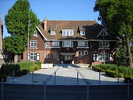 Seclin Town Hall | |
 Coat of arms | |
Location of Seclin .mw-parser-output .locmap .od{position:absolute}.mw-parser-output .locmap .id{position:absolute;line-height:0}.mw-parser-output .locmap .l0{font-size:0;position:absolute}.mw-parser-output .locmap .pv{line-height:110%;position:absolute;text-align:center}.mw-parser-output .locmap .pl{line-height:110%;position:absolute;top:-0.75em;text-align:right}.mw-parser-output .locmap .pr{line-height:110%;position:absolute;top:-0.75em;text-align:left}.mw-parser-output .locmap .pv>div{display:inline;padding:1px}.mw-parser-output .locmap .pl>div{display:inline;padding:1px;float:right}.mw-parser-output .locmap .pr>div{display:inline;padding:1px;float:left}html.skin-theme-clientpref-night .mw-parser-output .od,html.skin-theme-clientpref-night .mw-parser-output .od .pv>div,html.skin-theme-clientpref-night .mw-parser-output .od .pl>div,html.skin-theme-clientpref-night .mw-parser-output .od .pr>div{background:#000;color:#fff}html.skin-theme-clientpref-night .mw-parser-output .locmap{filter:grayscale(0.6)}@media(prefers-color-scheme:dark){html.skin-theme-clientpref-os .mw-parser-output .locmap{filter:grayscale(0.6)}html.skin-theme-clientpref-os .mw-parser-output .od,html.skin-theme-clientpref-os .mw-parser-output .od .pv>div,html.skin-theme-clientpref-os .mw-parser-output .od .pl>div,html.skin-theme-clientpref-os .mw-parser-output .od .pr>div{background:#000;color:#fff}}  Seclin  Seclin | |
| Coordinates: 50°32′56″N 3°01′49″E / 50.5489°N 3.0303°E | |
| Country | France |
| Region | Hauts-de-France |
| Department | Nord |
| Arrondissement | Lille |
| Canton | Faches-Thumesnil |
| Intercommunality | Métropole Européenne de Lille |
| Government | |
| • Mayor (2020–2026) | François-Xavier Cadart[1] |
| Area 1 | 17.42 km2 (6.73 sq mi) |
| Population (2021)[2] | 12,834 |
| • Density | 740/km2 (1,900/sq mi) |
| Time zone | UTC+01:00 (CET) |
| • Summer (DST) | UTC+02:00 (CEST) |
| INSEE/Postal code | 59560 /59113 |
| Elevation | 19–47 m (62–154 ft) (avg. 34 m or 112 ft) |
| 1 French Land Register data, which excludes lakes, ponds, glaciers > 1 km2 (0.386 sq mi or 247 acres) and river estuaries. | |
Population edit
| Year | Pop. | ±% p.a. |
|---|---|---|
| 1968 | 9,372 | — |
| 1975 | 9,924 | +0.82% |
| 1982 | 13,056 | +4.00% |
| 1990 | 12,281 | −0.76% |
| 1999 | 12,089 | −0.17% |
| 2007 | 12,219 | +0.13% |
| 2012 | 12,479 | +0.42% |
| 2017 | 12,414 | −0.10% |
| Source: INSEE[4] | ||
Notable residents edit
- André Ayew, Ghana national football team footballer
- Sébastien Enjolras, racing driver
- Victor Mollet, architect
- Jonathan Rousselle, basketball player
- Steeven Willems, Footballer
International relations edit
See also edit
References edit
- ^ "Répertoire national des élus: les maires" (in French). data.gouv.fr, Plateforme ouverte des données publiques françaises. 13 September 2022.
- ^ "Populations légales 2021". The National Institute of Statistics and Economic Studies. 28 December 2023.
- ^ INSEE commune file
- ^ Population en historique depuis 1968, INSEE
- ^ "Villes jumelées". ville-seclin.fr (in French). Seclin. Retrieved 18 November 2019.
Wikimedia Commons has media related to Seclin.