


Summary
Segundo is an unincorporated community and a census-designated place (CDP) located in and governed by Las Animas County, Colorado, United States. The population of the Segundo CDP was 100 at the United States Census 2020.[3] The Trinidad post office (Zip Code 81082) serves the area.[4]
Segundo, Colorado | |
|---|---|
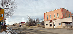 Colorado State Highway 12 as it passes through Segundo. | |
 Location of the Segundo CDP in Las Animas County, Colorado. | |
 Segundo Location of the Segundo CDP in the United States. | |
| Coordinates: 37°07′21″N 104°44′23″W / 37.1225204°N 104.7397385°W[1] | |
| Country | |
| State | |
| County | Las Animas County |
| Founded | 1904 |
| Government | |
| • Type | unincorporated community |
| Area | |
| • Total | 0.694 sq mi (1.797 km2) |
| • Land | 0.694 sq mi (1.797 km2) |
| • Water | 0.000 sq mi (0.000 km2) |
| Elevation | 6,598 ft (2,011 m) |
| Population | |
| • Total | 100 |
| • Density | 140/sq mi (56/km2) |
| Time zone | UTC-7 (MST) |
| • Summer (DST) | UTC-6 (MDT) |
| ZIP Code[4] | Trinidad 81082 |
| Area code | 719 |
| GNIS feature[2] | Segundo CDP |
History edit
Segundo was founded by Colorado Fuel and Iron (CF&I) as a company town to house its workers for a local coal mine. The town was the second mining community developed by CF&I in 1904 behind Primero and was referenced in the town's name, with segundo meaning "second" in Spanish.[5] CF&I offered adequate housing for the time, and promoted upward mobility through its sponsorship of a YMCA center, an elementary school, small businesses, and a company store. Segundo was a prosperous town until the 1920s, when the population began to decline due to constant health issues related to air pollution and outdated housing that lacked indoor plumbing. Declines in demand for metallurgical coke led to workers being laid off and, following a major fire in 1929, CF&I ceased their operations in Segundo. The town's population plummeted to the point that it almost became a ghost town.[6]
Geography edit
Segundo is located 14 miles (23 km) west of Trinidad along Colorado State Highway 12 in the valley of the Purgatoire River.
The Segundo CDP has an area of 444 acres (1.797 km2), all land.[1]
Demographics edit
The United States Census Bureau initially defined the Segundo CDP for the United States Census 2010.
| Year | Pop. | ±% |
|---|---|---|
| 2010 | 98 | — |
| 2020 | 100 | +2.0% |
| Source: United States Census Bureau | ||
See also edit
References edit
- ^ a b c "State of Colorado Census Designated Places - BAS20 - Data as of January 1, 2020". United States Census Bureau. Retrieved December 23, 2020.
- ^ a b c "U.S. Board on Geographic Names: Domestic Names". United States Geological Survey. Retrieved December 23, 2020.
- ^ a b United States Census Bureau. "Segundo CDP, Colorado". Retrieved April 14, 2023.
- ^ a b "Zip Code 81082 Map and Profile". zipdatamaps.com. 2020. Retrieved December 23, 2020.
- ^ Dawson, John Frank. Place Names in Colorado: Why 700 Communities Were So Named, 150 of Spanish or Indian origin. Denver, CO: The J. Frank Dawson Publishing Co. p. 46.
- ^ Glen D. Weaver and Ryan C. Graham, "Segundo, Colorado", New Mexico Historical Review (2008) 83#3 pp 323-351
External links edit
 Definitions from Wiktionary
 Media from Commons
 News from Wikinews
 Quotations from Wikiquote
 Texts from Wikisource
 Textbooks from Wikibooks
 Resources from Wikiversity
- Segundo @ UncoverColorado.com
- Segundo @ Sangres.com
- Segundo @ SouthernColorado.info
- Las Animas County website