
KNOWPIA
WELCOME TO KNOWPIA

Seilh 
Summary
Seilh (French pronunciation: [sɛj]; Occitan: Selh) is a commune in the Haute-Garonne department in southwestern France.[3]
Seilh | |
|---|---|
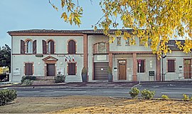 The town hall in Seilh | |
 Coat of arms | |
Location of Seilh .mw-parser-output .locmap .od{position:absolute}.mw-parser-output .locmap .id{position:absolute;line-height:0}.mw-parser-output .locmap .l0{font-size:0;position:absolute}.mw-parser-output .locmap .pv{line-height:110%;position:absolute;text-align:center}.mw-parser-output .locmap .pl{line-height:110%;position:absolute;top:-0.75em;text-align:right}.mw-parser-output .locmap .pr{line-height:110%;position:absolute;top:-0.75em;text-align:left}.mw-parser-output .locmap .pv>div{display:inline;padding:1px}.mw-parser-output .locmap .pl>div{display:inline;padding:1px;float:right}.mw-parser-output .locmap .pr>div{display:inline;padding:1px;float:left}html.skin-theme-clientpref-night .mw-parser-output .od,html.skin-theme-clientpref-night .mw-parser-output .od .pv>div,html.skin-theme-clientpref-night .mw-parser-output .od .pl>div,html.skin-theme-clientpref-night .mw-parser-output .od .pr>div{background:#000;color:#fff}html.skin-theme-clientpref-night .mw-parser-output .locmap{filter:grayscale(0.6)}@media(prefers-color-scheme:dark){html.skin-theme-clientpref-os .mw-parser-output .locmap{filter:grayscale(0.6)}html.skin-theme-clientpref-os .mw-parser-output .od,html.skin-theme-clientpref-os .mw-parser-output .od .pv>div,html.skin-theme-clientpref-os .mw-parser-output .od .pl>div,html.skin-theme-clientpref-os .mw-parser-output .od .pr>div{background:#000;color:#fff}}  Seilh  Seilh | |
| Coordinates: 43°41′44″N 1°21′15″E / 43.6956°N 1.3542°E | |
| Country | France |
| Region | Occitania |
| Department | Haute-Garonne |
| Arrondissement | Toulouse |
| Canton | Blagnac |
| Intercommunality | Toulouse Métropole |
| Government | |
| • Mayor (2020–2026) | Didier Castéra[1] |
| Area 1 | 6.16 km2 (2.38 sq mi) |
| Population (2021)[2] | 3,266 |
| • Density | 530/km2 (1,400/sq mi) |
| Time zone | UTC+01:00 (CET) |
| • Summer (DST) | UTC+02:00 (CEST) |
| INSEE/Postal code | 31541 /31840 |
| Elevation | 112–145 m (367–476 ft) (avg. 120 m or 390 ft) |
| 1 French Land Register data, which excludes lakes, ponds, glaciers > 1 km2 (0.386 sq mi or 247 acres) and river estuaries. | |
Population edit
| Year | Pop. | ±% p.a. |
|---|---|---|
| 1968 | 449 | — |
| 1975 | 492 | +1.32% |
| 1982 | 621 | +3.38% |
| 1990 | 816 | +3.47% |
| 1999 | 2,086 | +10.99% |
| 2007 | 2,916 | +4.28% |
| 2012 | 3,018 | +0.69% |
| 2017 | 3,268 | +1.60% |
| Source: INSEE[4] | ||
Monument edit
-
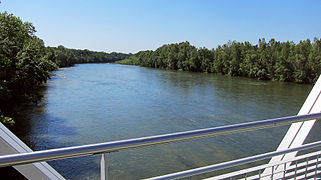 The Garonne
 -
 War memorial
 -
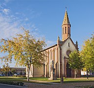 Church


See also edit
References edit
- ^ "Répertoire national des élus: les maires" (in French). data.gouv.fr, Plateforme ouverte des données publiques françaises. 13 September 2022.
- ^ "Populations légales 2021". The National Institute of Statistics and Economic Studies. 28 December 2023.
- ^ INSEE commune file
- ^ Population en historique depuis 1968, INSEE
Wikimedia Commons has media related to Seilh.