
KNOWPIA
WELCOME TO KNOWPIA

Seysses 
Summary
Seysses (French pronunciation: [sɛs]; Occitan: Sèishes) is a commune in the Haute-Garonne department, southwestern France.
Seysses | |
|---|---|
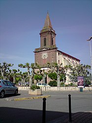 The church in Seysses | |
 Coat of arms | |
Location of Seysses .mw-parser-output .locmap .od{position:absolute}.mw-parser-output .locmap .id{position:absolute;line-height:0}.mw-parser-output .locmap .l0{font-size:0;position:absolute}.mw-parser-output .locmap .pv{line-height:110%;position:absolute;text-align:center}.mw-parser-output .locmap .pl{line-height:110%;position:absolute;top:-0.75em;text-align:right}.mw-parser-output .locmap .pr{line-height:110%;position:absolute;top:-0.75em;text-align:left}.mw-parser-output .locmap .pv>div{display:inline;padding:1px}.mw-parser-output .locmap .pl>div{display:inline;padding:1px;float:right}.mw-parser-output .locmap .pr>div{display:inline;padding:1px;float:left}html.skin-theme-clientpref-night .mw-parser-output .od,html.skin-theme-clientpref-night .mw-parser-output .od .pv>div,html.skin-theme-clientpref-night .mw-parser-output .od .pl>div,html.skin-theme-clientpref-night .mw-parser-output .od .pr>div{background:#000;color:#fff}html.skin-theme-clientpref-night .mw-parser-output .locmap{filter:grayscale(0.6)}@media(prefers-color-scheme:dark){html.skin-theme-clientpref-os .mw-parser-output .locmap{filter:grayscale(0.6)}html.skin-theme-clientpref-os .mw-parser-output .od,html.skin-theme-clientpref-os .mw-parser-output .od .pv>div,html.skin-theme-clientpref-os .mw-parser-output .od .pl>div,html.skin-theme-clientpref-os .mw-parser-output .od .pr>div{background:#000;color:#fff}}  Seysses  Seysses | |
| Coordinates: 43°29′56″N 1°18′48″E / 43.4989°N 1.3133°E | |
| Country | France |
| Region | Occitania |
| Department | Haute-Garonne |
| Arrondissement | Muret |
| Canton | Muret |
| Intercommunality | Le Muretain Agglo |
| Government | |
| • Mayor (2020–2026) | Jérôme Bouteloup[1] |
| Area 1 | 25.26 km2 (9.75 sq mi) |
| Population (2021)[2] | 9,789 |
| • Density | 390/km2 (1,000/sq mi) |
| Time zone | UTC+01:00 (CET) |
| • Summer (DST) | UTC+02:00 (CEST) |
| INSEE/Postal code | 31547 /31600 |
| Elevation | 160–182 m (525–597 ft) |
| 1 French Land Register data, which excludes lakes, ponds, glaciers > 1 km2 (0.386 sq mi or 247 acres) and river estuaries. | |
It is located 19 km south of Toulouse and 5 km north of Muret.[3]
Population edit
| Year | Pop. | ±% p.a. |
|---|---|---|
| 1968 | 2,229 | — |
| 1975 | 3,136 | +5.00% |
| 1982 | 4,221 | +4.34% |
| 1990 | 5,074 | +2.33% |
| 1999 | 5,753 | +1.41% |
| 2007 | 7,511 | +3.39% |
| 2012 | 7,910 | +1.04% |
| 2017 | 9,055 | +2.74% |
| 2018 | 9,322 | +2.95% |
| Source: INSEE[4] | ||
See also edit
References edit
- ^ "Répertoire national des élus: les maires" (in French). data.gouv.fr, Plateforme ouverte des données publiques françaises. 13 September 2022.
- ^ "Populations légales 2021". The National Institute of Statistics and Economic Studies. 28 December 2023.
- ^ "Bienvenue à Seysses - (31) Haute Garonne". Archived from the original on 24 March 2009. Retrieved 28 July 2009.
- ^ Population en historique depuis 1968, INSEE
External links edit
Wikimedia Commons has media related to Seysses.
- Official site