


Summary
Shalinsky District (Russian: Шалинский райо́н) is an administrative district (raion), one of the thirty in Sverdlovsk Oblast, Russia.[1] The area of the district is 4,852 square kilometers (1,873 sq mi).[3] Its administrative center is the urban locality (a work settlement) of Shalya.[2] Population: 23,834 (2010 Census);[4] 26,019 (2002 Census);[8] 31,384 (1989 Soviet census).[9] The population of Shalya accounts for 27.0% of the district's total population.[4]
Shalinsky District
Шалинский район | |
|---|---|
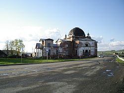 Sylva's Church, Shalinsky District | |
 Flag  Coat of arms | |
 Location of Shalinsky District in Sverdlovsk Oblast | |
| Coordinates: 57°16′01″N 58°49′37″E / 57.267°N 58.827°E | |
| Country | Russia |
| Federal subject | Sverdlovsk Oblast[1] |
| Established | 1932 |
| Administrative center | Shalya[2] |
| Area | |
| • Total | 4,852 km2 (1,873 sq mi) |
| Population | |
| • Total | 23,834 |
| • Density | 4.9/km2 (13/sq mi) |
| • Urban | 39.4% |
| • Rural | 60.6% |
| Administrative structure | |
| • Administrative divisions | 2 Work settlements, 9 Selsoviets |
| • Inhabited localities[5] | 2 Urban-type settlements[6], 41 rural localities |
| Municipal structure | |
| • Municipally incorporated as | Shalinsky Urban Okrug[7][5] |
| Website | http://www.shalya.ru/ |
Administrative and municipal status edit
Within the framework of administrative divisions, Shalinsky District is one of the thirty in the oblast.[1] The work settlement of Shalya serves as its administrative center.[2]
As a municipal division, the territory of the district is split between two municipal formations—Shalinsky Urban Okrug,[7][5] to which the work settlement of Shalya and thirty-eight of the administrative district's rural localities belong,[10] and Staroutkinsk Urban Okrug,[11][5] which covers the rest of the administrative district's territory, including the work settlement of Staroutkinsk and three remaining rural localities.[12]
References edit
Notes edit
- ^ a b c Charter of Sverdlovsk Oblast
- ^ a b c Государственный комитет Российской Федерации по статистике. Комитет Российской Федерации по стандартизации, метрологии и сертификации. №ОК 019-95 1 января 1997 г. «Общероссийский классификатор объектов административно-территориального деления. Код 65 257», в ред. изменения №278/2015 от 1 января 2016 г.. (State Statistics Committee of the Russian Federation. Committee of the Russian Federation on Standardization, Metrology, and Certification. #OK 019-95 January 1, 1997 Russian Classification of Objects of Administrative Division (OKATO). Code 65 257, as amended by the Amendment #278/2015 of January 1, 2016. ).
- ^ a b "General Information" (in Russian). Shalinsky District. Retrieved November 27, 2016.
- ^ a b c Russian Federal State Statistics Service (2011). Всероссийская перепись населения 2010 года. Том 1 [2010 All-Russian Population Census, vol. 1]. Всероссийская перепись населения 2010 года [2010 All-Russia Population Census] (in Russian). Federal State Statistics Service.
- ^ a b c d Order #120-P
- ^ The count of urban-type settlements may include the work settlements, the resort settlements, the suburban (dacha) settlements, as well as urban-type settlements proper.
- ^ a b Law #92-OZ
- ^ Federal State Statistics Service (May 21, 2004). Численность населения России, субъектов Российской Федерации в составе федеральных округов, районов, городских поселений, сельских населённых пунктов – районных центров и сельских населённых пунктов с населением 3 тысячи и более человек [Population of Russia, Its Federal Districts, Federal Subjects, Districts, Urban Localities, Rural Localities—Administrative Centers, and Rural Localities with Population of Over 3,000] (XLS). Всероссийская перепись населения 2002 года [All-Russia Population Census of 2002] (in Russian).
- ^ Всесоюзная перепись населения 1989 г. Численность наличного населения союзных и автономных республик, автономных областей и округов, краёв, областей, районов, городских поселений и сёл-райцентров [All Union Population Census of 1989: Present Population of Union and Autonomous Republics, Autonomous Oblasts and Okrugs, Krais, Oblasts, Districts, Urban Settlements, and Villages Serving as District Administrative Centers]. Всесоюзная перепись населения 1989 года [All-Union Population Census of 1989] (in Russian). Институт демографии Национального исследовательского университета: Высшая школа экономики [Institute of Demography at the National Research University: Higher School of Economics]. 1989 – via Demoscope Weekly.
- ^ OKATO lists two work settlements and forty-one rural localities in Shalinsky District. The work settlement of Shalya and thirty-eight rural localities are listed as a part of Shalinsky Urban Okrug in Law #85-OZ.
- ^ Law #48-OZ
- ^ OKATO lists two work settlements and forty-one rural localities in Shalinsky District. The work settlement of Staroutkinsk and three rural localities are listed as a part of Staroutkinsk Urban Okrug in Law #85-OZ.
Sources edit
- Областная Дума Законодательного Собрания Свердловской области. №105-ОЗ 23 декабря 2010 г. «Устав Свердловской обласит», в ред. Закона №56-ОЗ от 30 июня 2014 г. «О внесении изменений в Устав Свердловской области». Вступил в силу через 10 дней после официального опубликования (4 января 2011 г.), за исключением отдельных положений, вступивших в силу в иные сроки. Опубликован: "Областная газета", №466–467, 24 декабря 2010 г.. (Oblast Duma of the Legislative Assembly of Sverdlovsk Oblast. #105-OZ December 23, 2010 Charter of Sverdlovsk Oblast, as amended by the Law #56-OZ of June 30, 2014 On Amending the Charter of Sverdlovsk Oblast. Effective as of the day which is 10 days after the official publication date (January 4, 2011), with the exception of certain clauses which took effect on different dates.).
- Министерство строительства и развития инфраструктуры Свердловской области. Приказ №120-П от 21 апреля 2014 г. «Об утверждении списка административно-территориальных единиц и населённых пунктов Свердловской области». (Sverdlovsk Oblast Ministry of Construction and Infrastructure Development. Order #120-P of April 21, 2014 On Adopting the Registry of the Administrative-Territorial Units and Inhabited Localities in Sverdlovsk Oblast. ).
- Областная Дума Законодательного Собрания Свердловской области. Закон №92-ОЗ от 12 октября 2004 г. «Об установлении границ муниципального образования Шалинский район и наделении его статусом городского округа», в ред. Закона №85-ОЗ от 12 июля 2007 г. «О границах муниципальных образований, расположенных на территории Свердловской области». Вступил в силу с 31 декабря 2004 г. Опубликован: "Областная газета", №274–277, 15 октября 2004 г. (Oblast Duma of the Legislative Assembly of Sverdlovsk Oblast. Law #92-OZ of October 12, 2004 On Establishing the Borders of the Municipal Formation of Shalinsky District and on Granting It Urban Okrug Status, as amended by the Law #85-OZ of July 12, 2007 On the Borders of the Municipal Formations Located on the Territory of Sverdlovsk Oblast. Effective as of December 31, 2004.).
- Областная Дума Законодательного Собрания Свердловской области. Закон №48-ОЗ от 21 июля 2004 г. «Об установлении границ муниципального образования посёлок Староуткинск и наделении его статусом городского округа», в ред. Закона №85-ОЗ от 12 июля 2007 г. «О границах муниципальных образований, расположенных на территории Свердловской области». Вступил в силу с 31 декабря 2004 г. Опубликован: "Областная газета", №194–196, 22 июля 2004 г. (Oblast Duma of the Legislative Assembly of Sverdlovsk Oblast. Law #48-OZ of July 21, 2004 On Establishing the Borders of the Municipal Formation of the Settlement of Staroutkinsk and on Granting It Urban Okrug Status, as amended by the Law #85-OZ of July 12, 2007 On the Borders of the Municipal Formations Located on the Territory of Sverdlovsk Oblast. Effective as of December 31, 2004.).
- Областная Дума Законодательного Собрания Свердловской области. Закон №85-ОЗ от 12 июля 2007 г. «О границах муниципальных образований, расположенных на территории Свердловской области», в ред. Закона №107-ОЗ от 29 октября 2013 г. «Об упразднении отдельных населённых пунктов, расположенных на территории города Ивделя, и о внесении изменений в Приложение 39 к Закону Свердловской области "О границах муниципальных образований, расположенных на территории Свердловской области"». Вступил в силу через 10 дней после официального опубликования. Опубликован: "Областная газета", №232–249, 17 июля 2007 г. (Oblast Duma of the Legislative Assembly of Sverdlovsk Oblast. Law #85-OZ of July 12, 2007 On the Borders of the Municipal Formations on the Territory of Sverdlovsk Oblast, as amended by the Law #107-OZ of October 29, 2013 On Abolishing Several Inhabited Localities on the Territory of the Town of Ivdul and on Amending the Law of Sverdlovsk Oblast "On the Borders of the Municipal Formations on the Territory of Sverdlovsk Oblast". Effective as of the day which is 10 days after the official publication.).