


Summary
Shatsk (Russian: Шацк) is a town and the administrative center of Shatsky District in Ryazan Oblast, Russia, located on the Shacha River (Tsna's tributary) 145 kilometers (90 mi) southeast of Ryazan, the administrative center of the oblast. Population: 6,561 (2010 Russian census);[3] 7,563 (2002 Census);[8] 8,181 (1989 Soviet census).[9]
Shatsk
Шацк | |
|---|---|
 Flag  Coat of arms | |
Location of Shatsk .mw-parser-output .locmap .od{position:absolute}.mw-parser-output .locmap .id{position:absolute;line-height:0}.mw-parser-output .locmap .l0{font-size:0;position:absolute}.mw-parser-output .locmap .pv{line-height:110%;position:absolute;text-align:center}.mw-parser-output .locmap .pl{line-height:110%;position:absolute;top:-0.75em;text-align:right}.mw-parser-output .locmap .pr{line-height:110%;position:absolute;top:-0.75em;text-align:left}.mw-parser-output .locmap .pv>div{display:inline;padding:1px}.mw-parser-output .locmap .pl>div{display:inline;padding:1px;float:right}.mw-parser-output .locmap .pr>div{display:inline;padding:1px;float:left}html.skin-theme-clientpref-night .mw-parser-output .od,html.skin-theme-clientpref-night .mw-parser-output .od .pv>div,html.skin-theme-clientpref-night .mw-parser-output .od .pl>div,html.skin-theme-clientpref-night .mw-parser-output .od .pr>div{background:#000;color:#fff}html.skin-theme-clientpref-night .mw-parser-output .locmap{filter:grayscale(0.6)}@media(prefers-color-scheme:dark){html.skin-theme-clientpref-os .mw-parser-output .locmap{filter:grayscale(0.6)}html.skin-theme-clientpref-os .mw-parser-output .od,html.skin-theme-clientpref-os .mw-parser-output .od .pv>div,html.skin-theme-clientpref-os .mw-parser-output .od .pl>div,html.skin-theme-clientpref-os .mw-parser-output .od .pr>div{background:#000;color:#fff}}  Shatsk Location of Shatsk 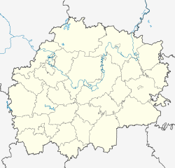 Shatsk Shatsk (Ryazan Oblast) | |
| Coordinates: 54°02′N 41°43′E / 54.033°N 41.717°E | |
| Country | Russia |
| Federal subject | Ryazan Oblast[1] |
| Administrative district | Shatsky District[1] |
| Town of district significance | Shatsk[2] |
| Founded | 1553 |
| Town status since | 1779 |
| Elevation | 140 m (460 ft) |
| Population | |
| • Total | 6,561 |
| • Estimate (2018)[4] | 5,935 (−9.5%) |
| • Capital of | Shatsky District,[1] town of district significance of Shatsk[2] |
| • Municipal district | Shatsky Municipal District[5] |
| • Urban settlement | Shatskoye Urban Settlement[5] |
| • Capital of | Shatsky Municipal District,[5] Shatskoye Urban Settlement[5] |
| Time zone | UTC+3 (MSK |
| Postal code(s)[7] | 391550, 391599 |
| OKTMO ID | 61656101001 |
History edit

In the 16th century, the so-called Shatsk Gates was a strip of open land through the forest useful for Tatar raids that the Russians had to fortify. Shatsk proper was founded in 1553 as a military outpost for defending the southern borders of the Grand Duchy of Moscow.[citation needed] It was granted town status by Catherine the Great in 1779.[citation needed]
Administrative and municipal status edit
Within the framework of administrative divisions, Shatsk serves as the administrative center of Shatsky District.[1] As an administrative division, it is incorporated within Shatsky District as the town of district significance of Shatsk.[2] As a municipal division, the town of district significance of Shatsk is incorporated within Shatsky Municipal District as Shatskoye Urban Settlement.[5]
Economy edit
Town industries include vodka production and a meat packing plant.[citation needed]
References edit
Notes edit
- ^ a b c d e Государственный комитет Российской Федерации по статистике. Комитет Российской Федерации по стандартизации, метрологии и сертификации. №ОК 019-95 1 января 1997 г. «Общероссийский классификатор объектов административно-территориального деления. Код 61 256», в ред. изменения №278/2015 от 1 января 2016 г.. (State Statistics Committee of the Russian Federation. Committee of the Russian Federation on Standardization, Metrology, and Certification. #OK 019-95 January 1, 1997 Russian Classification of Objects of Administrative Division (OKATO). Code 61 256, as amended by the Amendment #278/2015 of January 1, 2016. ).
- ^ a b c Государственный комитет Российской Федерации по статистике. Комитет Российской Федерации по стандартизации, метрологии и сертификации. №ОК 019-95 1 января 1997 г. «Общероссийский классификатор объектов административно-территориального деления. Код 61 256 500», в ред. изменения №278/2015 от 1 января 2016 г.. (State Statistics Committee of the Russian Federation. Committee of the Russian Federation on Standardization, Metrology, and Certification. #OK 019-95 January 1, 1997 Russian Classification of Objects of Administrative Division (OKATO). Code 61 256 500, as amended by the Amendment #278/2015 of January 1, 2016. ).
- ^ a b Russian Federal State Statistics Service (2011). Всероссийская перепись населения 2010 года. Том 1 [2010 All-Russian Population Census, vol. 1]. Всероссийская перепись населения 2010 года [2010 All-Russia Population Census] (in Russian). Federal State Statistics Service.
- ^ "26. Численность постоянного населения Российской Федерации по муниципальным образованиям на 1 января 2018 года". Federal State Statistics Service. Retrieved January 23, 2019.
- ^ a b c d e Law #101-OZ
- ^ "Об исчислении времени". Официальный интернет-портал правовой информации (in Russian). June 3, 2011. Retrieved January 19, 2019.
- ^ Почта России. Информационно-вычислительный центр ОАСУ РПО. (Russian Post). Поиск объектов почтовой связи (Postal Objects Search) (in Russian)
- ^ Federal State Statistics Service (May 21, 2004). Численность населения России, субъектов Российской Федерации в составе федеральных округов, районов, городских поселений, сельских населённых пунктов – районных центров и сельских населённых пунктов с населением 3 тысячи и более человек [Population of Russia, Its Federal Districts, Federal Subjects, Districts, Urban Localities, Rural Localities—Administrative Centers, and Rural Localities with Population of Over 3,000] (XLS). Всероссийская перепись населения 2002 года [All-Russia Population Census of 2002] (in Russian).
- ^ Всесоюзная перепись населения 1989 г. Численность наличного населения союзных и автономных республик, автономных областей и округов, краёв, областей, районов, городских поселений и сёл-райцентров [All Union Population Census of 1989: Present Population of Union and Autonomous Republics, Autonomous Oblasts and Okrugs, Krais, Oblasts, Districts, Urban Settlements, and Villages Serving as District Administrative Centers]. Всесоюзная перепись населения 1989 года [All-Union Population Census of 1989] (in Russian). Институт демографии Национального исследовательского университета: Высшая школа экономики [Institute of Demography at the National Research University: Higher School of Economics]. 1989 – via Demoscope Weekly.
Sources edit
- Рязанская областная Дума. Закон №101-ОЗ от 7 октября 2004 г. «О наделении муниципального образования — Шацкий район статусом муниципального района, об установлении его границ и границ муниципальных образований, входящих в его состав», в ред. Закона №123-ОЗ от 6 октября 2009 г. «О внесении изменений в статью 3 Закона Рязанской области "О наделении муниципального образования — Шацкий район статусом муниципального района, об установлении его границ и границ муниципальных образований, входящих в его состав"». Вступил в силу со дня официального опубликования. Опубликован: "Рязанские ведомости", №212–213 (без приложений), 14 октября 2004 г. (Ryazan Oblast Duma. Law #101-OZ of October 7, 2004 On Granting the Municipal Formation of Shatsky District the Status of a Municipal District, on Establishing Its Borders and the Borders of the Municipal Formations It Comprises, as amended by the Law #123-OZ of October 6, 2009 On Amending Article 3 of the Law of Ryazan Oblast "On Granting the Municipal Formation of Shatsky District the Status of a Municipal District, on Establishing Its Borders and the Borders of the Municipal Formations It Comprises". Effective as of the day of the official publication.).