
KNOWPIA
WELCOME TO KNOWPIA

Shenbei New Area 
Summary
Shenbei New Area (simplified Chinese: 沈北新区; traditional Chinese: 沈北新區; pinyin: Shěnběi Xīn Qū) is a development zone and one of ten districts of the prefecture-level city of Shenyang, the capital of Liaoning Province, Northeast China, and forms part of the northern suburbs. It borders Dongling District to the southeast, Dadong District and Huanggu District to the south, Yuhong District to the southwest, Xinmin City and Faku County to the northwest; it also borders the prefecture-level cities of Tieling to the northeast and Fushun to the southeast.
Shenbei
沈北新区 | ||||||||||||||||||||||||||||||||||||||||||
|---|---|---|---|---|---|---|---|---|---|---|---|---|---|---|---|---|---|---|---|---|---|---|---|---|---|---|---|---|---|---|---|---|---|---|---|---|---|---|---|---|---|---|
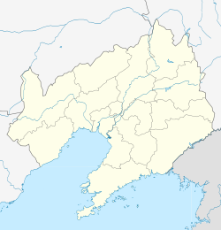 Shenbei Location in Liaoning | ||||||||||||||||||||||||||||||||||||||||||
| Coordinates: 42°02′49″N 123°31′50″E / 42.0469°N 123.5305°E[1] | ||||||||||||||||||||||||||||||||||||||||||
| Country | People's Republic of China | |||||||||||||||||||||||||||||||||||||||||
| Province | Liaoning | |||||||||||||||||||||||||||||||||||||||||
| Sub-provincial city | Shenyang | |||||||||||||||||||||||||||||||||||||||||
| Area | ||||||||||||||||||||||||||||||||||||||||||
| • Total | 878 km2 (339 sq mi) | |||||||||||||||||||||||||||||||||||||||||
| Population (2010) | ||||||||||||||||||||||||||||||||||||||||||
| • Total | 423,323 | |||||||||||||||||||||||||||||||||||||||||
| • Density | 480/km2 (1,200/sq mi) | |||||||||||||||||||||||||||||||||||||||||
| Time zone | UTC+8 (China Standard) | |||||||||||||||||||||||||||||||||||||||||
| Shenyang district map |
| |||||||||||||||||||||||||||||||||||||||||

Climate edit
| Climate data for Xinchengzi, Shenbei New Area (1991–2020 normals) | |||||||||||||
|---|---|---|---|---|---|---|---|---|---|---|---|---|---|
| Month | Jan | Feb | Mar | Apr | May | Jun | Jul | Aug | Sep | Oct | Nov | Dec | Year |
| Mean daily maximum °C (°F) | −5.3 (22.5) |
−0.2 (31.6) |
7.4 (45.3) |
16.9 (62.4) |
24.0 (75.2) |
27.6 (81.7) |
29.3 (84.7) |
28.5 (83.3) |
24.3 (75.7) |
16.1 (61.0) |
5.4 (41.7) |
−3.1 (26.4) |
14.2 (57.6) |
| Daily mean °C (°F) | −12.1 (10.2) |
−6.8 (19.8) |
1.2 (34.2) |
10.3 (50.5) |
17.7 (63.9) |
22.2 (72.0) |
24.6 (76.3) |
23.4 (74.1) |
17.6 (63.7) |
9.5 (49.1) |
−0.3 (31.5) |
−9.1 (15.6) |
8.2 (46.7) |
| Mean daily minimum °C (°F) | −17.9 (−0.2) |
−12.8 (9.0) |
−4.4 (24.1) |
3.9 (39.0) |
11.6 (52.9) |
17.1 (62.8) |
20.5 (68.9) |
19.2 (66.6) |
12.1 (53.8) |
3.9 (39.0) |
−5.3 (22.5) |
−14.4 (6.1) |
2.8 (37.0) |
| Average precipitation mm (inches) | 4.6 (0.18) |
7.6 (0.30) |
14.1 (0.56) |
31.3 (1.23) |
58.9 (2.32) |
84.0 (3.31) |
188.2 (7.41) |
149.6 (5.89) |
44.9 (1.77) |
39.3 (1.55) |
19.4 (0.76) |
9.1 (0.36) |
651 (25.64) |
| Average precipitation days (≥ 0.1 mm) | 3.2 | 3.1 | 4.7 | 6.7 | 9.2 | 11.8 | 12.2 | 11.2 | 7.3 | 6.3 | 5.4 | 4.1 | 85.2 |
| Average snowy days | 4.3 | 3.7 | 3.6 | 1.1 | 0 | 0 | 0 | 0 | 0 | 0.5 | 3.7 | 4.9 | 21.8 |
| Average relative humidity (%) | 64 | 56 | 52 | 50 | 54 | 68 | 79 | 81 | 73 | 66 | 64 | 65 | 64 |
| Mean monthly sunshine hours | 176.3 | 187.4 | 224.2 | 222.8 | 248.3 | 223.1 | 195.0 | 204.2 | 223.1 | 202.1 | 159.4 | 156.0 | 2,421.9 |
| Percent possible sunshine | 60 | 62 | 60 | 55 | 55 | 49 | 43 | 48 | 60 | 60 | 55 | 55 | 55 |
| Source: China Meteorological Administration[3][4] | |||||||||||||
References edit
- ^ Google (2014-07-02). "Shenbei" (Map). Google Maps. Google. Retrieved 2014-07-02.
- ^ 分地区土地面积和人口密度 (2012年末) (in Chinese). Shenyang Statistics Bureau. Retrieved 6 July 2014.
- ^ 中国气象数据网 – WeatherBk Data (in Simplified Chinese). China Meteorological Administration. Retrieved 5 October 2023.
- ^ 中国气象数据网 (in Simplified Chinese). China Meteorological Administration. Retrieved 5 October 2023.
- www.xzqh.org (in Chinese)
External links edit