


Summary
The Shire of Collie is a local government area in the South West region of Western Australia, about 60 kilometres (37 mi) east of Bunbury and about 200 kilometres (124 mi) south of the state capital, Perth. The Shire covers an area of 1,711 square kilometres (661 sq mi), and its seat of government is the town of Collie.
| Shire of Collie Western Australia | |||||||||||||||
|---|---|---|---|---|---|---|---|---|---|---|---|---|---|---|---|
 The Collie shire offices in April 2022 | |||||||||||||||
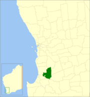 Location in Western Australia | |||||||||||||||
 | |||||||||||||||
| Population | 8,812 (LGA 2021)[1] | ||||||||||||||
| Established | 1900 | ||||||||||||||
| Area | 1,710.9 km2 (660.6 sq mi) | ||||||||||||||
| Shire President | Sarah Stanley | ||||||||||||||
| Council seat | Collie | ||||||||||||||
| Region | South West | ||||||||||||||
| State electorate(s) | Collie-Preston | ||||||||||||||
| Federal division(s) | O'Connor | ||||||||||||||
| Website | Shire of Collie | ||||||||||||||
| |||||||||||||||
History edit
The Shire of Collie originated in the amalgamation of the Municipality of Collie (1901) and the Collie Road District (1900) to form the Collie Coalfields Road District on 2 March 1951. It was declared a shire and named the Shire of Collie with effect from 1 July 1961 following the passage of the Local Government Act 1960, which reformed all remaining road districts into shires.[2]
Wards edit
The shire is no longer divided into wards and the eleven councillors sit at large.
Towns and localities edit
The towns and localities of the Shire of Collie with population and size figures based on the most recent Australian census:[3][4]
| Locality | Population | Area | Map | |||||||||||||||||||||
|---|---|---|---|---|---|---|---|---|---|---|---|---|---|---|---|---|---|---|---|---|---|---|---|---|
| Allanson | 591 (SAL 2021)[5] | 24.2 km2 (9.3 sq mi) | Buckingham | 27 (SAL 2021)[6] | 70.6 km2 (27.3 sq mi) | Cardiff | 118 (SAL 2021)[7] | 171 km2 (66 sq mi) | 
| |||||||||||||||
| Collie | 7,599 (SAL 2021)[8] | 53.4 km2 (20.6 sq mi) | Collie Burn | 55 (SAL 2016)[9][10] | 13.6 km2 (5.3 sq mi) | Harris River | 98 (SAL 2021)[11] | 152.1 km2 (58.7 sq mi) | Lyalls Mill | 17 (SAL 2021)[12] | 38.1 km2 (14.7 sq mi) | Muja | 18 (SAL 2016)[13][14] | 57.1 km2 (22.0 sq mi) | Mungalup | 53 (SAL 2021)[15] | 74.3 km2 (28.7 sq mi) | Palmer | 50 (SAL 2021)[16] | 157.6 km2 (60.8 sq mi) | Preston Settlement | 125 (SAL 2021)[17] | 42.6 km2 (16.4 sq mi) | 
|
| Shotts | 9 (SAL 2021)[18] | 75.1 km2 (29.0 sq mi) | 
| |||||||||||||||||||||
| Worsley | 39 (SAL 2021)[19] | 212.9 km2 (82.2 sq mi) | Yourdamung Lake | 14 (SAL 2021)[20] | 558.3 km2 (215.6 sq mi) |
Notable councillors
edit
Heritage-listed places edit As of 2023, 198 places are heritage-listed in the Shire of Collie,[21] of which eight are on the State Register of Heritage Places, among them Wellington Dam.[22] References edit
External links edit
33°21′47″S 116°09′22″E / 33.363°S 116.156°E |