


Summary
The Shire of Kulin is a local government area in the eastern Wheatbelt region of Western Australia, about 300 kilometres (186 mi) ESE of the state capital, Perth. The Shire's land area of 4,714 square kilometres (1,820 sq mi) forms a narrow east-west band, located between the Shire of Kondinin to the north and the Shire of Lake Grace to the south. Its seat of government is the town of Kulin. The local economy is based on agriculture - predominantly cereal grains and sheep.
| Shire of Kulin Western Australia | |||||||||||||||
|---|---|---|---|---|---|---|---|---|---|---|---|---|---|---|---|
 Kulin shire offices, 2014 | |||||||||||||||
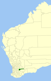 Location in Western Australia | |||||||||||||||
 | |||||||||||||||
| Population | 769 (LGA 2021)[1] | ||||||||||||||
| Established | 1918 | ||||||||||||||
| Area | 4,713.7 km2 (1,820.0 sq mi) | ||||||||||||||
| Shire President | Barry West | ||||||||||||||
| Council seat | Kulin | ||||||||||||||
| Region | Wheatbelt | ||||||||||||||
| State electorate(s) | Central Wheatbelt | ||||||||||||||
| Federal division(s) | O'Connor | ||||||||||||||
| Website | Shire of Kulin | ||||||||||||||
| |||||||||||||||
History edit
On 14 June 1918, the Roe Road District was gazetted. It was renamed to the Kulin Road District on 12 March 1926. On 1 July 1961, it became a shire under the Local Government Act 1960.[2]
Wards edit
The shire is divided into 4 wards.
- Town Ward (3 councillors)
- West Ward (3 councillors)
- Central Ward (2 councillors)
- East Ward (1 councillor)
From 1964 until 3 May 2003, the following system existed:
- Town Ward
- Central Ward
- Dudinin Ward
- East Ward
- Jitarning Ward
- Kulin Rock Ward
Towns and localities edit
The towns and localities of the Shire of Kulin with population and size figures based on the most recent Australian census:[3][4]
| Locality | Population | Area | Map | |||||||||||||||||||||||||||||||||||||||||||||||||||||||||||||||||||||||||||||||||||||||||
|---|---|---|---|---|---|---|---|---|---|---|---|---|---|---|---|---|---|---|---|---|---|---|---|---|---|---|---|---|---|---|---|---|---|---|---|---|---|---|---|---|---|---|---|---|---|---|---|---|---|---|---|---|---|---|---|---|---|---|---|---|---|---|---|---|---|---|---|---|---|---|---|---|---|---|---|---|---|---|---|---|---|---|---|---|---|---|---|---|---|---|---|---|
| Dudinin | 59 (SAL 2021)[5] | 396.8 km2 (153.2 sq mi) | 
| |||||||||||||||||||||||||||||||||||||||||||||||||||||||||||||||||||||||||||||||||||||||||
| Holt Rock | 46 (SAL 2021)[6] | 772.8 km2 (298.4 sq mi) | Jilakin | 49 (SAL 2021)[7] | 589.2 km2 (227.5 sq mi) | 
| ||||||||||||||||||||||||||||||||||||||||||||||||||||||||||||||||||||||||||||||||||||||
| Jitarning | 63 (SAL 2021)[8] | 439.9 km2 (169.8 sq mi) | 
| |||||||||||||||||||||||||||||||||||||||||||||||||||||||||||||||||||||||||||||||||||||||||
| Kulin | 352 (SAL 2021)[9] | 322.8 km2 (124.6 sq mi) | Kulin West | 88 (SAL 2021)[10] | 495.8 km2 (191.4 sq mi) | Little Italy | 34 (SAL 2021)[11] | 408.6 km2 (157.8 sq mi) | 
| |||||||||||||||||||||||||||||||||||||||||||||||||||||||||||||||||||||||||||||||||||
| Pingaring | 60 (SAL 2021)[12] | 877.6 km2 (338.8 sq mi) | Walyurin | 32 (SAL 2021)[13] | 408.8 km2 (157.8 sq mi) |
Population
edit
Heritage-listed places editAs of 2023, 140 places are heritage-listed in the Shire of Kulin,[14] of which two are on the State Register of Heritage Places.[15]
References edit
External links edit
32°40′16″S 118°09′11″E / 32.671°S 118.153°E |
