


Summary
The Shire of Wyalkatchem is a local government area located in the Wheatbelt region of Western Australia. Its seat of government is the town of Wyalkatchem, about 190 kilometres (118 mi) northeast of Perth, the state capital.
| Shire of Wyalkatchem Western Australia | |||||||||||||||
|---|---|---|---|---|---|---|---|---|---|---|---|---|---|---|---|
 The Wyalkatchem Shire offices | |||||||||||||||
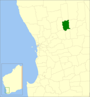 Location in Western Australia | |||||||||||||||
 | |||||||||||||||
| Population | 470 (LGA 2021)[1] | ||||||||||||||
| Established | 1920 | ||||||||||||||
| Area | 1,595.4 km2 (616.0 sq mi) | ||||||||||||||
| Shire President | Quentin Davies | ||||||||||||||
| Council seat | Wyalkatchem | ||||||||||||||
| Region | Wheatbelt | ||||||||||||||
| State electorate(s) | Central Wheatbelt | ||||||||||||||
| Federal division(s) | Durack | ||||||||||||||
| Website | Shire of Wyalkatchem | ||||||||||||||
| |||||||||||||||
History edit
On 18 June 1920, the Wyalkatchem Road District was created out of land previously administered by the Ninghan and Dowerin Road Boards. On 1 July 1961, it became the Shire of Wyalkatchem under the Local Government Act 1960, which reformed all remaining road districts into shires.[2]
Wards edit
The shire has no wards, and seven councillors. The shire president is elected from amongst the councillors.
Towns and localities edit
The towns and localities of the Shire of Wyalkatchem with population and size figures based on the most recent Australian census:[3][4]
| Suburb | Population | Area | Map | |||||||||||||||||||||||||||||||||||||||||||||||||||||||||||
|---|---|---|---|---|---|---|---|---|---|---|---|---|---|---|---|---|---|---|---|---|---|---|---|---|---|---|---|---|---|---|---|---|---|---|---|---|---|---|---|---|---|---|---|---|---|---|---|---|---|---|---|---|---|---|---|---|---|---|---|---|---|---|
| Benjaberring | 23 (SAL 2021)[5] | 174.9 km2 (67.5 sq mi) | 
| |||||||||||||||||||||||||||||||||||||||||||||||||||||||||||
| Cowcowing | 19 (SAL 2021)[6] | 235.3 km2 (90.8 sq mi) | 
| |||||||||||||||||||||||||||||||||||||||||||||||||||||||||||
| Korrelocking | 58 (SAL 2021)[7] | 451.4 km2 (174.3 sq mi) | Nalkain | 4 (SAL 2021)[8] | 75.3 km2 (29.1 sq mi) | Nembudding | 12 (SAL 2021)[9] | 146.2 km2 (56.4 sq mi) | 
| |||||||||||||||||||||||||||||||||||||||||||||||||||||
| Wyalkatchem | 358 (SAL 2021)[10] | 511.4 km2 (197.5 sq mi) |
Population
edit
Heritage-listed places editAs of 2023, 133 places are heritage-listed in the Shire of Wyalkatchem,[11] of which ten are on the State Register of Heritage Places.[12] References edit
External links edit
31°10′37″S 117°22′59″E / 31.177°S 117.383°E |