


Summary
Signal Hill is a 150-acre (61 ha) open space preserve located in Canton, in the U.S. state of Massachusetts; it is centered on a 188-foot (57 m) rocky knoll by the same name. The property, acquired in 2005 by the land conservation non-profit organization The Trustees of Reservations, offers frontage on the Neponset River and views of Great Blue Hill and Downtown Boston from open ledges. The Signal Hill preserve also includes wetlands, open fields, and a car-top boating access point.[1]
| Signal Hill | |
|---|---|
 Signal Hill in Spring | |
| Location | Massachusetts, United States |
| Coordinates | 42°11′06″N 71°09′32″W / 42.185°N 71.159°W |
| Established | 2005 |
| Operator | The Trustees of Reservations |
| Website | Signal Hill |
Signal Hill contains the Wamsutta archaeological site, discovered during construction of Interstate 95, which was a seasonal camp for Paleo-Indians radiocarbon dated by nearby charcoal remains to 12,140 before present,[2] around the time of the last glacial retreat, when rapid melting of the Wisconsin continental glacier created the mile-wide channel through which today's Neponset River flows. At this time, Signal Hill was a peninsula extending into a large lake of glacial meltwater.[2]
It is currently abutted by Interstate 95 as well as industrial and suburban land to the east, and river floodplain to the west. The preserve is open to non-motorized carry-in boating, hiking, picnicking, fishing, and similar pursuits. A trailhead for the 1.3 mile trail system[1] is located on University Road in Canton.[3]
Gallery edit
-
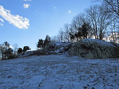 The hill in Winter
 -
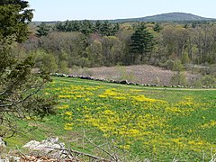 View of Great Blue Hill
 -
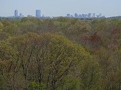 View of Downtown Boston skyline
 -
 Neponset River


References edit
- ^ a b "Signal Hill". The Trustees of Reservations. Retrieved 27 May 2021.
- ^ a b Chandler, Jim (7 July 2022). "On the shore of a Pleistocene Lake: the Wamsutta Site (19-NF-70)". Bulletin of the Massachusetts Archaeological Society. 62 (2): 52–62.
- ^ "Signal Hill Loop". AllTrails.com. Retrieved 27 May 2021.
External links edit
- The Trustees of Reservations