


Summary
Silang (Tagalog: [ˈsi.lɐŋ]), officially the Municipality of Silang (Tagalog: Bayan ng Silang), formerly known as Silan during the Spanish colonial era, is a 1st class urban municipality in the province of Cavite, Philippines. According to the 2020 census, it has a population of 295,644 people.[3]
Silang
Silan | |
|---|---|
| Municipality of Silang | |
      (From left, clockwise): Silang Church, Town Proper, Acienda Designer Outlet, Patio Medina, St. Benedict Parish–Westgrove, Welcome Arch | |
 Flag  Seal | |
| Nickname(s): Food Bastion for Metro Manila Gateway to Tagaytay | |
 Map of Cavite with Silang highlighted | |
OpenStreetMap .mw-parser-output .locmap .od{position:absolute}.mw-parser-output .locmap .id{position:absolute;line-height:0}.mw-parser-output .locmap .l0{font-size:0;position:absolute}.mw-parser-output .locmap .pv{line-height:110%;position:absolute;text-align:center}.mw-parser-output .locmap .pl{line-height:110%;position:absolute;top:-0.75em;text-align:right}.mw-parser-output .locmap .pr{line-height:110%;position:absolute;top:-0.75em;text-align:left}.mw-parser-output .locmap .pv>div{display:inline;padding:1px}.mw-parser-output .locmap .pl>div{display:inline;padding:1px;float:right}.mw-parser-output .locmap .pr>div{display:inline;padding:1px;float:left}html.skin-theme-clientpref-night .mw-parser-output .od,html.skin-theme-clientpref-night .mw-parser-output .od .pv>div,html.skin-theme-clientpref-night .mw-parser-output .od .pl>div,html.skin-theme-clientpref-night .mw-parser-output .od .pr>div{background:#000;color:#fff}html.skin-theme-clientpref-night .mw-parser-output .locmap{filter:grayscale(0.6)}@media(prefers-color-scheme:dark){html.skin-theme-clientpref-os .mw-parser-output .locmap{filter:grayscale(0.6)}html.skin-theme-clientpref-os .mw-parser-output .od,html.skin-theme-clientpref-os .mw-parser-output .od .pv>div,html.skin-theme-clientpref-os .mw-parser-output .od .pl>div,html.skin-theme-clientpref-os .mw-parser-output .od .pr>div{background:#000;color:#fff}}  Silang Location within the Philippines | |
| Coordinates: 14°13′50″N 120°58′30″E / 14.23056°N 120.975°E | |
| Country | Philippines |
| Region | Calabarzon |
| Province | Cavite |
| District | 5th district |
| Founded | 1595 |
| Barangays | 64 (see Barangays) |
| Government | |
| • Type | Sangguniang Bayan |
| • Mayor | Alston Kevin A. Anarna |
| • Vice Mayor | Edward Carranza |
| • Representative | Roy M. Loyola |
| • Municipal Council | Members |
| • Electorate | 150,289 voters (2022) |
| Area | |
| • Total | 209.43 km2 (80.86 sq mi) |
| Elevation | 305 m (1,001 ft) |
| Highest elevation | 432 m (1,417 ft) |
| Lowest elevation | 187 m (614 ft) |
| Population (2020 census)[3] | |
| • Total | 295,644 |
| • Density | 1,400/km2 (3,700/sq mi) |
| • Households | 71,463 |
| Economy | |
| • Income class | 1st municipal income class |
| • Poverty incidence | 5.80 |
| • Revenue | ₱ 903.8 million (2020) |
| • Assets | ₱ 4,239 million (2020) |
| • Expenditure | ₱ 624.4 million (2020) |
| • Liabilities | ₱ 2,091 million (2020) |
| Service provider | |
| • Electricity | Manila Electric Company (Meralco) |
| • Water | Silang Water District |
| Time zone | UTC+8 (PST) |
| ZIP code | 4118 |
| PSGC | 042118000 |
| IDD : area code | +63 (0)46 |
| Native languages | Tagalog |
| Major religions | |
| Feast date | February 2 |
| Ecclesiastical dioceses |
|
| Patron saint | Our Lady of Candelaria |
| Website | www |
Silang is located in the eastern section of Cavite. It is home to the Philippine National Police Academy, PDEA Academy, and International Institute of Rural Reconstruction head office.
With the continuous expansion of Metro Manila, the municipality is now part of the Manila's conurbation which spans southward toward Lipa City.
Etymology edit
The name of Silang (originally called Silan) originates from Tagalog silang, meaning "mountain pass".[5]
History edit
Pre-Hispanic period edit
The traditional origins of the town are attributed to ten Bornean datus who sailed northward on board balangays and ended in Silang through Taal Lake. Its first settlers were Gat Hingiw, his wife Gat Kaliwanag, and their seven children, who later moved to different parts of the town and established their respective barangays. Gat Pandan stayed in the original community and developed the area.[6]
Spanish colonial era edit
During the start of the Spanish colonization of the Philippines, tracts of land were given by the King of Spain to the conquistadores and their descendants, who collected tributes from the people residing in their acquired lands. Silang originally belonged to the encomienda (land grant) of Diego Jorge de Villalobos; his claim extended to what is today the towns of Carmona, Amadeo, Indang, Alfonso, General Trias, and Tanza.[6] For many years, Silang was one of the biggest towns, by the 20th century its land area was reduced to its current size, as some of its former villages later became independent towns. Indang was the first to be granted town status in 1655. By the 19th century, the town lost land to the towns of Carmona and Amadeo, and by 1938, the town's southern lands were ceded to become part of the city of Tagaytay.
The Silang encomienda was later purchased from King Ferdinand VI of Spain for 2,000 pesetas on March 9, 1746, to prevent it from becoming a "friar land" like the other towns of Cavite, executed through the representation of Bernabe Javier Manahan and Gervacio dela Cruz.[6]
Contemporary history edit
On January 22, 2023, the municipality was certified by Guinness World Records as volunteers from the municipal government and the Catholic parish church successfully lit 621 candles in a world record attempt for longest line of candles lit in relay, surpassing 366 set in India in 2016. The attempt was held to commemorate the feast of Nuestra Señora de Candelaria.[7][8]
Geography edit
The municipality of Silang is 23 kilometers (14 mi) from Imus and 43 kilometers (27 mi) south of Manila. It is bounded by General Trias, Dasmariñas, General Mariano Alvarez, and Carmona to the north, Biñan, Santa Rosa, and Cabuyao to the east, Tagaytay to the south, and Amadeo to the west.
Barangays edit
Silang is politically subdivided into 64 barangays.[9]
- Acacia
- Adlas
- Anahaw I
- Anahaw II
- Balite I
- Balite II
- Balubad
- Banaba
- Batas
- Biga I
- Biga II
- Biluso
- Bucal
- Buho
- Bulihan
- Cabangaan
- Carmen
- Hoyo
- Hukay
- Iba
- Inchican
- Ipil I
- Ipil II
- Kalubkob
- Kaong
- Lalaan I
- Lalaan II
- Litlit
- Lucsuhin
- Lumil
- Maguyam
- Malabag
- Mataas na Burol
- Malaking Tatiao
- Munting Ilog
- Narra I
- Narra II
- Narra III
- Paligawan
- Pasong Langka
- Poblacion I
- Poblacion II
- Poblacion III
- Poblacion IV
- Poblacion V
- Pooc I
- Pooc II
- Pulong Bunga
- Pulong Saging
- Puting Kahoy
- Sabutan
- San Miguel I
- San Miguel II
- San Vicente I
- San Vicente II
- Santol
- Tartaria
- Tibig
- Toledo
- Tubuan I
- Tubuan II
- Tubuan III
- Ulat
- Yakal
Climate edit
Silang has a tropical savanna climate (Aw in the Köppen climate classification) with a pronounced dry season from November to April. Its nearness to Tagaytay is the reason for its near-winter like cold temperatures during the early dry season, especially in the villages straddling the Tagaytay border and the town proper.
| Climate data for Silang, Cavite | |||||||||||||
|---|---|---|---|---|---|---|---|---|---|---|---|---|---|
| Month | Jan | Feb | Mar | Apr | May | Jun | Jul | Aug | Sep | Oct | Nov | Dec | Year |
| Mean daily maximum °C (°F) | 27 (81) |
28 (82) |
30 (86) |
32 (90) |
30 (86) |
29 (84) |
27 (81) |
27 (81) |
27 (81) |
28 (82) |
28 (82) |
27 (81) |
28 (83) |
| Mean daily minimum °C (°F) | 18 (64) |
18 (64) |
19 (66) |
20 (68) |
22 (72) |
22 (72) |
22 (72) |
22 (72) |
22 (72) |
21 (70) |
20 (68) |
19 (66) |
20 (69) |
| Average precipitation mm (inches) | 10 (0.4) |
10 (0.4) |
12 (0.5) |
27 (1.1) |
94 (3.7) |
153 (6.0) |
206 (8.1) |
190 (7.5) |
179 (7.0) |
120 (4.7) |
54 (2.1) |
39 (1.5) |
1,094 (43) |
| Average rainy days | 5.2 | 4.5 | 6.4 | 9.2 | 19.7 | 24.3 | 26.9 | 25.7 | 24.4 | 21.0 | 12.9 | 9.1 | 189.3 |
| Source: Meteoblue[10] | |||||||||||||
Demographics edit
|
|
| ||||||||||||||||||||||||||||||||||||||||||||||||||||||
| Source: Philippine Statistics Authority[11][12][13][14] | ||||||||||||||||||||||||||||||||||||||||||||||||||||||||
In the 2020 census, the population of Silang, Cavite, was 295,644 people,[3] with a density of 1,400 inhabitants per square kilometre or 3,600 inhabitants per square mile.
Religion edit

The majority of the people in Silang are adherents of the Christian Faith, composed of Roman Catholics, Members Church of God International, Protestants, and members of independent Christian groups. Majority of the Christian population is composed of Roman Catholics under the jurisdiction of the Diocese of Imus.
Adherents of the Philippine Independent Church, also known as the Aglipayan Church, under the jurisdiction of the Diocese of Cavite.
Other Christian groups in the town include mainstream Protestants, congregations of Mormons, and other churches are also present in the town.
With the influx of migrants from other provinces, other non-Christian faiths, particularly Islam, is practiced in the town.
Economy edit

Silang, like most of the towns in the province of Cavite, depends on a mainly agricultural economy. The primary crops grown in the area are coconut, coffee, corn, banana, pineapple, and tree crops like mango, lansones, caimito, santol, jackfruit, guava, and avocado. Fertile soils and abundant water sources make Silang suitable not only for common commercial crops but also for high value and exotic crops production. Most of the local farmers practice intercropping to increase land productivity and lessen soil erosion. Fruit production exceeds the demand of the municipality's population, thus, supply excesses are marketed to Metro Manila and neighboring urban centers. A number of poultry and swine farms are also located in some rural barangays.
Manufacturing and trade are Silang's other major sources of income. Trade and investments grew tremendously with the influx of both Manila-based and foreign investors. Total investments were estimated at ₱2.5 billion between 1996 and 2004, which helped bring about the employment of 3,000 people. Despite the slow down of progress in 2004, Land Value still soared, allowing investors to infiltrate and start business. The investment trend resulted in the increase in the price of prime realty from ₱3,000 to ₱15,000 per square meter and from ₱150 to ₱500 per square meter for raw lots in interior barangays. Trade establishments in Silang include gasoline stations, convenience stores, restaurants, lumber/hardware traders, shopping malls, groceries, resorts, and hotels.
The dry goods section of the Silang Public Market can now accommodate 228 stalls.
Silang houses the Maguyam Industrial Complex and the Daichi Industrial Complex in addition to a total of ten factories operating outside the export processing zone.
Transportation edit

Silang can be reached by bus or by jeepney. Coming from Manila, it would take around 2 hours to reach the town proper. Silang is accessible by land transportation. Major road networks to and from Laguna and Batangas traverse it making the town a potential trading center for agricultural products while enjoying an environment that is free of traffic and pollution problems. Commuters are assured of smooth travel within the borders of the municipality with of its good road networks of approximately 187.83 km (116.71 mi). Major roads include Aguinaldo Highway, Santa Rosa–Tagaytay Road, Governor's Drive (along the municipal boundary with General Mariano Alvarez), and Cavite–Laguna Expressway. Six major road projects were completed in 1996, being the Bulihan Resettlement Area Road, the 8 km (5.0 mi) Kaong-Maguyam Road, the Caramanzana Drive connecting the Silang Public Market with Aguinaldo Highway, the 2 km (1.2 mi) Sabutan-Iba Road, the DPWH funded Santa Rosa-Silang-Tagaytay Road, and the Malabag Road. The proposed Cavite–Tagaytay–Batangas Expressway will have its eastern end built in Silang.
Landmarks edit
- Lucsuhin Natural Bridge or Cabag Caves
- Our Lady of Candelaria Parish Church
Government edit

Elected officials edit
- Mayor: Kevin A. Anarna
- Vice Mayor: Edward 'Ted' Carranza
- Sangguniang Bayan Members:
- Mark Anthony A. Toledo
- Ivee Jayne A. Reyes
- Ivan Chester I. Amutan
- Aristides Jose Virgillio A. Velazco
- Perpetuo Desingaño
- Luis Junjang Batingal
- Juan Carlo K. Madlansacay
- Eric Cokiat Garcia
- LNB President: Reyes, Cris Kidlat (Brgy. Biluso)
- SKF President: Anarna, Jasper Marcus (Brgy. Maguyam)
List of chief executives edit
Gobernadorcillo (Leader of 'pueblo' or bayan during Spanish Era):
- Don Teodoro de Leon 1850–1852
- Anastacio Medina 1852–1858
- Codrato Mercado 1858–1872
- Severino Belarmino 1872
- Ancelmo Belardo 1875
- Julio Medina 1877–1878
- Lazaro Kiamzon 1879–1880
- Ignacio Ambalada 1881
- Angel Belardo 1881–1882
- Ignacio Ambalada (new term) 1883–1884
- Benito Gonzales 1884
- Vito Belarmino 1885–1886
- Lazaro Kiamzon (new term) 1887
- Benito Gonzales 1887–1888
- Gaspar Medina 1889–1890
- Marcelo Madlansacay 1891–1892
As the effect of the Maura Law in 1893, the tribunal del pueblo was changed to tribunal municipal and leaders of municipalities were called Capitan Municipal:
- Victor Belardo 1893–1894
- Nicolas Montoya 1895–1896
- Martin Medina 1896
- Isidoro Montoya 1896–1897
- Marcelo Madlansacay (former gobernadorcillo) 1897
- Vicente Poblete 1897–1898
- Jose Kiamzon 1898–1901
During the American Period, the 2nd commission passed the Municipal Code (Act No. 82) that created Municipalities. The leaders were called Presidente Municipal: First Elections were held 1903. (Silang Historical Society)
- Isaias Benjamin (appointed) 1901–1903
- Nicolas Madlansacay (elected) 1903–1904
- Primo Villanueva 1905–1906
- Pedro Laviña 1907–1908
- Isaias Benjamin (new term) 1909–1912
- Jose Kiamzon (former Capitan Municipal) 1912–1916
- Victor Kiamzon 1916–1919
- Epifanio Montoya 1919–1922
- Victor Kiamzon 1922–1925
- Venancio Toledo 1926–1931
- Victor Kiamzon 1931–1934
- Martin Torres – Feb–Aug 1934
Municipal Mayor(s):
- Jose Kiamzon 1934–1937
- Martin Torres 1937–1940
- Miguel Kiamzon 1940–1943
- Dominador Kiamzon 1943–1945
- Martin Torres 1946–1948
- Mariano Belen 1949–1953
- Zacarias Batingal – January–October 1954
- Martin Torres 1954–1955
- Zacarias Batingal March 1955
- Martin Torres April–October 1955
- Pedro Caragao November–December 1955
- Enrique Asuncion 1956–1971
- Edgardo Mercado 1972–1986
- Clarito Ambalada Poblete 1986–1995, June 30, 2004–June 30, 2013
- Ruben Montoya Madlansacay June 30, 1995–June 30, 2004
- Emilia Lourdes "Omil" Fule Poblete June 30, 2013–June 30, 2019
- Socorro Rosario "Corie" Fule Poblete June 30, 2019–June 30, 2022
- Kevin Amutan Anarna June 30, 2022
Health care edit

- Estrella Hospital
- Velazco Hospital
- Silang Specialists Medical Center
- Mazenod Hospital
Education edit
- Public high schools
- Kaong National High School
- Lumil National High School
- General Vito L. Belarmino National High School
- Malabag National High School
- Munting Ilog Integrated National High School – Main
- Bulihan National High School
- Emilia Ambalada Poblete National High School (Formerly: Munting Ilog National High School- Silang West Annex)
- Private schools
- New Life Christian School of Cavite
- Scuola di Scienza del Mija
- Cavite Institute
- La Belle Montessori School
- AIIAS Academy
- Lora Carnig School of All Nations
- Little Heirs Academy
- Sacred Hearts of Jesus and Mary Academe of Cavite
- Westridge Academy
- St.Scholastica's College-Westgrove
- Our Lady Of Peace Academy Of Cavite
- Mission and Vision Reformed Christian Academy
- Biga Achievers' Learning Institute
- Infant Jesus Academy of Silang
- Living Lamp Academy
- Silang Adventist Elementary School
- Hilltop Adventist Elementary School, Inc.
- Imperial Learning Center
- Father Michael Donoher Memorial School
- Trustworthy Learning Center
- Learning Links Academy
- Catholic schools
- The Sisters of Mary School – Boystown (Adlas Campus)
- The Sisters of Mary School – Girlstown (Biga Campus)
- Father Michael Donoher Memorial School
- Rogationist College
- Sacred Heart Villa School
- St. Scholastica's College – Westgrove
- Infant Jesus Academy of Silang
- Risen Christ Catholic School
- Paraclete Foundation Community School
- Colleges, state colleges and universities
- Sisters of Mary Technical Education Institute Cavite Inc.
- Adventist University of the Philippines
- Adventist International Institute of Advanced Studies
- Imus Computer College (ICC) – Silang Branch
- Cavite State University (Silang satellite campus)
- Far Eastern University (Silang satellite campus)
- Philippine Missionary Institute
- Unida Biblical Seminary
- Rogationist College
- PNPA (Public Safety College)
- St. Benilde Montessori College
- Saint Paul Seminary
- Our Lady of La Salette Seminary

Gallery edit
-
 Downtown
 -
 Municipal Police Station
 -
 Jose Rizal Monument
 -
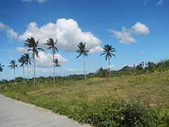 Coconut trees
 -
 Barangay Bulihan
 -
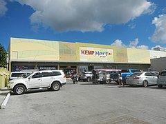 Kemp Mart Silang
 -
 The Risen Christ Parish in Bulihan
 -
 Boundary marker near Silang–Santa Rosa boundary
 -
 Another version of the official seal


Notable people edit
- Bayani Agbayani (b. 1969), comedian
References edit
- ^ Municipality of Silang | (DILG)
- ^ "2015 Census of Population, Report No. 3 – Population, Land Area, and Population Density" (PDF). Philippine Statistics Authority. Quezon City, Philippines. August 2016. ISSN 0117-1453. Archived (PDF) from the original on May 25, 2021. Retrieved July 16, 2021.
- ^ a b c Census of Population (2020). "Region IV-A (Calabarzon)". Total Population by Province, City, Municipality and Barangay. Philippine Statistics Authority. Retrieved July 8, 2021.
- ^ "PSA Releases the 2018 Municipal and City Level Poverty Estimates". Philippine Statistics Authority. December 15, 2021. Retrieved January 22, 2022.
- ^ Lesho, Marivic; Sippola, Eeva (2018). "Toponyms in Manila and Cavite, Philippines". Vergleichende Kolonialtoponomastik Strukturen und Funktionen kolonialer Ortsbenennung. De Gruyter. pp. 317–332. ISBN 9783110608618.
- ^ a b c "History of Silang". Museo de Silan. Retrieved on June 18, 2013.
- ^ Abrina, Dennis (January 24, 2023). "Silang sets new world record for candle relay". The Manila Times. Retrieved January 25, 2023.
- ^ Deña, Carla (January 23, 2023). "Silang, Cavite breaks Guinness World Record for longest line of candles lit in relay". Manila Bulletin. Retrieved January 25, 2023.
- ^ Philippine Standard Geographic Code listing for Silang Archived December 24, 2016, at the Wayback Machine – National Statistical Coordination Board
- ^ "Silang: Average Temperatures and Rainfall". Meteoblue. Retrieved May 12, 2020.
- ^ Census of Population (2015). "Region IV-A (Calabarzon)". Total Population by Province, City, Municipality and Barangay. Philippine Statistics Authority. Retrieved June 20, 2016.
- ^ Census of Population and Housing (2010). "Region IV-A (Calabarzon)" (PDF). Total Population by Province, City, Municipality and Barangay. National Statistics Office. Retrieved June 29, 2016.
- ^ Censuses of Population (1903–2007). "Region IV-A (Calabarzon)". Table 1. Population Enumerated in Various Censuses by Province/Highly Urbanized City: 1903 to 2007. National Statistics Office.
{{cite encyclopedia}}: CS1 maint: numeric names: authors list (link) - ^ "Province of Cavite". Municipality Population Data. Local Water Utilities Administration Research Division. Retrieved December 17, 2016.
- ^ "Poverty incidence (PI):". Philippine Statistics Authority. Retrieved December 28, 2020.
- ^ "Estimation of Local Poverty in the Philippines" (PDF). Philippine Statistics Authority. November 29, 2005.
- ^ "2003 City and Municipal Level Poverty Estimates" (PDF). Philippine Statistics Authority. March 23, 2009.
- ^ "City and Municipal Level Poverty Estimates; 2006 and 2009" (PDF). Philippine Statistics Authority. August 3, 2012.
- ^ "2012 Municipal and City Level Poverty Estimates" (PDF). Philippine Statistics Authority. May 31, 2016.
- ^ "Municipal and City Level Small Area Poverty Estimates; 2009, 2012 and 2015". Philippine Statistics Authority. July 10, 2019.
- ^ "PSA Releases the 2018 Municipal and City Level Poverty Estimates". Philippine Statistics Authority. December 15, 2021. Retrieved January 22, 2022.
- ^ "Silang". DILG CALABARZON.
External links edit
- Philippine Standard Geographic Code