
KNOWPIA
WELCOME TO KNOWPIA

Silver Sands, Western Australia 
Summary
Silver Sands is an inner northern coastal suburb of Mandurah, Western Australia.
| Silver Sands Mandurah, Western Australia | |||||||||||||||
|---|---|---|---|---|---|---|---|---|---|---|---|---|---|---|---|
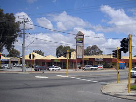 Silver Sands near Mandurah | |||||||||||||||
 | |||||||||||||||
| Coordinates | 32°30′43″S 115°44′06″E / 32.512°S 115.735°E | ||||||||||||||
| Population | 1,451 (SAL 2021)[1] | ||||||||||||||
| Established | 1989 | ||||||||||||||
| Postcode(s) | 6210 | ||||||||||||||
| Area | 1.4 km2 (0.54 sq mi) | ||||||||||||||
| LGA(s) | City of Mandurah | ||||||||||||||
| State electorate(s) | Mandurah | ||||||||||||||
| Federal division(s) | Canning | ||||||||||||||
| |||||||||||||||
The suburb, along with neighbouring San Remo, were gazetted in 1989. Both suburbs were named after developer estates, which entered into popular local usage.
Transport edit
Bus edit
- 584 Mandurah Station to Lakelands Station – serves Mandurah Terrace and Mandurah Road[2]
- 585 Mandurah Station to Lakelands Station – serves Mandurah Road[3]
References edit
- ^ Australian Bureau of Statistics (28 June 2022). "Silver Sands (suburb and locality)". Australian Census 2021 QuickStats. Retrieved 28 June 2022.
- ^ "Route 584". Bus Timetable 132 (PDF). Transperth. 8 May 2023 [effective from 12 June 2023].
- ^ "Route 585". Bus Timetable 132 (PDF). Transperth. 8 May 2023 [effective from 12 June 2023].