


Summary
Slavsk (Russian: Славск; German: Heinrichswalde; Lithuanian: Gastos[8]) is a town and the administrative center of Slavsky District in the Kaliningrad Oblast, Russia, located 105 kilometers (65 mi) northeast of Kaliningrad. Population figures: 4,614 (2010 Census);[3] 5,172 (2002 Census);[9] 4,682 (1989 Census).[10]
Slavsk
Славск | |
|---|---|
 Church in Slavsk | |
 Coat of arms | |
Location of Slavsk .mw-parser-output .locmap .od{position:absolute}.mw-parser-output .locmap .id{position:absolute;line-height:0}.mw-parser-output .locmap .l0{font-size:0;position:absolute}.mw-parser-output .locmap .pv{line-height:110%;position:absolute;text-align:center}.mw-parser-output .locmap .pl{line-height:110%;position:absolute;top:-0.75em;text-align:right}.mw-parser-output .locmap .pr{line-height:110%;position:absolute;top:-0.75em;text-align:left}.mw-parser-output .locmap .pv>div{display:inline;padding:1px}.mw-parser-output .locmap .pl>div{display:inline;padding:1px;float:right}.mw-parser-output .locmap .pr>div{display:inline;padding:1px;float:left}html.skin-theme-clientpref-night .mw-parser-output .od,html.skin-theme-clientpref-night .mw-parser-output .od .pv>div,html.skin-theme-clientpref-night .mw-parser-output .od .pl>div,html.skin-theme-clientpref-night .mw-parser-output .od .pr>div{background:#000;color:#fff}html.skin-theme-clientpref-night .mw-parser-output .locmap{filter:grayscale(0.6)}@media(prefers-color-scheme:dark){html.skin-theme-clientpref-os .mw-parser-output .locmap{filter:grayscale(0.6)}html.skin-theme-clientpref-os .mw-parser-output .od,html.skin-theme-clientpref-os .mw-parser-output .od .pv>div,html.skin-theme-clientpref-os .mw-parser-output .od .pl>div,html.skin-theme-clientpref-os .mw-parser-output .od .pr>div{background:#000;color:#fff}} 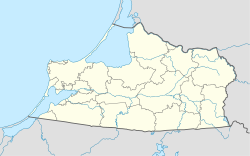 Slavsk Location of Slavsk 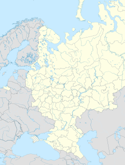 Slavsk Slavsk (European Russia)  Slavsk Slavsk (Europe)  Slavsk Slavsk (Russia) | |
| Coordinates: 55°05′N 21°40′E / 55.083°N 21.667°E | |
| Country | Russia |
| Federal subject | Kaliningrad Oblast[1] |
| Administrative district | Slavsky District[1] |
| Town of district significance | Slavsk[1] |
| Founded | 1292[2] |
| Elevation | 2 m (7 ft) |
| Population | |
| • Total | 4,614 |
| • Estimate (2018)[4] | 4,074 (−11.7%) |
| • Capital of | Slavsky District,[1] town of district significance of Slavsk[1] |
| • Municipal district | Slavsky Municipal District[5] |
| • Urban settlement | Slavskoye Urban Settlement[5] |
| • Capital of | Slavsky Municipal District,[5] Slavskoye Urban Settlement[5] |
| Time zone | UTC+2 (MSK–1 |
| Postal code(s)[7] | 238600 |
| OKTMO ID | 27727000001 |
History edit
The town was established in 1292 by the Teutonic Knights.[2] In 1454, King Casimir IV Jagiellon incorporated the territory to the Kingdom of Poland upon the request of the anti-Teutonic Prussian Confederation.[11] After the subsequent Thirteen Years' War (1454–1466), it became a part of Poland as a fief held by the Teutonic Knights,[12] and by Ducal Prussia afterwards.
From 1701, it formed part of the Kingdom of Prussia, and in 1819 it became seat of the Prussian Elchniederung district. In 1871 it became part of Germany. In the late 19th century, it had a population of over 1,800, partially Lithuanian.[8] According to German data 16,000 Lithuanians lived in the district in 1890[13] (29% of the population). Two annual fairs were held in the town in the late 19th century.[8]
| Year | Pop. | ±% |
|---|---|---|
| 1989 | 4,682 | — |
| 2002 | 5,172 | +10.5% |
| 2010 | 4,614 | −10.8% |
| 2018 | 4,074 | −11.7% |
| Source:[3] | ||
Administrative and municipal status edit
Within the framework of administrative divisions, Slavsk serves as the administrative center of Slavsky District.[1] As an administrative division, it is, together with six rural localities, incorporated within Slavsky District as the town of district significance of Slavsk.[1] As a municipal division, the town of district significance of Slavsk is incorporated within Slavsky Municipal District as Slavskoye Urban Settlement.[5]
Transportation edit
The town has a railway station on the Sovetsk-Kaliningrad railroad.
Notable people edit
- Ernst Siehr (1869–1945), German lawyer and politician
- Arthur Ewert (1890–1959), German politician
- Andrei Voronkov (1967–), Russian former volleyball player
Twin towns and sister cities edit
Slavsk is twinned with:
 Ronneby, Sweden
References edit
Notes edit
- ^ a b c d e f g h Resolution No. 640
- ^ a b c d Энциклопедия Города России. Moscow: Большая Российская Энциклопедия. 2003. p. 424. ISBN 5-7107-7399-9.
- ^ a b c Russian Federal State Statistics Service (2011). Всероссийская перепись населения 2010 года. Том 1 [2010 All-Russian Population Census, vol. 1]. Всероссийская перепись населения 2010 года [2010 All-Russia Population Census] (in Russian). Federal State Statistics Service.
- ^ "26. Численность постоянного населения Российской Федерации по муниципальным образованиям на 1 января 2018 года". Federal State Statistics Service. Retrieved 23 January 2019.
- ^ a b c d e Law No. 261
- ^ "Об исчислении времени". Официальный интернет-портал правовой информации (in Russian). 3 June 2011. Retrieved 19 January 2019.
- ^ Почта России. Информационно-вычислительный центр ОАСУ РПО. (Russian Post). Поиск объектов почтовой связи (Postal Objects Search) (in Russian)
- ^ a b c Słownik geograficzny Królestwa Polskiego i innych krajów słowiańskich, Tom III (in Polish). Warszawa. 1882. p. 592.
{{cite book}}: CS1 maint: location missing publisher (link) - ^ Russian Federal State Statistics Service (21 May 2004). Численность населения России, субъектов Российской Федерации в составе федеральных округов, районов, городских поселений, сельских населённых пунктов – районных центров и сельских населённых пунктов с населением 3 тысячи и более человек [Population of Russia, Its Federal Districts, Federal Subjects, Districts, Urban Localities, Rural Localities—Administrative Centers, and Rural Localities with Population of Over 3,000] (XLS). Всероссийская перепись населения 2002 года [All-Russia Population Census of 2002] (in Russian).
- ^ Всесоюзная перепись населения 1989 г. Численность наличного населения союзных и автономных республик, автономных областей и округов, краёв, областей, районов, городских поселений и сёл-райцентров [All Union Population Census of 1989: Present Population of Union and Autonomous Republics, Autonomous Oblasts and Okrugs, Krais, Oblasts, Districts, Urban Settlements, and Villages Serving as District Administrative Centers]. Всесоюзная перепись населения 1989 года [All-Union Population Census of 1989] (in Russian). Институт демографии Национального исследовательского университета: Высшая школа экономики [Institute of Demography at the National Research University: Higher School of Economics]. 1989 – via Demoscope Weekly.
- ^ Górski, Karol (1949). Związek Pruski i poddanie się Prus Polsce: zbiór tekstów źródłowych (in Polish). Poznań: Instytut Zachodni. p. 54.
- ^ Górski, pp. 96–97, 214–215
- ^ "Deutsche Verwaltungsgeschichte Ostpreußen, Kreis Elchniederung". www.verwaltungsgeschichte.de. Archived from the original on 12 January 2007.
Sources edit
- Правительство Калининградской области. Постановление №640 от 30 августа 2011 г. «Об утверждении реестра объектов административно-территориального деления Калининградской области», в ред. Постановления №877 от 21 ноября 2011 г «О внесении изменения в Постановление Правительства Калининградской области от 30 августа 2011 г. №640». Вступил в силу со дня официального опубликования. Опубликован: "Калининградская правда" (вкладыш "Официально"), №170, 15 сентября 2011 г. (Government of Kaliningrad Oblast. Resolution #640 of August 30, 2011 On the Adoption of the Registry of the Objects of the Administrative-Territorial Divisions of Kaliningrad Oblast, as amended by the Resolution #877 of November 21, 2011 On Amending the Resolution of the Government of Kaliningrad Oblast #640 of August 30, 2011. Effective as of the day of the official publication.).
- Калининградская областная Дума. Закон №261 от 30 июня 2008 г. «Об организации местного самоуправления на территории муниципального образования "Славский городской округ"», в ред. Закона №123 от 19 июня 2012 г. «О внесении изменения в Закон Калининградской области "Об организации местного самоуправления на территории муниципального образования "Славский городской округ"». Вступил в силу со дня официального опубликования. Опубликован: "Калининградская правда", №124, 11 июля 2008 г. (Kaliningrad Oblast Duma. Law #261 of June 30, 2008 On the Organization of the Local Self-Government on the Territory of the Municipal Formation of "Slavsky Urban Okrug", as amended by the Law #123 of June 19, 2012 On Amending the Law of Kaliningrad Oblast "On the Organization of the Local Self-Government on the Territory of the Municipal Formation of "Slavsky Urban Okrug". Effective as of the day of the official publication.).