


Summary
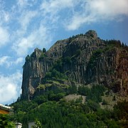
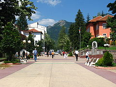
Smolyan (Bulgarian: Смолян) is a town and ski resort in the south of Bulgaria near the border with Greece. It is the administrative and industrial centre of the Smolyan Province. The town is built along the narrow valley of the Cherna ('black') and the Byala ('white') river in the central Rhodope Mountains. It is located at the foot of the mountain's highest peak Golyam Perelik (2191 m). Popular ski resorts of Pamporovo and Chepelare lie in the vicinity. As of June 2022 the town has a population of 30 689 inhabitants.
Smolyan | |
|---|---|
Town | |
 | |
 Coat of arms | |
 Smolyan Location of Smolyan | |
| Coordinates: 41°35′N 24°42′E / 41.583°N 24.700°E | |
| Country | Bulgaria |
| Province (Oblast) | Smolyan |
| Government | |
| • Mayor | Nikolay Melemov (GERB) |
| Area | |
| • Town | 134.59 km2 (51.97 sq mi) |
| Elevation | 1,002 m (3,287 ft) |
| Population (Census 2021) | |
| • Town | 30 689 |
| • Urban | 34,465 |
| Time zone | UTC+2 (EET) |
| • Summer (DST) | UTC+3 (EEST) |
| Postal Code | 4700 |
| Area code | 0301 |
| Website | www |
Name edit
The name of the town comes from the local Slavic tribe of the Smolyani, the name of whom is probably cognate to the Slavic word smola ("resin").[1]
History edit

According to archaeological evidence, the area around Smolyan was first settled in the 2nd-1st millennium BC. In the Middle Ages it acquired its name from the Slavic tribe, the Smolyani, who settled in the region in the 7th century. During the Middle Ages, it was ruled by the Part of the Byzantine and Bulgarian Empires. For a while during the 14th century it came under the control of the Bulgarian feudal lord Momchil, alongside the whole Rhodope mountains, before eventually being subjugated by the Ottoman Empire. During the Ottoman period the town was renamed to "Paşmaklı". It remained under Ottoman rule for five centuries, a township of the Ottoman Sanjak of Gümülcine in the Adrianople Vilayet between 1867 and 1912. It remained a Muslim-majority town with a large Christian minority until 1912.
The area was liberated by the 21st Sredna Gora Regiment led by Vladimir Serafimov in 1912, during the First Balkan War. However, the town retained its Ottoman-era name "Paşmaklı" until 1934, when it was changed to "Smolyan" by official decree. The modern town of Smolyan was formed by the merger of three existing villages — Ustovo, Raykovo and Ezerovo — in 1960.

Population edit
The population of Smolyan just after World War II was about 5,000.[2] Since then, it started growing decade by decade, mostly because of the migrants from the rural areas and the surrounding smaller towns, reaching its peak in the beginning of the 1990s, exceeding 34,000.[3]
| Smolyan | |||||||||||||||
|---|---|---|---|---|---|---|---|---|---|---|---|---|---|---|---|
| Year | 1887 | 1910 | 1934 | 1946 | 1956 | 1965 | 1975 | 1985 | 1992 | 2001 | 2005 | 2009 | 2011 | 2021 | |
| Population | no data | no data | no data | 5,406 | 7,472 | 17,448 | 28,492 | 31,539 | 34,086 | 33,153 | 31,988 | 31,718 | 30,642 | 26,167 | |
| Highest number 34,086 in 1992 | |||||||||||||||
| Sources: National Statistical Institute,?? citypopulation.de,?? pop-stat.mashke.org,?? Bulgarian Academy of Sciences?? | |||||||||||||||
Ethnic linguistic and religious composition edit
According to the latest 2011 census data, the individuals declared their ethnic identity were distributed as follows:[4][5]
- Bulgarians: 25,045 (97.0%)
- Roma: 258 (1.0%)
- Turks: 153 (0.6%)
- Others: 120 (0.5%)
- Indefinable: 248 (1.0%)
- Undeclared: 4,818 (15.7%)
Total: 30,642
In Smolyan Municipality 32708 declared as Bulgarians, 301 as Roma and 170 as Turks, and 9,000 did not declare their ethnic group.
Culture and sports edit
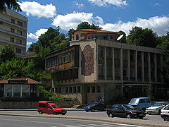
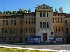
Due to its suitable location on top of Mount Rozhen, the Bulgarian National Astronomical Observatory is located nearby, with a planetarium in operation in the town. There is one theatre, the Rhodope Drama Theatre, and a gathering of theatre practitioners and scholars known as The Rhodopi International Theatre Laboratory is held every summer. There is also a regional historical museum founded in 1935.[citation needed]
Smolyan has an elite division football team, PFC Rodopa Smolyan, that had been playing in the A Professional Football Group between 2003-2007.
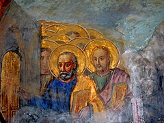
The largest church in southern Bulgaria, the Cathedral of Saint Vissarion of Smolyan, was inaugurated in the city in July 2006.
Municipality edit
Smolyan is also the seat of Smolyan municipality (part of Smolyan Province), which includes the following 79 villages:
- Aligovska
- Arda
- Belev dol
- Bilyanska
- Borikovo
- Bostina
- Bukata
- Bukatsite
- Chamla
- Chepleten
- Chereshkite
- Chereshovo
- Chereshovska Reka
- Chokmanovo
- Chuchur
- Dimovo
- Dunevo
- Elenska
- Elyovo
- Fatovo
- Gabritsa
- Gela
- Gozdevitsa
- Gorna Arda
- Gorovo
- Gradat
- Gudevitsa
- Hasovitsa
- Isyovtsi
- Katranitsa
- Kiselichevo
- Kokorkovo
- Koshnitsa
- Kremene
- Kukuvitsa
- Kutela
- Laka
- Levochevo
- Lipets
- Lyulka
- Milkovo
- Mogilitsa
- Momchilovtsi
- Mugla
- Nadartsi
- Oreshitsa
- Ostri Pazlak
- Petkovo
- Peshtera
- Pisanitsa
- Podvis
- Polkovnik Serafimovo
- Poprelka
- Potoka
- Rechani
- Reka
- Rovina
- Selishte
- Shiroka Laka
- Sivino
- Slaveyno
- Smilyan
- Sokolovtsi
- Solishta
- Sredok
- Stikal
- Stoykite
- Sarnino
- Strazha
- Taran
- Tikale
- Trebishte
- Turyan
- Uhlovitsa
- Valchan
- Varbovo
- Vievo
- Vlahovo
- Zaevite
- Zmievo
Geography edit
Climate edit
Smolyan has a dry-warm-summer humid continental climate (Köppen climate classification: Dsb), featuring warm, dry summers and cold, snowy winters.
| Climate data for Smolyan | |||||||||||||
|---|---|---|---|---|---|---|---|---|---|---|---|---|---|
| Month | Jan | Feb | Mar | Apr | May | Jun | Jul | Aug | Sep | Oct | Nov | Dec | Year |
| Mean daily maximum °C (°F) | 2.7 (36.9) |
4.5 (40.1) |
9.2 (48.6) |
13.6 (56.5) |
18.5 (65.3) |
22.2 (72.0) |
25.6 (78.1) |
25.7 (78.3) |
21.1 (70.0) |
16.3 (61.3) |
10.2 (50.4) |
4.1 (39.4) |
14.6 (58.3) |
| Mean daily minimum °C (°F) | −5.2 (22.6) |
−3.4 (25.9) |
−2.1 (28.2) |
3.9 (39.0) |
7.7 (45.9) |
10.8 (51.4) |
12.8 (55.0) |
12.7 (54.9) |
8.8 (47.8) |
4.7 (40.5) |
1.1 (34.0) |
−3.8 (25.2) |
4.0 (39.2) |
| Average precipitation mm (inches) | 80 (3.1) |
70 (2.8) |
90 (3.5) |
90 (3.5) |
200 (7.9) |
100 (3.9) |
80 (3.1) |
30 (1.2) |
10 (0.4) |
90 (3.5) |
180 (7.1) |
210 (8.3) |
1,290 (50.8) |
| Average relative humidity (%) | 72 | 74 | 69 | 70 | 70 | 69 | 66 | 57 | 62 | 74 | 72 | 77 | 69 |
| Source: [6] | |||||||||||||
Honour edit
Smolyan Point on Livingston Island in the South Shetland Islands, Antarctica is named after Smolyan.
Notable people edit
- Valya Balkanska
- Victor Houteff, founder of the Davidian branch, an offshoot of the Seventh-day Adventist Church.
Gallery edit


References edit
- ^ "гр. Смолян" (in Bulgarian). BGGLOBE. Retrieved 2008-09-14.
- ^ България / Bălgarija pop-stat.mashke.org
- ^ (in English) „WorldCityPopulation“
- ^ (in Bulgarian) Population on 01.02.2011 by provinces, municipalities, settlements and age; National Statistical Institute
- ^ Population by province, municipality, settlement and ethnic identification, by 01.02.2011; Bulgarian National Statistical Institute (in Bulgarian)
- ^ "Weather Base". Weather Base. Retrieved December 21, 2012.
External links edit
- Smolyan municipality website
- Smolyan municipality at Domino.bg
- Planetarium Smolyan
- National Astronomical Observatory "Rozhen"
- Official website of village of "Kutela"