


Summary
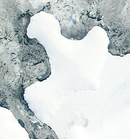
Smyley Island is an Antarctic island lying off the Antarctic Peninsula. The island is 61 km (38 mi) long and from 13 to 34 km (8 to 21 mi) wide, and lies about 20 km (12 mi) north of Case Island. It connects to the Stange Ice Shelf and is separated from Alexander Island by the Ronne Entrance. Smyley Island is one of the 27 islands of Palmer Land, Antarctica.[1]
 | |
 Smyley Island Location in Antarctica | |
| Geography | |
|---|---|
| Location | Palmer Land, Antarctica |
| Coordinates | 72°55′S 78°0′W / 72.917°S 78.000°W |
| Length | 61 km (37.9 mi) |
| Width | 34 km (21.1 mi) |
| Administration | |
| Administered under the Antarctic Treaty System | |
| Demographics | |
| Population | Uninhabited |
Discovery and naming edit
In 1939–1941 Smyley Island was first identified as a peninsula of mainland Antarctica by the United States Antarctic Service and was named Cape Smyley. In 1968 it was identified as an island on a U.S. Geological Survey map.[1] The island is named after Captain William H. Smyley, the American master of the sealing vessel Ohio during 1841–42.[1]
Important Bird Area edit
A 497 ha site on fast ice near Scorseby Head, on the northern shore of the island, has been designated an Important Bird Area (IBA) by BirdLife International because it supports a breeding colony of some 6,000 emperor penguins, based on 2009 satellite imagery.[2]
See also edit
References edit
![]() This article incorporates public domain material from "Smyley Island". Geographic Names Information System. United States Geological Survey.
This article incorporates public domain material from "Smyley Island". Geographic Names Information System. United States Geological Survey.
External links edit
- British Antarctic Survey diary