
KNOWPIA
WELCOME TO KNOWPIA

Sohung County 
Summary
Sŏhŭng County is a county in North Hwanghae province, North Korea.
Sŏhŭng County
서흥군 | |
|---|---|
| Korean transcription(s) | |
| • Hanja | 瑞興郡 |
| • McCune-Reischauer | Sŏhŭng-gun |
| • Revised Romanization | Seoheung-gun |
 Poman-ri Fish Farm, Sohung County | |
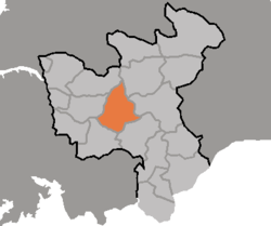 Map of North Hwanghae showing the location of Sohung | |
| Country | North Korea |
| Province | North Hwanghae Province |
| Area | |
| • Total | 566.14 km2 (218.59 sq mi) |
| Population (2008) | |
| • Total | 100,887 |
History edit
In 1952, during the Korean War, the North Koreans established a military training school in Sohung County called the Kumgang Political Institute with approximately 1,500 cadets.[1] It was headed by South Korean Kim Ung-bin.
Administrative divisions edit
Sŏhŭng county is divided into 1 ŭp (town) and 20 ri (villages):
|
|
As of 2015[update], Sohung county had a population of around 100,000 people, with approximately 30,000 of these living in Sohung town.[2]
Transportation edit
Sŏhŭng county is served by the P'yŏngbu line of the Korean State Railway.
References edit
38°25′35″N 126°10′05″E / 38.42639°N 126.16806°E