


Summary
25°03′35″N 121°33′26″E / 25.059788°N 121.55727°E
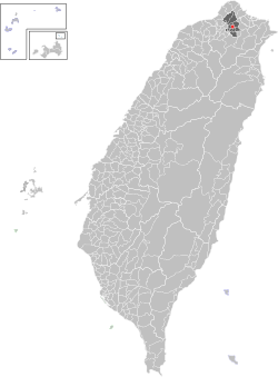
Songshan
松山區 Matsuyama | |
|---|---|
| Songshan District | |
 | |
 | |
| Country | Republic of China (Taiwan) |
| Region | Eastern Taipei |
| Divisions | List
|
| Area | |
| • Total | 9.2878 km2 (3.5860 sq mi) |
| • Rank | Ranked 9th of 12 |
| Population (January 2023) | |
| • Total | 190,772 |
| • Rank | Ranked 8th of 12 |
| • Density | 21,000/km2 (53,000/sq mi) |
| Postal code | 105 |
| Website | ssdo |
| Songshan District, Taipei | |||||||||||||
|---|---|---|---|---|---|---|---|---|---|---|---|---|---|
| Chinese name | |||||||||||||
| Traditional Chinese | 松山區 | ||||||||||||
| |||||||||||||
| former name | |||||||||||||
| Traditional Chinese | 錫口 | ||||||||||||
| |||||||||||||
| Japanese name | |||||||||||||
| Kanji | 松山 | ||||||||||||
| Hiragana | まつやま | ||||||||||||
| |||||||||||||
Songshan District is a district of Taipei, Taiwan. The Songshan Airport and the Taipei Arena are located here.
History edit
Songshan was originally named Malysyakkaw, a lowland Ketagalan word meaning "Where the river twists". Its written form (Chinese: 麻里折口; Pe̍h-ōe-jī: Bâ-lí-chek-kháu) was abbreviated (錫口; Sek-kháu)[1] in 1815 during Qing rule.
During Japanese rule (1895-1945), the area served as a prime tea-growing area in northern Taiwan. In 1920, the area's settlements were established as Matsuyama Village (Japanese: 松山庄), Shichisei District, Taihoku Prefecture. The village, named after Matsuyama City in Japan, was incorporated into Taihoku City (modern-day Taipei) in 1938.
At the outset of one-party rule by the Kuomintang (1945-1990), the Mandarin Chinese reading of the kanji characters 松山 (i.e. Sung-shan) was adopted as the name of the district, which in 1946 officially comprised 26 municipal villages (里). In 1949, the area's tea estates gave way to military housing for lower-income Kuomintang refugee families. The bodies of many residents and political victims from Taiwan's martial law period are buried in hillside cemeteries that now overlook the Taipei 101 shopping district.[2][3] By 1980, Songshan was the most populous area of the city.
In 1990, the southern half of Songshan District became Xinyi District while the northern half retained its original name. The boundary of this smaller Songshan District was altered in May 1994 when the course of Keelung River was moved slightly to the south.
Administrative divisions edit


Songshan is divided into four regions (地區), or secondary district (次分區), which in turn are divided into 33 municipal villages.
| Type | Chinese[4] | Hanyu Pinyin | Tongyong Pinyin | Pe̍h-ōe-jī | Notes |
|---|---|---|---|---|---|
| Region | 三民次分區 | Sānmín | Sanmin | Sam-bîn | northeast |
| Urban villages |
莊敬里 | Zhuāngjìng | Jhuangjin | Chong-kèng | |
| 東榮里 | Dōngróng | Dongrong | Tang-êng | ||
| 三民里 | Sānmín | Sanmin | Sam-bîn | ||
| 新益里 | Xīnyì | Sinyi | Sin-ek | ||
| 富錦里 | Fùjǐn | Fujin | Hù-kím | ||
| 新東里 | Xīndōng | Sindong | Sin-tang | ||
| 富泰里 | Fùtài | Futai | Hù-thài | ||
| 介壽里 | Jièshòu | Jieshou | Kài-siū | literally means "Longevity to Chiang Kai-shek" | |
| Region | 東社次分區 | Dōngshè | Dongshe | northwest and central (largest region) | |
| Urban villages |
精忠里 | Jīngzhōng | Jinjhong | Cheng-tiong | |
| 東光里 | Dōngguāng | Dongguang | Tang-kng | ||
| 龍田里 | Lóngtián | Longtian | Liông-tiân | ||
| 東昌里 | Dōngchāng | Dongchang | Tang-chhiong | ||
| 東勢里 | Dōngshì | Dongshi | Tang-sì | ||
| 中華里 | Zhōnghuá | Jhonghua | Tiong-hôa | ||
| 民有里 | Mínyǒu | Minyou | Bîn-iú | ||
| 民福里 | Mínfú | Minfu | Bîn-hok | ||
| 松基里 | Sōngjī | Songji | Siông-ki | ||
| Region | 本鎮次分區 | Běnzhèn | Benjheng | southeast | |
| Urban villages |
慈祐里 | Cíyòu | Cihyou | Chû-iū | |
| 安平里 | Ānpíng | Anping | An-pêng | ||
| 鵬程里 | Péngchéng | Pengcheng | Phêng-têng | ||
| 自強里 | Zìqiáng | Zihciang | Chū-kiông | ||
| 吉祥里 | Jíxiáng | Jisiang | Kiat-siông | ||
| 新聚里 | Xīnjù | Sinjyu | Sin-chū | ||
| 復盛里 | Fùshèng | Fusheng | Ho̍k-sēng | ||
| Region | 中崙次分區 | Zhōnglún | Jhonglyuen | Tiong-lūn | southwest |
| Urban villages |
中正里 | Zhōngzhèng | Jhongjheng | Tiong-chèng | |
| 中崙里 | Zhōnglún | Jhonglyuen | Tiong-lūn | ||
| 美仁里 | Měirén | Meiren | Bí-jîn | ||
| 吉仁里 | Jírén | Jiren | Kiat-jîn | ||
| 敦化里 | Dūnhuà | Dunhua | Tun-hòa | ||
| 復源里 | Fùyuán | Fuyuan | Ho̍k-goân | ||
| 復建里 | Fùjiàn | Fujian | Ho̍k-kiān | ||
| 復勢里 | Fùshì | Fushi | Ho̍k-sì | ||
| 福成里 | Fùchéng | Fucheng | Hok-sêng |
Government institutions edit

Institutions edit
Economy edit

The district is a major financial center in Taipei, with many banking institutions located on Dunhua North Road (敦化北路) and Nanjing East Road (南京東路).
Mandarin Airlines,[5] Daily Air[6] and Far Eastern Air Transport[7] have their headquarters in Songshan.
Before moving its headquarters to a new location at CAL Park, Taoyuan International Airport, China Airlines formerly had its headquarters in the location of its current Taipei Branch Office on Nanjing E. Rd.[8][9][10] After the headquarters move, China Airlines developed part of the training center at Taipei Songshan Airport into a business aviation center.[11]
Infrastructures edit
Education edit
- National Open University — Taipei Learning Center (空中大學 台北指導中心)[1]
- Sungshan Community College (松山社區大學): located within Zhonglun Senior High School (中崙高中), in Jixiang Village [2]
- Taipei Municipal Zhonglun High School
- Taipei Municipal Xisong High School
- Yu Da High School of Commerce and Home Economics (私立育達高級商業家事職業學校, short 育達商職): a private vocational high school in Meiren Village [3]
In addition, there are six middle schools, and eight elementary schools[12]
Tourist attractions edit

- Breeze Center
- Ciyou Temple (松山慈祐宮)
- Puppetry Art Center of Taipei
- Raohe Street Night Market, organized in 1987, contains over 160 booths.
- Songshan Xiahai Chenghuang Temple (松山霞海城隍廟) was built in 1753.
- Taipei-Fu Chenghuang Temple (台北府城隍廟) was built in 1926.
- Fo Guang Shan Pumen Temple (佛光山普門寺) is the Taipei branch monastery of Fo Guang Shan Order.
- Taipei Arena is a modern facility that hosts events ranging from sports to concerts.
- Taipei Gymnasium
- The Metropolitan Hall is a venue for music, dancing, and theatrical performances operated by Taipei City Arts Promotion Office
- Land Reform Museum
- Aurora Art Museum
- Taiwan Stock Museum
- Yingfeng Riverside Park
- Guanshan Riverside Park
- Sanmin Park
- Xinzhong Park
- Japanese Cultural Center
Transportation edit

Roads edit
Fuxing North Road (復興北路) runs along the western boundary of the district. The other major north–south road is Dunhua North Road (敦化北路). Several major east–west arteries include Minquan East Road (民權東路), Sec. 3–5; Minsheng East Road (民生東路), Sec. 3–5; Nanjing East Road (南京東路), Sec. 3–5; and Bade Road (八德路), Sec. 2–4.
The southern border is outlined by the Civic Blvd (市民大道). Meanwhile, National Highway 1 borders the northern part of the district.
Metro edit
The Taipei Metro serves the district via the following stations:
- Zhongshan Junior High School metro station
- Songshan Airport metro station
- Taipei Arena metro station
- Nanjing Sanmin metro station
- Songshan station
- Nanjing Fuxing metro station
Airport edit
Songshan Airport is located in Dongshe Region, accessible by the Taipei Metro Wenhu line's Songshan Airport metro station.
Notable natives edit
- Ying Wei-min, actor and singer
See also edit
References edit
- ^ "Entry #40238 (錫口)". 臺灣閩南語常用詞辭典 [Dictionary of Frequently-Used Taiwan Minnan]. (in Chinese and Hokkien). Ministry of Education, R.O.C. 2011.
- ^ di Genova, Trista (1 March 2009). "Taipei graveyard holds key to White Terror: Arrigo". The China Post.
- ^ Chiu, Shao-wen; Pan, Jason (5 April 2013). "FEATURE: Taipei's graveyards are also some of its hottest tourist spots". Taipei Times. Retrieved 29 December 2014.
- ^ 里鄰經費辦理情形 (in Chinese (Taiwan)). 21 February 2019. Retrieved 25 June 2019.
臺北市松山區各里辦公處網站登載年度公告里鄰經費辦理情形 --三民次分區-- 莊敬里 東榮里 三民里 新益里 富錦里 新東里 富泰里 介壽里 --東社次分區-- 精忠里 東光里 龍田里 東昌里 東勢里 中華里 民有里 民福里 松基里 --本鎮次分區-- 慈祐里 安平里 鵬程里 自強里 吉祥里 新聚里 復盛里 --中崙次分區-- 中正里 中崙里 美仁里 吉仁里 敦化里 復源里 復建里 復勢里 福成里
- ^ "Contact Us." Mandarin Airlines. Retrieved 2010-03-15. "台北總公司: 105台北市民生東路三段134號13樓."
- ^ "德安航空股份有限公司一般租機合約書." (Archive) Daily Air. Retrieved on January 5, 2012. "地址:台北市敦化北路340號之10"
- ^ Home page. Far Eastern Air Transport. Retrieved on January 6, 2011. "地址:台北市敦化北路405巷123弄5號 " - Map (Archive)
- ^ "Investor Relations." China Airlines. Retrieved 2009-05-20. "Address: No.131, Sec. 3, Nanjing E. Rd., Taipei City 104, Taiwan (R.O.C.)"
- ^ "Cargo." Taoyuan International Airport. Retrieved 2010-03-15. "Address: 12F., No.131, Sec. 3, Nanjing E. Rd., Songshan District, Taipei City 105, Taiwan (R.O.C.)."
- ^ Staff. "CAL to inaugurate new HQ near Taoyuan airport." The China Post. Thursday September 10, 2009. Retrieved 2010-03-15.
- ^ Staff. "Plans for faster service at Songshan Airport: CAA." The China Post. July 5, 2009. Retrieved on March 15, 2010.
- ^ "台北市行政地圖松山區." Taipei City Education Portal Site, Department of Education, Taipei City. Updated 2011-06-08. Retrieved 2011-06-08.
External links edit
- Official website
 (in Chinese)
 - Map of the Songshan District from Taiwan's Ministry of the Interior(in Chinese)