
KNOWPIA
WELCOME TO KNOWPIA

Sorata Municipality 
Summary
Sorata Municipality (Aymara: Surat'a) is the first municipal section of the Larecaja Province in the La Paz Department, Bolivia. Its capital is Sorata. The Illampu - Janq'u Uma massif is located within the municipality, site of the 17th highest lake in the world, Laguna Glaciar.
Sorata Municipality | |
|---|---|
Municipality | |
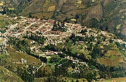 Sorata town as seen from Purani Churiquimbaya botanic garden | |
 Sorata Municipality Location of the Arani Municipality within Bolivia | |
| Coordinates: 15°45′0″S 68°32′0″W / 15.75000°S 68.53333°W | |
| Country | |
| Department | La Paz Department |
| Province | Larecaja Province |
| Seat | Sorata |
| Area | |
| • Total | 794 sq mi (2,056 km2) |
| Population (2001) | |
| • Total | 18,932 |
| • Ethnicities | Aymara |
| Time zone | UTC-4 (BOT) |
Geography edit
The Cordillera Real traverses the municipality. The highest peaks of the municipality are Illampu and Janq'u Uma. Other mountains are listed below:[1][2][3][4]
- Allqamarini
- Chunta Qullu
- Ch'alla Quta
- Ch'iyar Qullu
- Ch'uch'u
- Ch'uch'u Apachita
- Ch'uxña Quta
- Ch'uxñani
- Illampu
- Jach'a Apachita
- Jach'a Pukara
- Jach'a Waylla Punta
- Janq'u K'ark'a
- Janq'u Uma
- Jichu Quta
- Jukumarini
- Llawi Imaña
- Phallata
- P'iq'iñ Qullu
- Qala Phusa
- Quña Quñani
- Quriwani
- Q'asiri
- Saywani
- Uma Jalanta
- Uma Manqha
- Wankar Quta Qullu
- Warachani
- Wila Quta
- Wila Wilani
- Wiluyu Janq'u Uma
- Yapuchañani
Languages edit
The languages spoken in the Sorata Municipality are mainly Aymara and Spanish.[5]
| Language | Inhabitants |
|---|---|
| Quechua | 363 |
| Aymara | 16,029 |
| Guaraní | 7 |
| Another native | 8 |
| Spanish | 11,223 |
| Foreign | 70 |
| Only native | 6,680 |
| Native and Spanish | 9,540 |
| Only Spanish | 1,690 |
See also edit
References edit
External links edit
- Population data and map of Sorata Municipality