
KNOWPIA
WELCOME TO KNOWPIA

Soultzmatt 
Summary
Soultzmatt (French pronunciation: [sultsmat] ⓘ; German: Sulzmatt) is a commune in the Haut-Rhin department in Grand Est in north-eastern France.
Soultzmatt | |
|---|---|
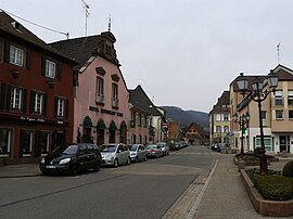 The main road through Soultzmatt | |
|
Flag  Coat of arms | |
Location of Soultzmatt .mw-parser-output .locmap .od{position:absolute}.mw-parser-output .locmap .id{position:absolute;line-height:0}.mw-parser-output .locmap .l0{font-size:0;position:absolute}.mw-parser-output .locmap .pv{line-height:110%;position:absolute;text-align:center}.mw-parser-output .locmap .pl{line-height:110%;position:absolute;top:-0.75em;text-align:right}.mw-parser-output .locmap .pr{line-height:110%;position:absolute;top:-0.75em;text-align:left}.mw-parser-output .locmap .pv>div{display:inline;padding:1px}.mw-parser-output .locmap .pl>div{display:inline;padding:1px;float:right}.mw-parser-output .locmap .pr>div{display:inline;padding:1px;float:left}html.skin-theme-clientpref-night .mw-parser-output .od,html.skin-theme-clientpref-night .mw-parser-output .od .pv>div,html.skin-theme-clientpref-night .mw-parser-output .od .pl>div,html.skin-theme-clientpref-night .mw-parser-output .od .pr>div{background:#000;color:#fff}html.skin-theme-clientpref-night .mw-parser-output .locmap{filter:grayscale(0.6)}@media(prefers-color-scheme:dark){html.skin-theme-clientpref-os .mw-parser-output .locmap{filter:grayscale(0.6)}html.skin-theme-clientpref-os .mw-parser-output .od,html.skin-theme-clientpref-os .mw-parser-output .od .pv>div,html.skin-theme-clientpref-os .mw-parser-output .od .pl>div,html.skin-theme-clientpref-os .mw-parser-output .od .pr>div{background:#000;color:#fff}}  Soultzmatt  Soultzmatt | |
| Coordinates: 47°57′45″N 7°14′20″E / 47.9625°N 7.2389°E | |
| Country | France |
| Region | Grand Est |
| Department | Haut-Rhin |
| Arrondissement | Thann-Guebwiller |
| Canton | Wintzenheim |
| Intercommunality | Région de Guebwiller |
| Government | |
| • Mayor (2020–2026) | Jean-Paul Diringer[1] |
| Area 1 | 19.57 km2 (7.56 sq mi) |
| Population (2021)[2] | 2,432 |
| • Density | 120/km2 (320/sq mi) |
| Time zone | UTC+01:00 (CET) |
| • Summer (DST) | UTC+02:00 (CEST) |
| INSEE/Postal code | 68318 /68570 |
| Elevation | 236–773 m (774–2,536 ft) (avg. 280 m or 920 ft) |
| 1 French Land Register data, which excludes lakes, ponds, glaciers > 1 km2 (0.386 sq mi or 247 acres) and river estuaries. | |
Its vineyards produce one of the finest Alsacian wines: the Grand Cru Zinnkoepflé.
Population edit
| Year | Pop. | ±% p.a. |
|---|---|---|
| 1968 | 2,057 | — |
| 1975 | 2,040 | −0.12% |
| 1982 | 1,924 | −0.83% |
| 1990 | 1,997 | +0.47% |
| 1999 | 2,138 | +0.76% |
| 2007 | 2,244 | +0.61% |
| 2012 | 2,346 | +0.89% |
| 2017 | 2,411 | +0.55% |
| Source: INSEE[3] | ||
See also edit
References edit
- ^ "Répertoire national des élus: les maires" (in French). data.gouv.fr, Plateforme ouverte des données publiques françaises. 13 September 2022.
- ^ "Populations légales 2021". The National Institute of Statistics and Economic Studies. 28 December 2023.
- ^ Population en historique depuis 1968, INSEE
Wikimedia Commons has media related to Soultzmatt.