


Summary
South Somerset was a local government district in Somerset, England, from 1974 to 2023. The district covered an area of 370 square miles (958 km2)[2] ranging from the borders with Devon, Wiltshire and Dorset to the edge of the Somerset Levels. It had a population of approximately 158,000.[3] The administrative centre of the district was Yeovil.
South Somerset | |
|---|---|
|
| |
 Shown within Somerset | |
| Sovereign state | United Kingdom |
| Constituent country | England |
| Region | South West England |
| Ceremonial county | Somerset |
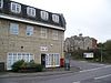
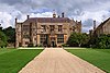
| Admin HQ | Yeovil |
| Created | 1 April 1974 |
| Government | |
| • Type | South Somerset District Council |
| • Leader | Val Keitch |
| • Council | |
| • MPs: | David Warburton (Conservative), Marcus Fysh (Conservative) |
| Area | |
| • Total | 370.29 sq mi (959.04 km2) |
| Population (2021)[1] | |
| • Total | 173,173 |
| • Density | 470/sq mi (180/km2) |
| Time zone | UTC0 (GMT) |
| • Summer (DST) | UTC+1 (BST) |
| Post Code | |
| Area code | 01935/01963 |
| Website | http://www.southsomerset.gov.uk/ |
On 1 April 2023, the district was abolished and replaced by Somerset Council, a unitary district for the area previously served by Somerset County Council.[4]
History edit
The district was formed on 1 April 1974, and was originally known as Yeovil, adopting the South Somerset name in 1985. It was formed by the merger of the municipal boroughs of Chard, Yeovil, along with Crewkerne and Ilminster urban districts and the Chard Rural District, Langport Rural District, Wincanton Rural District and Yeovil Rural District.
The district covered the whole of the Yeovil constituency, and part of Somerton and Frome. The district was governed by the South Somerset District Council, last elected in the 2019 South Somerset District Council election.
Abolition edit
On 1 April 2023, the district council was abolished and replaced by Somerset Council, a unitary authority for the area previously served by Somerset County Council.[4] Elections for the new council took place in May 2022. It ran alongside South Somerset and the other district councils in the county until their abolition.[5]
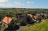
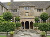
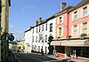
Towns edit
Its main towns included:
Wards edit
The electoral wards included: Camelot and Wessex.
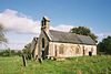
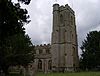
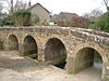
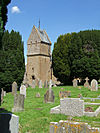
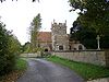
Parishes edit
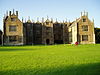
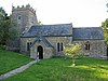
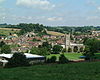
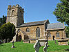
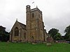
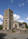
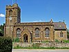
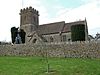
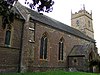
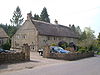
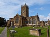
| Image | Name | Status | Population | Former local authority | Coordinates | Refs |
|---|---|---|---|---|---|---|
 |
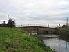
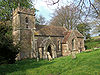
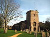
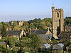
Abbas and Templecombe | Civil parish | 1,560 | Wincanton Rural District | 50°59′N 2°25′W / 50.99°N 2.41°W | [6][7] |
 |
Alford | Civil parish | 63 | Wincanton Rural District | 51°05′N 2°34′W / 51.08°N 2.57°W | [7] |
 |
Aller | Civil parish | 410 | Langport Rural District | 51°03′N 2°51′W / 51.05°N 2.85°W | [6][8] |
 |
Ansford | Civil parish | 1,085 | Wincanton Rural District | 51°05′N 2°31′W / 51.09°N 2.51°W | [6][7] |
 |
Ash | Civil parish | 626 | Yeovil Rural District | 50°59′N 2°45′W / 50.98°N 2.75°W | [6][9] |
 |
Ashill | Civil parish | 529 | Chard Rural District | 50°56′N 2°58′W / 50.94°N 2.96°W | [6][10] |
 |
Babcary | Civil parish | 248 | Langport Rural District | 51°03′N 2°37′W / 51.05°N 2.62°W | [6][8] |
 |
Barrington | Civil parish | 438 | Langport Rural District | 50°58′N 2°52′W / 50.96°N 2.87°W | [6][8] |
 |
Barton St David | Civil parish | 561 | Langport Rural District | 51°05′N 2°39′W / 51.08°N 2.65°W | [6][8] |
 |
Barwick | Civil parish | 1,221 | Yeovil Rural District | 50°55′N 2°37′W / 50.92°N 2.62°W | [6][9] |
 |
Beercrocombe | Civil parish | 134 | Langport Rural District | 50°59′N 2°58′W / 50.98°N 2.97°W | [6][8] |
 |
Compton Pauncefoot | Civil parish | 130 | Wincanton Rural District | 51°02′N 2°30′W / 51.03°N 2.50°W | [7] |
 |
Bratton Seymour | Civil parish | 104 | Wincanton Rural District | 51°04′N 2°28′W / 51.07°N 2.47°W | [6][7] |
 |
Brewham | Civil parish | 441 | Wincanton Rural District | 51°08′N 2°24′W / 51.13°N 2.40°W | [6][7] |
 |
Broadway | Civil parish | 740 | Chard Rural District | 50°56′N 2°58′W / 50.93°N 2.97°W | [6][10] |
 |
Bruton | Town | 2,907 | Wincanton Rural District | 51°07′N 2°27′W / 51.11°N 2.45°W | [6][7] |
 |
Brympton | Civil parish | 7,308 | Yeovil Rural District | 50°56′N 2°41′W / 50.94°N 2.68°W | [6][9] |
 |
Buckland St Mary | Civil parish | 521 | Chard Rural District | 50°55′N 3°02′W / 50.91°N 3.04°W | [6][10] |
 |
Castle Cary | Town | 2,276 | Wincanton Rural District | 51°05′N 2°31′W / 51.09°N 2.51°W | [6][7] |
 |
Chaffcombe | Civil parish | 229 | Chard Rural District | 50°53′N 2°55′W / 50.89°N 2.92°W | [6][10] |
 |
Chard Town | Town | 13,074 | Chard Municipal Borough | 50°52′N 2°58′W / 50.87°N 2.96°W | [6][10] |
 |
Charlton Horethorne | Civil parish | 591 | Wincanton Rural District | 51°01′N 2°29′W / 51.01°N 2.48°W | [6] |
 |
Charlton Mackrell | Civil parish | 1,073 | Langport Rural District | 51°03′N 2°41′W / 51.05°N 2.68°W | [6][8] |
 |
Charlton Musgrove | Civil parish | 398 | Wincanton Rural District | 51°05′N 2°23′W / 51.08°N 2.39°W | [6][7] |
 |
Chillington | Civil parish | 164 | Chard Rural District | 50°53′N 2°52′W / 50.89°N 2.87°W | [6][10] |
 |
Chilthorne Domer | Civil parish | 574 | Yeovil Rural District | 50°58′N 2°41′W / 50.97°N 2.68°W | [6][9] |
 |
Chilton Cantelo | Civil parish | 445 | Yeovil Rural District | 51°00′N 2°36′W / 51.00°N 2.60°W | [6][9] |
 |
Chiselborough | Civil parish | 275 | Yeovil Rural District | 50°56′N 2°46′W / 50.93°N 2.76°W | [6][9] |
 |
Closworth | Civil parish | 220 | Yeovil Rural District | 50°53′N 2°37′W / 50.89°N 2.62°W | [6][9] |
 |
Combe St Nicholas | Civil parish | 1,373 | Chard Rural District | 50°53′N 2°59′W / 50.89°N 2.99°W | [6][10] |
 |
Compton Dundon | Civil parish | 705 | Langport Rural District | 51°05′N 2°44′W / 51.09°N 2.73°W | [6][8] |
 |
Corton Denham | Civil parish | 189 | Wincanton Rural District | 51°00′N 2°31′W / 51.00°N 2.52°W | [6][7] |
 |
Crewkerne | Town | 7,000 | Crewkerne Urban District | 50°53′N 2°47′W / 50.88°N 2.79°W | [6][11] |
 |
Cricket St Thomas | Civil parish | 50 | Chard Rural District | 50°52′N 2°53′W / 50.87°N 2.89°W | [10] |
 |
Cucklington | Civil parish | 173 | Wincanton Rural District | 51°03′N 2°21′W / 51.05°N 2.35°W | [6][7] |
 |
Cudworth | Civil parish | 69 | Chard Rural District | 50°53′N 2°53′W / 50.89°N 2.89°W | [10] |
 |
Curry Mallet | Civil parish | 306 | Langport Rural District | 50°59′N 2°58′W / 50.99°N 2.96°W | [6][8] |
 |
Curry Rivel | Civil parish | 2,148 | Langport Rural District | 51°02′N 2°52′W / 51.03°N 2.86°W | [6][8] |
 |
Dinnington | Civil parish | 65 | Chard Rural District | 50°55′N 2°51′W / 50.91°N 2.85°W | [10] |
 |
Donyatt | Civil parish | 347 | Chard Rural District | 50°56′N 2°57′W / 50.93°N 2.95°W | [6][10] |
 |
Dowlish Wake | Civil parish | 277 | Chard Rural District | 50°55′N 2°53′W / 50.91°N 2.89°W | [6][10] |
 |
Drayton | Civil parish | 379 | Langport Rural District | 51°01′08″N 2°51′00″W / 51.019°N 2.85°W | [6][8] |
 |
East Chinnock | Civil parish | 479 | Yeovil Rural District | 50°55′N 2°43′W / 50.92°N 2.72°W | [6][9] |
 |
East Coker | Civil parish | 1,667 | Yeovil Rural District | 50°55′N 2°39′W / 50.91°N 2.65°W | [6][9] |
 |
Fivehead | Civil parish | 609 | Langport Rural District | 50°59′N 2°55′W / 50.99°N 2.92°W | [6][8] |
 |
Hambridge and Westport | Civil parish | 514 | Langport Rural District | 50°59′N 2°52′W / 50.99°N 2.86°W | [6][8] |
 |
Hardington Mandeville | Civil parish | 585 | Yeovil Rural District | 50°54′N 2°41′W / 50.90°N 2.69°W | [6][9] |
 |
Haselbury Plucknett | Civil parish | 744 | Yeovil Rural District | 50°53′N 2°45′W / 50.89°N 2.75°W | [6][9] |
 |
Henstridge | Civil parish | 1,814 | Wincanton Rural District | 50°58′N 2°23′W / 50.97°N 2.39°W | [6] |
 |
High Ham | Civil parish | 909 | Langport Rural District | 51°05′N 2°49′W / 51.08°N 2.82°W | [6][8] |
 |
Hinton St George | Civil parish | 442 | Chard Rural District | 50°55′N 2°49′W / 50.91°N 2.82°W | [6][10] |
 |
Holton | Civil parish | 238 | Wincanton Rural District | 51°02′N 2°27′W / 51.04°N 2.45°W | [6][7] |
 |
Horsington | Civil parish | 571 | Wincanton Rural District | 51°01′N 2°26′W / 51.01°N 2.43°W | [6][7] |
 |
Horton | Civil parish | 812 | Chard Rural District | 50°56′N 2°58′W / 50.93°N 2.97°W | [6][10] |
 |
Huish Episcopi | Civil parish | 2,095 | Langport Rural District | 51°02′N 2°49′W / 51.04°N 2.81°W | [6][8] |
 |
Ilchester | Civil parish | 2,153 | Yeovil Rural District | 51°00′N 2°41′W / 51.00°N 2.68°W | [6][9] |
 |
Ilminster | Town | 5,808 | Chard Rural District Ilminster Urban District |
50°56′N 2°55′W / 50.93°N 2.91°W | [6][10] |
 |
Ilton | Civil parish | 854 | Chard Rural District | 50°57′N 2°55′W / 50.95°N 2.92°W | [6][10] |
 |
Isle Abbots | Civil parish | 205 | Langport Rural District | 50°59′N 2°55′W / 50.98°N 2.92°W | [6][8] |
 |
Isle Brewers | Civil parish | 150 | Langport Rural District | 50°59′N 2°54′W / 50.99°N 2.90°W | [6] |
 |
Keinton Mandeville | Civil parish | 1,068 | Langport Rural District | 51°04′N 2°39′W / 51.07°N 2.65°W | [6][8] |
 |
Kingsbury Episcopi | Civil parish | 1,307 | Langport Rural District | 50°59′N 2°49′W / 50.99°N 2.81°W | [6][8] |
 |
Kingsdon | Civil parish | 303 | Langport Rural District | 51°02′N 2°41′W / 51.04°N 2.69°W | [6][8] |
 |
Kingstone | Civil parish | 83 | Chard Rural District | 50°55′N 2°53′W / 50.92°N 2.89°W | [10] |
 |
Kingweston | Civil parish | 128 | Langport Rural District | 51°05′N 2°41′W / 51.08°N 2.68°W | [8] |
 |
Knowle St Giles | Civil parish | 244 | Chard Rural District | 50°54′N 2°56′W / 50.90°N 2.93°W | [6][10] |
 |
Langport | Town | 1,081 | Langport Rural District | 51°02′N 2°50′W / 51.04°N 2.83°W | [6][8] |
 |
Long Load | Civil parish | 332 | Yeovil Rural District | 51°01′N 2°46′W / 51.01°N 2.76°W | [6][9] |
 |
Long Sutton | Civil parish | 833 | Langport Rural District | 51°02′N 2°46′W / 51.03°N 2.76°W | [6][8] |
 |
Lopen | Civil parish | 260 | Chard Rural District | 50°56′N 2°49′W / 50.93°N 2.82°W | [6][10] |
 |
Lovington | Civil parish | 141 | Wincanton Rural District | 51°04′N 2°35′W / 51.07°N 2.58°W | [6][7] |
 |
Maperton | Civil parish | 140 | Wincanton Rural District | 51°02′N 2°28′W / 51.04°N 2.46°W | [6][7] |
 |
Marston Magna | Civil parish | 523 | Yeovil Rural District | 51°00′N 2°35′W / 51.00°N 2.58°W | [6][9] |
 |
Martock | Civil parish | 4,766 | Yeovil Rural District | 50°58′N 2°46′W / 50.97°N 2.77°W | [6][9] |
 |
Merriott | Civil parish | 1,979 | Chard Rural District | 50°55′N 2°47′W / 50.91°N 2.79°W | [6][10] |
 |
Milborne Port | Civil parish | 2,802 | Wincanton Rural District | 50°58′N 2°28′W / 50.97°N 2.46°W | [6][7] |
 |
Misterton | Civil parish | 826 | Chard Rural District | 50°52′N 2°47′W / 50.87°N 2.78°W | [6][10] |
 |
Montacute | Civil parish | 831 | Yeovil Rural District | 50°57′N 2°43′W / 50.95°N 2.72°W | [6][9] |
 |
Muchelney | Civil parish | 195 | Langport Rural District | 51°01′16″N 2°49′12″W / 51.021°N 2.82°W | [6][8] |
 |
Mudford | Civil parish | 696 | Yeovil Rural District | 50°58′N 2°37′W / 50.97°N 2.61°W | [6][9] |
 |
North Barrow | Civil parish | 233 | Wincanton Rural District | 51°04′N 2°34′W / 51.06°N 2.57°W | [6][7] |
 |
North Cadbury | Civil parish | 950 | Wincanton Rural District | 51°03′N 2°31′W / 51.05°N 2.52°W | [6][7] |
 |
North Cheriton | Civil parish | 208 | Wincanton Rural District | 51°02′N 2°26′W / 51.03°N 2.44°W | [6][7] |
 |
North Perrott | Civil parish | 246 | Yeovil Rural District | 50°53′N 2°45′W / 50.88°N 2.75°W | [6][9] |
 |
Norton sub Hamdon | Civil parish | 743 | Yeovil Rural District | 50°56′N 2°46′W / 50.94°N 2.76°W | [6][9] |
 |
Odcombe | Civil parish | 759 | Yeovil Rural District | 50°56′N 2°42′W / 50.94°N 2.70°W | [6][9] |
 |
Penselwood | Civil parish | 273 | Wincanton Rural District | 51°05′N 2°21′W / 51.08°N 2.35°W | [6][7] |
 |
Pitcombe | Civil parish | 532 | Wincanton Rural District | 51°06′N 2°28′W / 51.10°N 2.47°W | [6][7] |
 |
Pitney | Civil parish | 374 | Langport Rural District | 51°03′N 2°47′W / 51.05°N 2.79°W | [6][8] |
 |
Puckington | Civil parish | 117 | Langport Rural District | 50°58′N 2°53′W / 50.96°N 2.89°W | [6][8] |
 |
Queen Camel | Civil parish | 908 | Wincanton Rural District | 51°01′N 2°35′W / 51.02°N 2.58°W | [6][7] |
 |
Rimpton | Civil parish | 235 | Yeovil Rural District | 50°59′N 2°34′W / 50.99°N 2.56°W | [6][9] |
 |
Seavington St Mary | Civil parish | 384 | Chard Rural District | 50°56′N 2°52′W / 50.93°N 2.86°W | [6][10] |
 |
Seavington St Michael | Civil parish | 127 | Chard Rural District | 50°56′N 2°50′W / 50.93°N 2.84°W | [6][10] |
 |
Shepton Beauchamp | Civil parish | 728 | Chard Rural District | 50°57′N 2°51′W / 50.95°N 2.85°W | [6][10] |
 |
Shepton Montague | Civil parish | 208 | Wincanton Rural District | 51°05′N 2°28′W / 51.08°N 2.47°W | [6][7] |
 |
Somerton | Town | 4,697 | Langport Rural District | 51°03′N 2°44′W / 51.05°N 2.74°W | [6][8] |
 |
South Barrow | Civil parish | 162 | Wincanton Rural District | 51°03′N 2°34′W / 51.05°N 2.56°W | [6][7] |
 |
South Cadbury | Civil parish | 284 | Wincanton Rural District | 51°02′N 2°31′W / 51.03°N 2.52°W | [6][7] |
 |
South Petherton | Civil parish | 3,367 | Yeovil Rural District | 50°57′N 2°49′W / 50.95°N 2.81°W | [6][9] |
 |
Sparkford | Civil parish | 617 | Wincanton Rural District | 51°02′N 2°34′W / 51.04°N 2.57°W | [6][7] |
 |
Stocklinch | Civil parish | 154 | Chard Rural District | 50°57′N 2°53′W / 50.95°N 2.88°W | [6][10] |
 |
Stoke sub Hamdon | Civil parish | 1,068 | Yeovil Rural District | 50°57′N 2°45′W / 50.95°N 2.75°W | [6][9] |
 |
Stoke Trister | Civil parish | 313 | Wincanton Rural District | 51°04′N 2°23′W / 51.06°N 2.38°W | [6][7] |
 |
Tatworth and Forton | Civil parish | 2,660 | Chard Rural District | 50°51′N 2°58′W / 50.85°N 2.96°W | [6][10] |
 |
Tintinhull | Civil parish | 902 | Yeovil Rural District | 50°58′N 2°43′W / 50.97°N 2.71°W | [6][9] |
 |
Wambrook | Civil parish | 184 | Chard Rural District | 50°52′N 3°00′W / 50.86°N 3.00°W | [6][10] |
 |
Wayford | Civil parish | 114 | Chard Rural District | 50°51′N 2°51′W / 50.85°N 2.85°W | [10] |
 |
West Camel | Civil parish | 459 | Yeovil Rural District | 51°01′N 2°36′W / 51.02°N 2.60°W | [6][9] |
 |
West and Middle Chinnock | Civil parish | 592 | Yeovil Rural District | 50°55′N 2°46′W / 50.92°N 2.76°W | [6][9] |
 |
West Coker | Civil parish | 2,018 | Yeovil Rural District | 50°55′N 2°41′W / 50.92°N 2.69°W | [6][9] |
 |
West Crewkerne | Civil parish | 631 | Chard Rural District | 50°53′N 2°47′W / 50.88°N 2.79°W | [6][10] |
 |
Whitelackington | Civil parish | 209 | Chard Rural District | 50°56′N 2°53′W / 50.94°N 2.88°W | [6][10] |
 |
Whitestaunton | Civil parish | 256 | Chard Rural District | 50°53′N 3°01′W / 50.89°N 3.02°W | [6][10] |
 |
Wincanton | Town | 5,272 | Wincanton Rural District | 51°04′N 2°25′W / 51.06°N 2.41°W | [6][7] |
 |
Winsham | Civil parish | 748 | Chard Rural District | 50°51′N 2°53′W / 50.85°N 2.89°W | [6][10] |
 |
Yarlington | Civil parish | 123 | Wincanton Rural District | 51°04′N 2°29′W / 51.06°N 2.49°W | [6][7] |
 |
Yeovil | Town | 30,378 | Yeovil Municipal Borough | 50°57′N 2°38′W / 50.95°N 2.64°W | [6][12] |
 |
Yeovil Without | Civil parish | 6,834 | Yeovil Rural District | 50°58′N 2°39′W / 50.96°N 2.65°W | [6][9] |
 |
Yeovilton and District | Civil parish | 1,425 | Yeovil Rural District | 51°00′N 2°39′W / 51.00°N 2.65°W | [6][9][13] |
Major roads edit
Railway stations edit
- Bruton (Heart of Wessex Line and Reading to Taunton Line), Great Western Railway
- Castle Cary (Heart of Wessex Line and Reading to Taunton Line), Great Western Railway
- Crewkerne (West of England Main Line), South Western Railway
- Templecombe (West of England Main Line), South Western Railway
- Yeovil Junction (West of England Main Line), South Western Railway
- Yeovil Pen Mill (Heart of Wessex Line), Great Western Railway
Heritage Railways edit
- Chard branch line, former Great Western Railway line between Chard and Taunton
- Yeovil Railway Centre
Education edit
County schools (those which are not independent) in the five non-metropolitan districts of the county were operated by Somerset County Council (now Somerset Council).
For a full list of schools see: List of schools in Somerset
See also edit
References edit
- ^ "Mid-Year Population Estimates, UK, June 2021". Office for National Statistics. 21 December 2022. Retrieved 18 October 2023.
- ^ "An introduction to South Somerset" (PDF). South Somerset District Council. Archived (PDF) from the original on 29 November 2014. Retrieved 6 June 2012.
- ^ "Population of South Somerset". South Somerset District Council. Archived from the original on 30 October 2007. Retrieved 11 July 2009.
- ^ a b "Frequently asked questions". Somerset County Council. Archived from the original on 1 January 2022. Retrieved 1 January 2022.
- ^ "Elections for new Somerset Council to be held in May 2022". BBC News. 2 December 2021. Archived from the original on 1 January 2022. Retrieved 1 January 2022.
- ^ a b c d e f g h i j k l m n o p q r s t u v w x y z aa ab ac ad ae af ag ah ai aj ak al am an ao ap aq ar as at au av aw ax ay az ba bb bc bd be bf bg bh bi bj bk bl bm bn bo bp bq br bs bt bu bv bw bx by bz ca cb cc cd ce cf cg ch ci cj ck cl cm cn co cp cq cr cs ct cu cv cw cx cy cz da db dc dd de df dg dh "Statistics for Wards, LSOAs and Parishes — SUMMARY Profiles" (Excel). Somerset Intelligence. Archived from the original on 4 January 2014. Retrieved 4 January 2014.
- ^ a b c d e f g h i j k l m n o p q r s t u v w x y z aa ab ac "Wincanton RD". A vision of Britain Through Time. University of Portsmouth. Archived from the original on 5 January 2014. Retrieved 4 January 2014.
- ^ a b c d e f g h i j k l m n o p q r s t u v w x y "Langport RD". A vision of Britain Through Time. University of Portsmouth. Archived from the original on 5 January 2014. Retrieved 4 January 2014.
- ^ a b c d e f g h i j k l m n o p q r s t u v w x y z aa ab ac "Yeovil RD". A vision of Britain Through Time. University of Portsmouth. Archived from the original on 8 December 2013. Retrieved 4 January 2014.
- ^ a b c d e f g h i j k l m n o p q r s t u v w x y z aa ab ac ad ae af "Chard RD". A vision of Britain Through Time. University of Portsmouth. Archived from the original on 5 January 2014. Retrieved 4 January 2014.
- ^ "Crewkerne UD". A vision of Britain Through Time. University of Portsmouth. Archived from the original on 5 January 2014. Retrieved 4 January 2014.
- ^ "Yeovil MB". A vision of Britain Through Time. University of Portsmouth. Archived from the original on 5 January 2014. Retrieved 4 January 2014.
- ^ "The South Somerset (Reorganisation of Community Governance) Order 2022" (PDF). Local Government Boundary Commission for England. Archived (PDF) from the original on 20 March 2022. Retrieved 21 May 2022.
External links edit
- South Somerset District Council