


Summary
South Uptown is a residential neighborhood in the Calhoun Isles community of Minneapolis, Minnesota. It is in Ward 10, represented by council member Aisha Chughtai.[3]
South Uptown | |
|---|---|
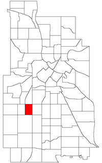 Location of South Uptown within the U.S. city of Minneapolis | |
| Country | United States |
| State | Minnesota |
| County | Hennepin |
| City | Minneapolis |
| Community | Calhoun-Isles |
| City Council Ward | 10 |
| Government | |
| • Council Member | Aisha Chughtai |
| Area | |
| • Total | 0.367 sq mi (0.95 km2) |
| Population (2020)[2] | |
| • Total | 6,075 |
| • Density | 17,000/sq mi (6,400/km2) |
| Time zone | UTC-6 (CST) |
| • Summer (DST) | UTC-5 (CDT) |
| ZIP code | 55408 |
| Area code | 612 |
| Census | Pop. | Note | %± |
|---|---|---|---|
| 1980 | 6,223 | — | |
| 1990 | 5,825 | −6.4% | |
| 2000 | 5,907 | 1.4% | |
| 2010 | 5,647 | −4.4% | |
| 2020 | 6,075 | 7.6% |
In 2018, the neighborhood voted to change its name to South Uptown from its former name CARAG (Calhoun Area Residents' Action Group) after its namesake, the former Lake Calhoun, was renamed to Bde Maka Ska. Other potential names for the neighborhood included "Bryant Park" and "Bryant Square".[4] The Minneapolis City Council approved the name change in November 2018.[5]
It is located directly south of Lowry Hill East and directly east of East Bde Maka Ska. Its boundaries are Lake Street to the north, Lyndale Avenue to the east, 36th Street to the south, and Hennepin Avenue to the west. South Uptown, Lowry Hill East, East Bde Maka Ska and East Isles form the business district of Uptown.
References edit
- ^ "Carag neighborhood in Minneapolis, Minnesota (MN), 55408 detailed profile". City-Data. 2011. Retrieved 2013-11-12.
- ^ "South Uptown - MN Compass". Minnesota Compass. 2022. Retrieved 2022-09-14.
- ^ "Find My Ward". City of Minneapolis. Retrieved 23 April 2024.
- ^ Boller, Jay. "Minneapolis' CARAG neighborhood votes to switch name to South Uptown". City Pages. Archived from the original on 2019-04-03. Retrieved 2018-09-20.
- ^ "Neighborhood name change: Calhoun Area Residents Action Group to South Uptown (2018-01232)". City of Minneapolis. Retrieved 2021-07-27.
External links edit
- Minneapolis Neighborhood Profile - South Uptown
- South Uptown Neighborhood Association
44°56′36″N 93°17′36″W / 44.94330°N 93.29332°W