
-
 SADF 15 SAI in the Soutpansberg Military Area
 -
 SADF 32 Battalion (elements)
 -
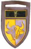 SADF 116 Battalion in the Soutpansberg Military Area
 -
 SADF 7 SAI Battalion
 -
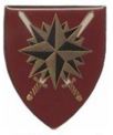 SADF Special Forces

KNOWPIA
WELCOME TO KNOWPIA
Soutpansberg Military Area 
Summary
The Soutpansberg Military Area (SMA) Headquarters was situated in Messina in the Northern Province of South Africa. The size of the area for which the SMA was responsible for was approximately 4,040 square kilometres (1,560 sq mi).
| Soutpansberg Military Area | |
|---|---|
 Soutpansberg Military Area emblem | |
| Disbanded | 2008 |
| Country | |
| Allegiance | |
| Branch | |
| Type | Militarised Area |
| Part of | Chief of the Army |
| Garrison/HQ | Messina, Northern Province |
| Engagements | South African Border War |
| Insignia | |
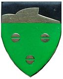
| Soutpansberg Military Area Command Bar |  |
History edit
After the independence of Zimbabwe and its subsequent close relations with liberation organisations in South Africa, a security threat from the north was expected. A militarised zone known as the Soutpansberg Military Area was therefore effected and bordered two international borders, those of Botswana and Zimbabwe. The length of borderline for which the Military Area was responsible was approximately 74 kilometres (46 mi) shared with Botswana and approximately 225 kilometres (140 mi) shared with Zimbabwe.

Some parts of the affected area allowed commercial farmers to continue to operate, while others areas, particularly to the east of Messina, were depopulated and became a military exclusive zone called the Madimbo Corridor.[1][2]
Barriers edit
Along the borderline with Zimbabwe, starting at the Sand River just east of Messina up to the Alldays area, a Norex electrical fence marked the borderline. There was a gap of approximately 32 kilometres in the Norex fence at the Vhembe area. The Norex fence was manned by military personnel from the Military Area who were stationed at substations every ten kilometres along the border. One to two soldiers were deployed at each substation.
When interference occurred on the fence, which was set on alarm mode, it would register at the substation closest to the interference, at the Military Area headquarters, as well as at the offices of the contractor responsible for the maintenance of the electrical fence. The electrical fence was severely damaged during the 2000 floods and was under repair, placing an extra burden on funds and personnel to maintain the same level of readiness.[3]
The rest of the borderline east of the Sand River follows the Limpopo River, and consists mainly of farmland. In this area, sisal plants formed a barrier in the past, but these were cleared to make way for an extension of the Norex electrical fence. However, the fence was never erected because funds were not made available to do so. The sisal barrier was also very badly damaged by elephants and monkeys eating the plants. It is debatable whether the sisal ‘fence’ was ever really effective. Farmers along this stretch of the border assisted the military and the police in reporting suspected crossings and illegal immigrants in their areas.[4]
Units in the Military Area edit
Command edit

Conventional Forces in the SMA edit
Elements of 32 Battalion were used in the Military Area after they arrived from South West Africa. A Northern Sotho specific Infantry, 116 Battalion was based in Messina.


Special Service Companies for Quick Reaction edit
The SMA, similar to the SWATF approach, also activated an immediate reaction force (Special Service Company) to deal with any attack and was primarily infantry company strength and fully motorised.

907 Special Service Company was formed from 116 Battalion's Bravo Company at Spence Shaft in 1986. 907 SSC was based at Madimbo and deployed on Buffels but converted to Casspirs later.
Citizen Commando Units in the SMA edit
Various commando units such as Limpopo Commando and the Soutpansberg Commando were also based in the Military Area, just outside Messina and was responsible for border protection. Limpopo Commando was responsible for the stretch from Pontdrift East up to the nature reserve west of Messina.
-
-
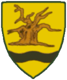 SADF Limpopo Commando

The SMA replaced by Operation Corona edit
Border safeguarding was redesigned out under Operation Corona[5] when the SANDF resumed these duties from the Police. Phase one of the border safeguarding initiative witnessed deployments on the South Africa/Zimbabwe borderline.
Phase two saw the SANDF deploy on the Zimbabwe, Mozambique, Swaziland and Lesotho borders, with two sub-units to Limpopo (Pontdrift and Musina), two sub-units to Mpumalanga (Macadamia and Skukuza), two sub-units to Kwa-Zulu- Natal (Ndumo and Pongola) and one sub-unit to the Free State (Ladybrand).
Phase three also focused on these borders. By 2013, the Lesotho/Free State border was covered, followed by the Lesotho/KwaZulu-Natal border by 2014.
References edit
- ^ Moloto, Moloko. "Military silent on rural title deed saga". IOL. The Star. Retrieved 30 January 2017.
- ^ "Land and Conflict in the Madimbo Corridor".[dead link]
- ^ "Order of Battle - South Africa". globalsecurity.org. Retrieved 30 January 2017.
- ^ O'Toole, Sean; Botes, Paul (4 April 2011). "Porous border is smugglers' paradise". M&G. Mail & Guardian. Retrieved 30 January 2017.
- ^ Martin, Guy. "SANDF receives first upgraded border safeguarding base - defenceWeb". www.defenceweb.co.za.