


Summary
Sowme'eh Sara County (Persian: شهرستان صومعهسرا) is in Gilan province, Iran. Its capital is the city of Sowme'eh Sara.[3]
Sowme'eh Sara County
Persian: شهرستان صومعهسرا | |
|---|---|
County | |
 Location of Sowme'eh Sara County in Gilan province (center, yellow) | |
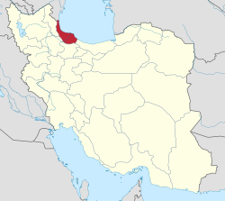 Location of Gilan province in Iran | |
| Coordinates: 37°23′N 49°20′E / 37.383°N 49.333°E[1] | |
| Country | |
| Province | Gilan |
| Capital | Sowme'eh Sara |
| Districts | Central, Mirza Kuchek Janghli, Taher Gurab, Tulem, Ziabar |
| Population (2016)[2] | |
| • Total | 125,074 |
| Time zone | UTC+3:30 (IRST) |
| Sowme'eh Sara County can be found at GEOnet Names Server, at this link, by opening the Advanced Search box, entering "9207016" in the "Unique Feature Id" form, and clicking on "Search Database". | |
At the 2006 census, the county's population was 129,629 in 35,636 households.[4] The following census in 2011 counted 127,757 people in 39,238 households.[5] At the 2016 census, the county's population was 125,074 in 41,975 households.[2] This county is located in the west of Gilan and is surrounded by Fuman County, Masal County, and Bandar-e Anzali County.
Administrative divisions edit
The population history of Sowme'eh Sara County's administrative divisions over three consecutive censuses is shown in the following table. The latest census shows three districts, seven rural districts, and three cities.[2]
After the census, Pishkhan Rural District was established in the Central District. Taher Gurab Rural District was separated from the district in the formation of Taher Gurab District, which was divided into two rural districts, including the new Abatar Rural District. Likewise, Ziabar Rural District was separated from the district in the establishment of Ziabar District, also divided into two rural districts that included the newly formed Baham Bar Rural District. Neither of the new districts contains a city.[6]
| Administrative Divisions | 2006[4] | 2011[5] | 2016[2] |
|---|---|---|---|
| Central District | 75,412 | 77,089 | 78,144 |
| Kasma RD | 16,062 | 14,675 | 12,198 |
| Pishkhan RD1 | |||
| Taher Gurab RD | 11,441 | 10,497 | 8,997 |
| Ziabar RD | 11,387 | 10,939 | 9,866 |
| Sowme'eh Sara (city) | 36,522 | 40,978 | 47,083 |
| Mirza Kuchek Janghli District | 24,862 | 23,086 | 21,139 |
| Gurab Zarmikh RD | 15,672 | 14,333 | 12,774 |
| Markiyeh RD | 5,007 | 4,165 | 3,525 |
| Gurab Zarmikh (city) | 4,183 | 4,588 | 4,840 |
| Taher Gurab District1 | |||
| Abatar RD1 | |||
| Taher Gurab RD | |||
| Tulem District | 29,355 | 27,582 | 25,791 |
| Hend Khaleh RD | 13,109 | 12,572 | 11,013 |
| Tulem RD | 9,451 | 8,539 | 8,043 |
| Marjaghal (city) | 6,795 | 6,471 | 6,735 |
| Ziabar District1 | |||
| Baham Bar RD1 | |||
| Ziabar RD | |||
| Total | 129,629 | 127,757 | 125,074 |
| RD: Rural District 1Established after the 2016 census[6] | |||
References edit
- ^ OpenStreetMap contributors (9 October 2023). "Sowme'eh Sara County" (Map). OpenStreetMap. Retrieved 9 October 2023.
- ^ a b c d "Census of the Islamic Republic of Iran, 1395 (2016)". AMAR (in Persian). The Statistical Center of Iran. p. 01. Archived from the original (Excel) on 4 December 2020. Retrieved 19 December 2022.
- ^ Habibi, Hassan (21 June 1369). "Approval of the organization and chain of citizenship of the elements and units of the national divisions of Gilan province centered on the city of Rasht". Islamic Parliament Research Center (in Persian). Ministry of Interior, Defense Political Commission of the Government Board. Archived from the original on 12 October 2016. Retrieved 12 December 2023.
- ^ a b "Census of the Islamic Republic of Iran, 1385 (2006)". AMAR (in Persian). The Statistical Center of Iran. p. 01. Archived from the original (Excel) on 20 September 2011. Retrieved 25 September 2022.
- ^ a b "Census of the Islamic Republic of Iran, 1390 (2011)". Syracuse University (in Persian). The Statistical Center of Iran. p. 01. Archived from the original (Excel) on 8 October 2023. Retrieved 19 December 2022.
- ^ a b Jahangiri, Ishaq (15 February 1400). "Letter of approval regarding country divisions in Sowme'eh Sara County of Gilan province". Qavanin (in Persian). Ministry of Interior, Council of Ministers. Archived from the original on 9 October 2023. Retrieved 9 October 2023.