


Summary
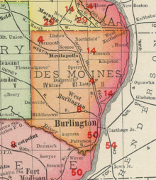
Sperry is an unincorporated community in central Des Moines County, Iowa, United States. It lies along local roads north of the city of Burlington, the county seat of Des Moines County.[2] Its elevation is 751 feet (229 m).[3] Although Sperry is unincorporated, it has a post office with the ZIP code of 52650,[4] which opened on 5 February 1870.[5]
Sperry, Iowa | |
|---|---|
 Sperry Location within the state of Iowa  Sperry Sperry (the United States) | |
| Coordinates: 40°57′25″N 91°9′24″W / 40.95694°N 91.15667°W | |
| Country | United States |
| State | Iowa |
| County | Des Moines |
| Area | |
| • Total | 2.24 sq mi (5.80 km2) |
| • Land | 2.24 sq mi (5.79 km2) |
| • Water | 0.00 sq mi (0.00 km2) |
| Elevation | 751 ft (229 m) |
| Population (2020) | |
| • Total | 124 |
| • Density | 55.43/sq mi (21.40/km2) |
| Time zone | UTC-6 (Central (CST)) |
| • Summer (DST) | UTC-5 (CDT) |
| ZIP codes | 52650 |
| Area code | 319 |
| FIPS code | 19-74325 |
| GNIS feature ID | 461847 |
The community is part of the Burlington, IA–IL Micropolitan Statistical Area.
Demographics edit
| Census | Pop. | Note | %± |
|---|---|---|---|
| 2020 | 124 | — | |
| U.S. Decennial Census[6] | |||
History edit
Sperry got its start in the year 1869, when John M. Sperry settled there and opened a post office.[7]
Sperry was a station stop on the Burlington, Cedar Rapids and Northern Railway later a part of the Chicago, Rock Island and Pacific Railroad; construction of the line began in 1869. This line was also used by the Burlington and Northwestern Railway system, later part of the Chicago, Burlington and Quincy Railroad. All service on the line by both the Rock Island and Burlington systems ended in 1980.
References edit
- ^ "2020 U.S. Gazetteer Files". United States Census Bureau. Retrieved March 16, 2022.
- ^ Rand McNally. The Road Atlas '08. Chicago: Rand McNally, 2008, p. 39.
- ^ U.S. Geological Survey Geographic Names Information System: Sperry, Iowa
- ^ Zip Code Lookup
- ^ U.S. Geological Survey Geographic Names Information System: Sperry Post Office
- ^ "Census of Population and Housing". Census.gov. Retrieved June 4, 2016.
- ^ The History of Des Moines County, Iowa: Containing a History of the County, Its Cities, Towns, &c. Western Historical Company. 1879. pp. 614.
- ^ Cram's Modern Atlas: The New Unrivaled New Census Edition. J. R. Gray & Company. 1902. pp. 203–207.
- ^ Company, Rand McNally and (1925). Premier Atlas of the World: Containing Maps of All Countries of the World, with the Most Recent Boundary Decisions, and Maps of All the States,territories, and Possessions of the United States with Population Figures from the Latest Official Census Reports, Also Data of Interest Concerning International and Domestic Political Questions. Rand McNally & Company. p. 190.