
KNOWPIA
WELCOME TO KNOWPIA

Standish, Minneapolis 
Summary
Standish is a neighborhood within the Powderhorn community in Minneapolis, Minnesota, United States named after Captain Miles Standish. Its boundaries are East 36th Street to the north, Hiawatha Avenue to the east, East 42nd and 43rd Streets to the south, and Cedar Avenue to the west.
Standish | |
|---|---|
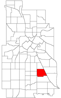 Location of Standish within the U.S. city of Minneapolis | |
| Country | United States |
| State | Minnesota |
| County | Hennepin |
| City | Minneapolis |
| Community | Powderhorn |
| Founded | 1849 |
| City Council Ward | 12 |
| Government | |
| • Council Member | Aurin Chowdhury |
| Area | |
| • Total | 0.82 sq mi (2.1 km2) |
| Population (2020)[2] | |
| • Total | 6,625 |
| • Density | 8,100/sq mi (3,100/km2) |
| Time zone | UTC-6 (CST) |
| • Summer (DST) | UTC-5 (CDT) |
| ZIP code | 55406, 55407 |
| Area code | 612 |
| Census | Pop. | Note | %± |
|---|---|---|---|
| 1980 | 6,420 | — | |
| 1990 | 6,478 | 0.9% | |
| 2000 | 6,632 | 2.4% | |
| 2010 | 6,527 | −1.6% | |
| 2020 | 6,625 | 1.5% |
Standish is entirely located within Minneapolis City Council Ward 12,[3] represented by Aurin Chowdhury. It shares a neighborhood organization with the Ericsson neighborhood, even though that neighborhood is part of the Nokomis community; signs at the neighborhood boundaries welcome you to "Standish-Ericsson".
Roosevelt High School is located in Standish. 44°56′00″N 93°14′09″W / 44.9332°N 93.2357°W[4]
References edit
- ^ "Standish neighborhood in Minneapolis, Minnesota (MN), 55406, 55407 detailed profile". City-Data. 2011. Retrieved 2013-11-12.
- ^ "Standish neighborhood data". Minnesota Compass. Retrieved 2023-02-19.
- ^ "Find My Ward". City of Minneapolis. Retrieved 19 April 2024.
- ^ Standish, Minneapolis, MN. Google Earth. Retrieved 2011-03-09.
External links edit
- Minneapolis Neighborhood Profile - Standish
- Standish-Ericsson Neighborhood Association
- Standish and Ericsson Neighbors Forum - Online Group