


Summary
Stirling is a suburb of Perth, the capital city of Western Australia, about 10 km north of Perth's central business district (CBD) along the Mitchell Freeway. Its local government area is the City of Stirling, whose council offices and administration centre are located in the southwest of the mostly residential suburb.
| Stirling Perth, Western Australia | |||||||||||||||
|---|---|---|---|---|---|---|---|---|---|---|---|---|---|---|---|
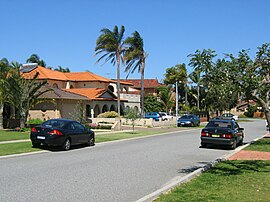 Homes in the suburb of Stirling | |||||||||||||||
 | |||||||||||||||
| Coordinates | 31°52′59″S 115°48′36″E / 31.883°S 115.81°E | ||||||||||||||
| Population | 10,165 (SAL 2021)[1] | ||||||||||||||
| Established | 1960s | ||||||||||||||
| Postcode(s) | 6021 | ||||||||||||||
| Area | 4.6 km2 (1.8 sq mi) | ||||||||||||||
| Location | 10 km (6 mi) NNW of Perth CBD | ||||||||||||||
| LGA(s) | City of Stirling | ||||||||||||||
| State electorate(s) | Balcatta | ||||||||||||||
| Federal division(s) | Cowan | ||||||||||||||
| |||||||||||||||
History edit
Stirling is named after James Stirling, the first Western Australian governor (1829–1838). The name was approved in April 1976 at the request of the City of Stirling, as the area contained the Council's headquarters.[2] The suburb was part of Balcatta until 1976.
Throughout the wetland regions, Aboriginals hunted for kangaroo, emu, snakes, tortoise, mudfish, gilgies and water birds and their eggs, to name a few food sources. Aboriginal sites are known to have existed in a few locations in the Gwelup-Balcatta region.[3]
Early European settlement (to 1960) edit
The area's first European settlement was as an extension of the Osborne Park market area.[4] Its initial growth in importance as an agricultural area in the 1920s came from three major factors:[5] retired Chinese miners from the Eastern Goldfields, the post-World War I Soldier Settlement Scheme (many of whom had no experience in intensive farming), and an influx of Italians prior to Mussolini's effective banning of emigration in 1927, who mostly started life in Western Australia as miners and woodcutters. Dino Gava[6] noted: "The process of (Italian) chain migration was strong in Osborne Park and Wanneroo. They arrived ill-prepared with regard to language and education but their youth and willingness to work made them desirable settlers." By 1935, the area was producing all sorts of fruit and vegetables, and a 1961 newspaper reported that "hundreds of acres are under cultivation, (and) nearly all types of vegetable are produced in the area. Part of the produce is exported to other countries."[7]
Suburban development (1960-) edit
Major changes occurred in the 1960s and 1970s. The main access to the area from Perth was via Wanneroo Road and Balcatta Beach Road, a road which roughly corresponded to Karrinyup Road but included modern-day North Beach Drive and Osborne Place. Hertha Road (now Civic Place and Telford Crescent) was the main road in the area, and the site of the present-day footbridge was the municipal rubbish tip until the early 1970s. The Osborne Park hospital was opened on 4 April 1962 and the civic centre and council chambers were opened in 1966, along with houses in the George Street area near the civic centre. The postal district was approved and gazetted in April 1976, and over the next eight years, most of the suburb was subdivided and built.
The building of the Mitchell Freeway to Karrinyup Road in 1983-84 facilitated the growth of Stirling as a regional hub, and the bus/train interchange (on the Joondalup railway line) was completed in 1992. As at 2006, some subdivisions in the Stirling region are still being developed.[8]
Geography edit
Stirling is bounded by the Mitchell Freeway between Erindale Road and Hutton Street on the west and south, Amelia and Poincaire Streets to the north, and an uneven line running roughly south from Jones Street's north-south section to the east. Lake estates and public parks, including the Stirling Civic Gardens, make up a moderate percentage of the suburb's area.[9]
Demographics edit
At the 2001 Australian census, Stirling had a population of 5,752 people living in 2,159 dwellings, many of which are single detached dwellings, many of them two-storey brick on relatively large lots. The suburb is one of Perth's most ethnically diverse - in 2001, 23% were of Italian descent, 24% of Macedonian, 6% Asian and 4% Greek,[10] and this reflects strongly in the architectural styles which have been adopted in the area.
Facilities edit
Stirling is host to the Osborne Park Hospital, a 205-bed community general hospital which offers some specialist services as well as radiology and pathology. There are no schools within the suburb, although Balcatta Senior High School is located on the northern boundary (Poincaire Street) and numerous primary schools are located in nearby Gwelup, Osborne Park and Balcatta.
Stirling relies on the Stirling Village shopping centre, containing an IGA and specialty stores, in Cedric Street for basic commercial services, and Karrinyup Shopping Centre for other services. Numerous reserves and sports grounds are scattered throughout the area. The Stirling Lions soccer club is based just outside the suburb.[9]
Transport edit
Stirling is served by the Stirling train station, which is a 9-minute commute to the Perth CBD. Services through the suburb include the Transperth 414 bus route running along Cedric Street between Stirling and Glendalough, the 403/404 routes from Perth which services Hamilton Street in the suburb's southeast, and the CircleRoute along lower Cedric Street and Karrinyup Road.[11] The Public Transport Authority is responsible for these services.
Bus edit
- 402 Stirling Station to Perth Busport – serves Cedric Street and Karrinyup Road[12]
- 403 Stirling Station to Perth Busport – serves Cedric Street, Karrinyup Road, Telford Crescent, Messina Avenue, Cassino Drive and Hamilton Street[13]
- 414 Stirling Station to Glendalough Station – serves Cedric Street, Karrinyup Road and Jones Street[14]
- 415 Stirling Station to Mirrabooka Bus Station – serves Cedric Street[15]
- 424 Stirling Station to Karrinyup Bus Station – serves Cedric Street and Karrinyup Road[16]
- 425 Stirling Station to Warwick Station – serves Cedric Street and Karrinyup Road[17]
- 427 Stirling Station to Warwick Station – serves Cedric Street, Civic Place, Hugo Street, Osborne Place, Karrinyup Road and Erindale Road[18]
- 428 Stirling Station to Warwick Station – serves Cedric Street, Amelia Street and Odin Drive[19]
- 998 Fremantle Station to Fremantle Station (limited stops) – CircleRoute Clockwise, serves Stirling Station, Cedric Street and Karrinyup Road[20]
- 999 Fremantle Station to Fremantle Station (limited stops) – CircleRoute Anti-Clockwise, serves Karrinyup Road, Cedric Street and Stirling Station[21]
Bus routes serving Stirling Station only:
- 410, 412, 421 and 422 Stirling Station to Scarborough Beach Bus Station[22][23][24][25]
- 413 Stirling Station to Glendalough Station[26]
- 423 Stirling Station to Warwick Station[27]
Rail edit
Politics edit
Stirling is a mixed-wealth suburb with many "mortgage belt" families. In 2001, 52% of the suburb's population were from Southern Europe, and the Balcatta Central and Osborne Park booths are among the northern suburbs' few genuinely marginal booths at federal level. However, they strongly support the Australian Labor Party at state elections.
|
| ||||||||||||||||||||||||||||||||||||
|
| ||||||||||||||||||||||||||||||||||||
References edit
- ^ Australian Bureau of Statistics (28 June 2022). "Stirling (WA) (suburb and locality)". Australian Census 2021 QuickStats. Retrieved 28 June 2022.
- ^ "History of metropolitan suburb names – S". Western Australian Land Information Authority. Archived from the original on 16 March 2022. Retrieved 17 April 2007.
- ^ Friends of Lake Gwelup. "A Brief History of Gwelup". Archived from the original on 22 April 2007. Retrieved 27 September 2006.
- ^ City of Stirling. "Suburbs - Stirling". Retrieved 17 January 2007.
- ^ Cooper, W.S.; G. McDonald (1999). Diversity's Challenge: A History of the City of Stirling. City of Stirling. pp. 289–291.
- ^ Gava, Dino M. (1978). The History of Italian Immigrants in Osborne Park 1900–1950 (MA Thesis). History Department, University of Western Australia. p. 17.
- ^ "Rich Market Garden". North Suburban Supplement. The West Australian. 1 June 1961. p. 4.
- ^ Port Bouvard Limited. "Princeton Estate". Retrieved 18 November 2006. Estate developer's website.
- ^ a b Department of Land Information. StreetSmart Perth Street Directory (48 (2007) ed.). West Australian Newspapers Ltd. Maps 311–312, 342.
- ^ Australian Bureau of Statistics (25 October 2007). "Stirling (State Suburb)". 2006 Census QuickStats. Retrieved 5 October 2008.
- ^ Northern 59 timetable, Transperth, effective 8 August 2005; Northern 56 timetable, Transperth, effective 10 December 2006. Accessed 17 January 2007.
- ^ "Route 402". Bus Timetable 58 (PDF). Transperth. 21 June 2023 [effective from 16 July 2023].
- ^ "Route 403". Bus Timetable 58 (PDF). Transperth. 21 June 2023 [effective from 16 July 2023].
- ^ "Route 414". Bus Timetable 59 (PDF). Transperth. 24 October 2023 [effective from 17 December 2023].
- ^ "Route 415". Bus Timetable 59 (PDF). Transperth. 24 October 2023 [effective from 17 December 2023].
- ^ "Route 424". Bus Timetable 61 (PDF). Transperth. 25 October 2023 [effective from 17 December 2023].
- ^ "Route 425". Bus Timetable 62 (PDF). Transperth. 11 January 2024 [effective from 28 January 2024].
- ^ "Route 427". Bus Timetable 61 (PDF). Transperth. 25 October 2023 [effective from 17 December 2023].
- ^ "Route 428". Bus Timetable 61 (PDF). Transperth. 25 October 2023 [effective from 17 December 2023].
- ^ "Route 998". CircleRoute Timetable 200 (PDF). Transperth. 29 August 2023 [effective from 20 November 2023].
- ^ "Route 999". CircleRoute Timetable 200 (PDF). Transperth. 29 August 2023 [effective from 20 November 2023].
- ^ "Route 410". Bus Timetable 60 (PDF). Transperth. 20 June 2023 [effective from 16 July 2023].
- ^ "Route 412". Bus Timetable 60 (PDF). Transperth. 20 June 2023 [effective from 16 July 2023].
- ^ "Route 421". Bus Timetable 62 (PDF). Transperth. 11 January 2024 [effective from 28 January 2024].
- ^ "Route 422". Bus Timetable 62 (PDF). Transperth. 11 January 2024 [effective from 28 January 2024].
- ^ "Route 413". Bus Timetable 59 (PDF). Transperth. 24 October 2023 [effective from 17 December 2023].
- ^ "Route 423". Bus Timetable 62 (PDF). Transperth. 11 January 2024 [effective from 28 January 2024].
External links edit
- City of Stirling
- Osborne Park Hospital