


Summary
Stroud Green is a suburb and electoral ward in north London, England, split between the London boroughs of Haringey and Islington. On its south-western side, Stroud Green Road forms part of the boundary between the two boroughs.[2]
| Stroud Green | |
|---|---|
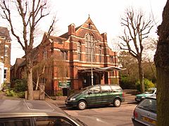 Holy Trinity, Stroud Green | |
 Stroud Green Location within Greater London | |
| Population | 11,758 (2011 census.Ward)[1] |
| OS grid reference | TQ311881 |
| London borough | |
| Ceremonial county | Greater London |
| Region | |
| Country | England |
| Sovereign state | United Kingdom |
| Post town | LONDON |
| Postcode district | N4 |
| Dialling code | 020 |
| Police | Metropolitan |
| Fire | London |
| Ambulance | London |
| UK Parliament | |
| London Assembly | |
Stroud Green Road is the main local hub and shopping area. At its eastern end it intersects Seven Sisters Road and Blackstock Road at a major crossroads. Stroud Green Road is a populous thoroughfare linking Crouch Hill with the major north London transport interchange of Finsbury Park station.
History edit
Toponymy edit
In 1407, the area was called Strode, which is formed from the Old English 'stōd' and means 'marshy ground covered with brushwood'. It is recorded as Stowde Grene in 1546, the 'grene' suffix is Middle English and means 'village green'.[3]
Locale edit
Stroud Green Road edit
The neighbourhood high street, Stroud Green Road, includes a wide range of restaurants[4] and other mainly independent shops.[5] There are also two high-street supermarkets.
The Finsbury Park end of the road, though different in character to the stretch further north, is currently benefitting from a large regeneration scheme centred on Finsbury Park town centre.
The folk record label Topic Records was based at 48–50 Stroud Green Road and many folk LPs were recorded there. The label has since moved to Uppingham in Rutland.
Library edit
In the east of the neighbourhood, next to Harringay railway station is the Stroud Green & Harringay Library.
Transport edit
Stroud Green Road runs north west from the transport hub of Finsbury Park station, and stops just 150 yards south east of Crouch Hill railway station on the Gospel Oak to Barking line. On the eastern border of Stroud Green is Harringay railway station on the Great Northern Line. London bus routes W3, W7, and 210 run the length of Stroud Green Road, terminating at Finsbury Park. The low railway bridge at Finsbury Park prevents bus routes running directly from areas north of Finsbury Park such as Stroud Green Road directly into central London.
Stroud Green railway station closed in 1954. It was on the Finsbury Park to Edgware line, and along with nearby Crouch End railway station had been planned to be added to the Northern line of London Underground, but World War II intervened.
References edit
- ^ "Haringey Ward population 2011". Neighbourhood Statistics. Office for National Statistics. Retrieved 22 October 2016.
- ^ See for example the catchment area covered by the discussion forum StroudGreen.org
- ^ Mills, D. (2000). Oxford Dictionary of London Place Names. Oxford.
- ^ The wide selection of restaurants on Stroud Green Road range from the standard Indian and Chinese to the more exotic Mauritian and Caribbean. The street is home to the original branch of Italian-owned North London pizza restaurant chain La Porchetta, as well as several bars and pubs.
- ^ Time Out described the range of shops as "impressive" and giving a sense of "how international the district is".Lamont T. (ed): "London for Londoners", pp. 86-88. Time Out, 2006
External links edit
- Stroud Green Community bulletin board
- Stroud Green Flickr Group
- Stroud Green Primary School
- Finsbury Park + Stroud Green Neighbourhood Forum