


Summary
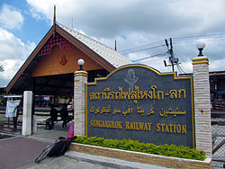
Su-ngai Kolok (Thai: สุไหงโกลก, Malay: Sungai Golok) is a border town and subdistrict on the Malaysia-Thailand Border in Su-ngai Kolok District, Narathiwat Province, Thailand. It is one of the largest and most prosperous districts in Narathiwat Province. It is also one of the major economic centers in the southern part of Thailand. It is capital of the Su-ngai Kolok District. As of 2005, the town (thesaban mueang) had a population of 38,612. Across the border is Rantau Panjang, Kelantan, Malaysia.
Su-ngai Kolok
สุไหงโกลก | |
|---|---|
| เทศบาลเมืองสุไหงโกลก Su-ngai Kolok town municipality | |
 | |
 Su-ngai Kolok Location in Thailand | |
| Coordinates: 6°2′N 101°58′E / 6.033°N 101.967°E | |
| Country | Thailand |
| Province | Narathiwat |
| District | Su-ngai Kolok |
| Population (2005) | |
| • Total | 38,612 |
| Time zone | UTC+7 (ICT) |
Geography edit
Su-ngai Kolok is in the southeastern part of the province. Adjacent areas are: in the north is Su-ngai Padi and Tak Bai; in the east, Kelantan (Malaysia); in the south, Kelantan (Malaysia) and Wan; in the west Su-ngai Padi.
Etymology edit
The word "su-ngai" is Malay and means 'river'. Golok is also Malay and means 'traditional sword'. Therefore, Su-ngai Golok means 'sword river'.
History edit
The township was upgraded to town (thesaban mueang) status on 20 February 2004.
References edit
External links edit
 Sungai Kolok travel guide from Wikivoyage
- kolokcity.net
- Islamic insurgency in Thailand’s strangest party town
6°02′N 101°58′E / 6.033°N 101.967°E