


Summary
Sukamara Regency (Indonesian: Kabupaten Sukamara) is one of the thirteen regencies which comprise the Central Kalimantan Province on the island of Kalimantan (Borneo), Indonesia. It was created on 10 April 2002 from the former southwest part of West Kotawaringin Regency. The town of Sukamara is the capital of Sukamara Regency, which covers an area of 3,827 km2. The population of the Regency was 44,952 at the 2010 Census[2] and 63,464 at the 2020 Census;[3] the official estimate as at mid 2022 was 66,845 (comprising 35,122 males and 31,723 females).[1]
Sukamara Regency
Kabupaten Sukamara | |
|---|---|
 Coat of arms | |
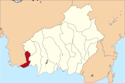 Location within Central Kalimantan | |
 Sukamara Regency Location in Kalimantan and Indonesia  Sukamara Regency Sukamara Regency (Indonesia) | |
| Coordinates: 2°37′36″S 111°14′12″E / 2.6267°S 111.2368°E | |
| Country | Indonesia |
| Region | Kalimantan |
| Province | Central Kalimantan |
| Capital | Sukamara |
| Government | |
| • Regent | Ahmad Dirman |
| • Vice Regent | Windu Subagio |
| Area | |
| • Total | 1,478 sq mi (3,827 km2) |
| Population (mid 2022 estimate) | |
| • Total | 66,845 |
| • Density | 45/sq mi (17/km2) |
| [1] | |
| Time zone | UTC+7 (Western Indonesia Time) |
| Area code | (+62) 532 |
| Website | sukamarakab |
Administrative Districts edit
Sukamara Regency consists of five districts (kecamatan), tabulated below with their areas and populations from the 2010 Census[2] and the 2020 Census,[3] together with the official estimates as at mid 2022.[1] The table also includes the locations of the district administrative centres, the number of administrative villages in each district (a total of 29 rural desa and 3 urban kelurahan), and its postal codes.
| Kode Wilayah |
Name of District (kecamatan) |
Area in km2 |
Pop'n Census 2010 |
Pop'n Census 2020 |
Pop'n Estimate mid 2022 |
Admin centre |
No. of villages |
Post codes |
|---|---|---|---|---|---|---|---|---|
| 62.08.02 | Jelai (a) | 796 | 4,412 | 5,520 | 5,690 | Kuala Jelai | 5 (b) | 74171 |
| 62.08.04 | Pantai Lunci | 804 | 4,846 | 5,860 | 6,070 | Sungai Cabang Barat | 4 | 74170 |
| 62.08.01 | Sukamara | 1,028 | 19,626 | 30,890 | 32,410 | Padang | 8 (c) | 74172 |
| 62.08.03 | Balai Riam | 539 | 6,649 | 10,620 | 11,350 | Balai Riam | 8 | 74173 |
| 62.08.05 | Permata Kecubung | 660 | 9,922 | 10,560 | 11,320 | Ajang | 7 | 74174 |
| Totals | 3,827 | 44,952 | 63,464 | 66,845 | Sukamara | 32 |
Note: (a) Jelai District includes four small offshore islands - Pulau Jamban, Pulau Nibung Hilir, Pulau Nibung Hulu and Pulau Tangguk.
(b) includes one kelurahan - the town of Kuala Jelai. (c) includes 2 kelurahan - Mendawai and Padang.
.
Demographics edit
Religion as of the Indonesian census of 2010:[4]
- Muslim 78.9%
- Protestant 8.4%
- Roman Catholic 4.6%
- Buddhist 0.3%
- Hindu 0.2%
- Confucian 0.1%
- Other 7.3%
- Not stated or not asked 0.3%
Climate edit
Sukamara has a tropical rainforest climate (Af) with heavy rainfall year-round.
| Climate data for Sukamara | |||||||||||||
|---|---|---|---|---|---|---|---|---|---|---|---|---|---|
| Month | Jan | Feb | Mar | Apr | May | Jun | Jul | Aug | Sep | Oct | Nov | Dec | Year |
| Mean daily maximum °C (°F) | 29.7 (85.5) |
29.9 (85.8) |
30.4 (86.7) |
31.0 (87.8) |
31.3 (88.3) |
31.1 (88.0) |
31.5 (88.7) |
31.8 (89.2) |
31.9 (89.4) |
31.6 (88.9) |
30.9 (87.6) |
30.1 (86.2) |
30.9 (87.7) |
| Daily mean °C (°F) | 26.2 (79.2) |
26.3 (79.3) |
26.6 (79.9) |
26.9 (80.4) |
27.2 (81.0) |
26.9 (80.4) |
27.0 (80.6) |
27.1 (80.8) |
27.2 (81.0) |
27.0 (80.6) |
26.8 (80.2) |
26.3 (79.3) |
26.8 (80.2) |
| Mean daily minimum °C (°F) | 22.7 (72.9) |
22.8 (73.0) |
22.8 (73.0) |
22.9 (73.2) |
23.1 (73.6) |
22.7 (72.9) |
22.5 (72.5) |
22.4 (72.3) |
22.6 (72.7) |
22.5 (72.5) |
22.7 (72.9) |
22.6 (72.7) |
22.7 (72.9) |
| Average rainfall mm (inches) | 234 (9.2) |
240 (9.4) |
294 (11.6) |
319 (12.6) |
268 (10.6) |
234 (9.2) |
209 (8.2) |
152 (6.0) |
230 (9.1) |
260 (10.2) |
303 (11.9) |
310 (12.2) |
3,053 (120.2) |
| Source: Climate-Data.org[5] | |||||||||||||
External links edit
- Official website
References edit
2°37′36″S 111°14′12″E / 2.6267°S 111.2368°E