


Summary
Sulphur Springs is a city in Benton County, Arkansas, United States. The population was 481 at the 2020 census.[3] It is part of the Northwest Arkansas region.
Sulphur Springs, Arkansas | |
|---|---|
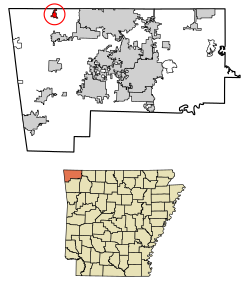 Location of Sulphur Springs in Benton County, Arkansas. | |
| Coordinates: 36°29′01″N 94°27′33″W / 36.48361°N 94.45917°W | |
| Country | United States |
| State | Arkansas |
| County | Benton |
| Area | |
| • Total | 1.01 sq mi (2.63 km2) |
| • Land | 1.01 sq mi (2.62 km2) |
| • Water | 0.00 sq mi (0.01 km2) |
| Elevation | 909 ft (277 m) |
| Population (2020) | |
| • Total | 481 |
| • Density | 475.77/sq mi (183.78/km2) |
| Time zone | UTC-6 (Central (CST)) |
| • Summer (DST) | UTC-5 (CDT) |
| ZIP code | 72768 |
| Area code | 479 |
| FIPS code | 05-67760 |
| GNIS feature ID | 2405541[2] |
History edit
Sulphur Springs got its start in 1885 as a mineral spa resort.[4]
Geography edit
Sulphur Springs is located in northwest Benton County. The city center is about one mile south of the Missouri-Arkansas state line. Arkansas Highway 59 runs through the city, leading north to Noel, Missouri, and south to Gravette.[5] According to the United States Census Bureau, the city has a total area of 1.0 square mile (2.6 km2), all land.[3]
Sulphur Springs is in the Springfield Plateau subregion of the Ozarks. It has porous rocks through which rain easily can pass underground to the aquifers. When water in aquifers flow down a hillside, or are pushed up to the surface, this causes a spring. The springs in Sulphur Springs are exceptionally rich in several minerals, and historically the springs were labeled to indicate the purported mineral found in each:[6][7]
- Black sulphur: Water with hydrogen sulfide that has come into contact with a metal such as iron, which then corrodes to create ferrous sulfide
- Chalybeate: High in iron salts, especially ferrous bicarbonate
- Lithium salts: A rare mineral water
- Magnesia: High in magnesium, often magnesium carbonate
- Nitre: High in potassium nitrate, also known as saltpeter
- Potash sulphur: Containing potassium and sulfur
- White sulphur: Containing a high concentration of sulfur compounds, especially hydrogen sulfide gas and sulfates. "White" meant colorless.
Demographics edit
| Census | Pop. | Note | %± |
|---|---|---|---|
| 1900 | 315 | — | |
| 1910 | 500 | 58.7% | |
| 1920 | 470 | −6.0% | |
| 1930 | 404 | −14.0% | |
| 1940 | 435 | 7.7% | |
| 1950 | 543 | 24.8% | |
| 1960 | 460 | −15.3% | |
| 1970 | 503 | 9.3% | |
| 1980 | 496 | −1.4% | |
| 1990 | 523 | 5.4% | |
| 2000 | 671 | 28.3% | |
| 2010 | 511 | −23.8% | |
| 2020 | 481 | −5.9% | |
| U.S. Decennial Census[8] | |||
At the 2020 census,[9] 481 people lived in Sulphur Springs. There were 193 households. The median age was 34.5 years old.
Income and poverty: Median income was $36.691; 17.2% experiencing poverty.
Education: 47% high school or equivalent degree; 11% some college, no degree; 4.6% Associates degree; 10.4% Bachelor's degree; 3.7% Graduate or professional degree.
Employment: 70.2% employees of private companies; 19.5% local, state, and federal workers; 10.2% self-employed.
Average travel time to work: 24.3 minutes; 65.9% drive alone to work; 27.3% carpool to work; 6.3% work from home.
Health: 28.6% without health care coverage; 21.5% have one or more disabilities.
Living arrangements: 46.1% married couple household; 29% male householder with no spouse present; 17.1% female householder with no spouse present.
Race and ethnicity: 390 people white alone; 68 two or more races; 55 some other race than the options given; 16 Hispanic or Latino of any race; 7 Native Hawaiian or Pacific Islander; 5 American Indian and Alaska native alone; 4 Black alone; 2 Asian alone.
Education edit
It is in the Gravette School District,[10] which operates Gravette High School.
Places of interest edit
The Harbor House in Sulphur Springs has stood for over one hundred years. It was a bed and breakfast that has permanently closed.
Notable people edit
- Jim Hendren (born 1963), a businessman from Sulphur Springs, represents District 2 in the Arkansas Senate, former member of the Arkansas House of Representatives
References edit
- ^ "2020 U.S. Gazetteer Files". United States Census Bureau. Retrieved October 29, 2021.
- ^ a b U.S. Geological Survey Geographic Names Information System: Sulphur Springs, Benton County, Arkansas
- ^ a b "Geographic Identifiers: 2010 Demographic Profile Data (G001): Sulphur Springs city, Arkansas". U.S. Census Bureau, American Factfinder. Archived from the original on February 12, 2020. Retrieved September 24, 2013.
- ^ History of Benton, Washington, Carroll, Madison, Crawford, Franklin, and Sebastian Counties, Arkansas. Higginson Book Company. 1889. p. 118.
- ^ Arkansas Atlas & Gazetteer, DeLorme, 2004, 2nd edition, p. 22, ISBN 0-89933-345-1
- ^ Black, J. Dickson (1975). History of Benton County. Little Rock, Arkansas: International Graphics Industries. Retrieved April 1, 2024.
- ^ "Healing Waters: Online Exhibit". Shiloh Museum of Ozark History. Archived from the original on April 1, 2024. Retrieved April 1, 2024.
- ^ "Census of Population and Housing". Census.gov. Retrieved June 4, 2015.
- ^ "2020 Census Profile, Sulphur Springs, Arkansas". United States Census Bureau. Retrieved March 29, 2024.
- ^ "2020 CENSUS - SCHOOL DISTRICT REFERENCE MAP: Benton County, AR" (PDF). U.S. Census Bureau. Retrieved May 25, 2022.