


Summary
The Susquehanna Valley is a region of low-lying land that borders the Susquehanna River in the U.S. states of New York, Pennsylvania, and Maryland. The valley consists of areas that lie along the main branch of the river, which flows from Upstate New York through Pennsylvania and Maryland into the Chesapeake Bay, as well as areas that lie along the shorter West Branch in Pennsylvania.[1]

History and architectural features edit
As of 2014, seventeen of the oldest covered bridges in the United States were located in the Susquehanna Valley.[2]
Geography edit
Historians and environmentalists at the Chesapeake Conservancy have described the Susquehanna River as the "lifeblood" of the Chesapeake Bay and also as "extension of the Susquehanna Valley that the Atlantic Ocean has steadily flooded over the last 15,000 years."[3]
Within Pennsylvania, the Susquehanna Valley is linked inextricably with the Chesapeake Bay watershed, which extends from Virginia, West Virginia, Washington, D.C., and Maryland through Delaware, Pennsylvania and New York. Pennsylvania's connections to the watershed are "primarily in the counties along the Susquehanna River, the West Branch of the Susquehanna, and their tributaries," according to Shelby Splain. "Located in the middle of the commonwealth, about half of the land in Pennsylvania drains into it."[4]
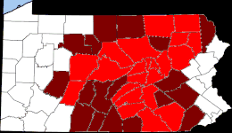
Communities in the valley edit

Main Branch edit
Cities edit
- Oneonta, New York
- Binghamton, New York
- Wilkes-Barre, Pennsylvania
- Scranton, Pennsylvania
- Sunbury, Pennsylvania
- Harrisburg, Pennsylvania
- Lancaster, Pennsylvania
- York, Pennsylvania
- Havre de Grace, Maryland
Counties edit
- Otsego County, New York
- Delaware County, New York
- Chenango County, New York
- Broome County, New York
- Susquehanna County, Pennsylvania
- Tioga County, New York
- Bradford County, Pennsylvania
- Wyoming County, Pennsylvania
- Lackawanna County, Pennsylvania
- Luzerne County, Pennsylvania
- Columbia County, Pennsylvania
- Montour County, Pennsylvania
- Potter County, Pennsylvania
- Tioga County, Pennsylvania
- Northumberland County, Pennsylvania
- Snyder County, Pennsylvania[5]
- Juniata County, Pennsylvania[6]
- Perry County, Pennsylvania[7]
- Dauphin County, Pennsylvania
- Cumberland County, Pennsylvania
- York County, Pennsylvania
- Lancaster County, Pennsylvania
- Cecil County, Maryland
- Harford County, Maryland
West Branch edit
Cities edit
Counties edit
References edit
- ^ Nash, Gary B. "The Quest for the Susquehanna Valley: New York, Pennsylvania, and the Seventeenth Century Fur Trade," in New York History, Vol. 48 No. 1, pp. 3-27. Ithaca, New York: Cornell University Press, January 1967 (retrieved online via JStor, February 4, 2023).
- ^ "25 things to know about Susquehanna Valley history" (photo slideshow). Lancaster, Pennsylvania: WGAL-TV, April 14, 2014.
- ^ "Envision the Susquehanna," in "Regional Initiatives." Annapolis, Maryland: Cheasapeake Conservancy, retrieved online February 2023.
- ^ Splain, Shelby Weaver. "Telling a Fuller Story about African American History in Pennsylvania’s Chesapeake Bay Watershed," in Pennsylvania Historic Preservation. Harrisburg, Pennsylvania: Pennsylvania Historical and Museum Commission, October 14, 2020.
- ^ Ellis, Franklin. History of that part of the Susquehanna and Juniata valleys, embraced in the counties of Mifflin, Juniata, Perry, Union and Snyder, in the Commonwealth of Pennsylvania. Philadelphia, Pennsylvania: Everts, Peck & Richards, 1886.
- ^ Ellis, History of that part of the Susquehanna and Juniata valleys, embraced in the counties of Mifflin, Juniata, Perry, Union and Snyder, in the Commonwealth of Pennsylvania.
- ^ Ellis, History of that part of the Susquehanna and Juniata valleys, embraced in the counties of Mifflin, Juniata, Perry, Union and Snyder, in the Commonwealth of Pennsylvania.
External links edit
- Barrett, Brenda and Jackie Kramer. "Contact Period Landscapes of the Lower Susquehanna River." Annapolis, Maryland: NPS Chesapeake Bay Office, National Park Service, 2016 (retrieved online February 4, 2023).
- "Indigenous Peoples of the Susquehanna Valley." The Historical Marker Database, retrieved online February 4, 2023.
41°58′N 75°45′W / 41.967°N 75.750°W