


Summary
Swinstead is a village and civil parish in the South Kesteven district of Lincolnshire, England. It is situated 5 miles (8.0 km) west from Bourne, 9 miles (14.5 km) north from Stamford and 11 miles (17.7 km) south-east from Grantham. It is a village of just over 100 households, the population of the civil parish being measured at 234 in the 2011 census.[1]
| Swinstead | |
|---|---|
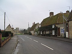 Swinstead village | |
 Swinstead Location within Lincolnshire | |
| Population | 234 (2011) |
| OS grid reference | TF017224 |
| • London | 90 mi (140 km) S |
| District | |
| Shire county | |
| Region | |
| Country | England |
| Sovereign state | United Kingdom |
| Post town | GRANTHAM |
| Postcode district | NG33 |
| Police | Lincolnshire |
| Fire | Lincolnshire |
| Ambulance | East Midlands |
| UK Parliament | |

Swinstead parish church is dedicated to St Mary. The village's last public house closed in 2008, and the nearest amenities are 2 miles (3.2 km) away at Corby Glen. Adjacent villages include Creeton, Swayfield and Grimsthorpe.
England international footballer Beaumont Jarrett was vicar of Swinstead from 1883 to 1895.[2]
In William Shakespeare's King John, King John stayed in "Swinsted Abbey", but it is Swineshead Abbey that he stayed: this confusion was common in late-sixteenth century texts, for Swinstead is about 25 miles from Swineshead.[3]
References edit
- ^ "Civil Parish population 2011". Neighbourhood Statistics. Office for National Statistics. Retrieved 1 June 2016.
- ^ "Beaumont Jarrett (JRT873BG)". A Cambridge Alumni Database. University of Cambridge.
- ^ William Shakespeare, King John, the Arden Shakespeare 3rd Series, ed. Jesse M. lander and J.J.M. Tobin, Arden Shakespeare, 2019, p. 313, note 8.
External links edit
 Media related to Swinstead at Wikimedia Commons
- Historic England. "Tower Farm (520867)". Research records (formerly PastScape). (alternatively Swinstead Old Hall), a 19th-century farm and farm buildings, to the west on the Grimsthorpe Estate.
- Bourne & Heckington (Map) (3 ed.). 1:25000. OS Explorer Map. OSGB. 2006. § 248. ISBN 978-0-319-23811-0. Retrieved 14 March 2010.
- "Swinstead", Genuki.org.uk. Retrieved 11 May 2012
- Swinstead – aerial view