
KNOWPIA
WELCOME TO KNOWPIA

Taborinsky District 
Summary
Taborinsky District (Russian: Таборинский райо́н) is an administrative district (raion), one of the thirty in Sverdlovsk Oblast, Russia.[1] As a municipal division, it is incorporated as Taborinsky Municipal District.[6] The area of the district is 11,367 square kilometers (4,389 sq mi).[citation needed] Its administrative center is the rural locality (a selo) of Tabory.[2] Population: 3,574 (2010 Census);[4] 5,089 (2002 Census);[8] 7,121 (1989 Soviet census).[9] The population of Tabory accounts for 52.7% of the district's total population.[4]
Taborinsky District
Таборинский район | |
|---|---|
 Village in Taborinsky District | |
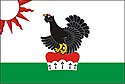 Flag 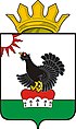 Coat of arms | |
 Location of Taborinsky District in Sverdlovsk Oblast | |
| Coordinates: 58°45′40″N 63°18′50″E / 58.761°N 63.314°E | |
| Country | Russia |
| Federal subject | Sverdlovsk Oblast[1] |
| Established | 1924 |
| Administrative center | Tabory[2] |
| Area | |
| • Total | 11,367 km2 (4,389 sq mi) |
| Population | |
| • Total | 3,574 |
| • Estimate (2018)[5] | 3,052 (−14.6%) |
| • Density | 0.31/km2 (0.81/sq mi) |
| • Urban | 0% |
| • Rural | 100% |
| Administrative structure | |
| • Inhabited localities | 34 rural localities |
| Municipal structure | |
| • Municipally incorporated as | Taborinsky Municipal District[6] |
| • Municipal divisions[6] | 0 urban settlements, 3 rural settlements |
| Time zone | UTC+5 (MSK+2 |
| OKTMO ID | 65645000 |
| Website | http://tabory.midural.ru/ |
References edit
Notes edit
- ^ a b Charter of Sverdlovsk Oblast
- ^ a b Государственный комитет Российской Федерации по статистике. Комитет Российской Федерации по стандартизации, метрологии и сертификации. №ОК 019-95 1 января 1997 г. «Общероссийский классификатор объектов административно-территориального деления. Код 65 245», в ред. изменения №278/2015 от 1 января 2016 г.. (State Statistics Committee of the Russian Federation. Committee of the Russian Federation on Standardization, Metrology, and Certification. #OK 019-95 January 1, 1997 Russian Classification of Objects of Administrative Division (OKATO). Code 65 245, as amended by the Amendment #278/2015 of January 1, 2016. ).
- ^ Error: Unable to display the reference properly. See the documentation for details.
- ^ a b c Russian Federal State Statistics Service (2011). Всероссийская перепись населения 2010 года. Том 1 [2010 All-Russian Population Census, vol. 1]. Всероссийская перепись населения 2010 года [2010 All-Russia Population Census] (in Russian). Federal State Statistics Service.
- ^ "26. Численность постоянного населения Российской Федерации по муниципальным образованиям на 1 января 2018 года". Federal State Statistics Service. Retrieved January 23, 2019.
- ^ a b c Law #85-OZ
- ^ "Об исчислении времени". Официальный интернет-портал правовой информации (in Russian). June 3, 2011. Retrieved January 19, 2019.
- ^ Federal State Statistics Service (May 21, 2004). Численность населения России, субъектов Российской Федерации в составе федеральных округов, районов, городских поселений, сельских населённых пунктов – районных центров и сельских населённых пунктов с населением 3 тысячи и более человек [Population of Russia, Its Federal Districts, Federal Subjects, Districts, Urban Localities, Rural Localities—Administrative Centers, and Rural Localities with Population of Over 3,000] (XLS). Всероссийская перепись населения 2002 года [All-Russia Population Census of 2002] (in Russian).
- ^ Всесоюзная перепись населения 1989 г. Численность наличного населения союзных и автономных республик, автономных областей и округов, краёв, областей, районов, городских поселений и сёл-райцентров [All Union Population Census of 1989: Present Population of Union and Autonomous Republics, Autonomous Oblasts and Okrugs, Krais, Oblasts, Districts, Urban Settlements, and Villages Serving as District Administrative Centers]. Всесоюзная перепись населения 1989 года [All-Union Population Census of 1989] (in Russian). Институт демографии Национального исследовательского университета: Высшая школа экономики [Institute of Demography at the National Research University: Higher School of Economics]. 1989 – via Demoscope Weekly.
Sources edit
- Областная Дума Законодательного Собрания Свердловской области. №105-ОЗ 23 декабря 2010 г. «Устав Свердловской обласит», в ред. Закона №56-ОЗ от 30 июня 2014 г. «О внесении изменений в Устав Свердловской области». Вступил в силу через 10 дней после официального опубликования (4 января 2011 г.), за исключением отдельных положений, вступивших в силу в иные сроки. Опубликован: "Областная газета", №466–467, 24 декабря 2010 г.. (Oblast Duma of the Legislative Assembly of Sverdlovsk Oblast. #105-OZ December 23, 2010 Charter of Sverdlovsk Oblast, as amended by the Law #56-OZ of June 30, 2014 On Amending the Charter of Sverdlovsk Oblast. Effective as of the day which is 10 days after the official publication date (January 4, 2011), with the exception of certain clauses which took effect on different dates.).
- Областная Дума Законодательного Собрания Свердловской области. Закон №85-ОЗ от 12 июля 2007 г. «О границах муниципальных образований, расположенных на территории Свердловской области», в ред. Закона №107-ОЗ от 29 октября 2013 г. «Об упразднении отдельных населённых пунктов, расположенных на территории города Ивделя, и о внесении изменений в Приложение 39 к Закону Свердловской области "О границах муниципальных образований, расположенных на территории Свердловской области"». Вступил в силу через 10 дней после официального опубликования. Опубликован: "Областная газета", №232–249, 17 июля 2007 г. (Oblast Duma of the Legislative Assembly of Sverdlovsk Oblast. Law #85-OZ of July 12, 2007 On the Borders of the Municipal Formations on the Territory of Sverdlovsk Oblast, as amended by the Law #107-OZ of October 29, 2013 On Abolishing Several Inhabited Localities on the Territory of the Town of Ivdul and on Amending the Law of Sverdlovsk Oblast "On the Borders of the Municipal Formations on the Territory of Sverdlovsk Oblast". Effective as of the day which is 10 days after the official publication.).