


Summary
Tago, officially the Municipality of Tago (Surigaonon: Lungsod nan Tago; Tagalog: Bayan ng Tago), is a 2nd class municipality in the province of Surigao del Sur, Philippines. According to the 2020 census, it has a population of 39,831 people.[3]
Tago | |
|---|---|
| Municipality of Tago | |
 Flag | |
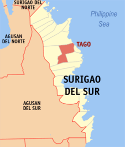 Map of Surigao del Sur with Tago highlighted | |
OpenStreetMap .mw-parser-output .locmap .od{position:absolute}.mw-parser-output .locmap .id{position:absolute;line-height:0}.mw-parser-output .locmap .l0{font-size:0;position:absolute}.mw-parser-output .locmap .pv{line-height:110%;position:absolute;text-align:center}.mw-parser-output .locmap .pl{line-height:110%;position:absolute;top:-0.75em;text-align:right}.mw-parser-output .locmap .pr{line-height:110%;position:absolute;top:-0.75em;text-align:left}.mw-parser-output .locmap .pv>div{display:inline;padding:1px}.mw-parser-output .locmap .pl>div{display:inline;padding:1px;float:right}.mw-parser-output .locmap .pr>div{display:inline;padding:1px;float:left}html.skin-theme-clientpref-night .mw-parser-output .od,html.skin-theme-clientpref-night .mw-parser-output .od .pv>div,html.skin-theme-clientpref-night .mw-parser-output .od .pl>div,html.skin-theme-clientpref-night .mw-parser-output .od .pr>div{background:#000;color:#fff}html.skin-theme-clientpref-night .mw-parser-output .locmap{filter:grayscale(0.6)}@media(prefers-color-scheme:dark){html.skin-theme-clientpref-os .mw-parser-output .locmap{filter:grayscale(0.6)}html.skin-theme-clientpref-os .mw-parser-output .od,html.skin-theme-clientpref-os .mw-parser-output .od .pv>div,html.skin-theme-clientpref-os .mw-parser-output .od .pl>div,html.skin-theme-clientpref-os .mw-parser-output .od .pr>div{background:#000;color:#fff}}  Tago Location within the Philippines | |
| Coordinates: 9°01′09″N 126°14′00″E / 9.0192°N 126.2333°E | |
| Country | Philippines |
| Region | Caraga |
| Province | Surigao del Sur |
| District | 1st district |
| Founded | November 6, 1918 |
| Barangays | 24 (see Barangays) |
| Government | |
| • Type | Sangguniang Bayan |
| • Mayor | Betty E. Pimentel |
| • Vice Mayor | Henrich M. Pimentel |
| • Representative | Romeo S. Momo Sr. |
| • Electorate | 28,901 voters (2022) |
| Area | |
| • Total | 253.28 km2 (97.79 sq mi) |
| Elevation | 6.0 m (19.7 ft) |
| Highest elevation | 87 m (285 ft) |
| Lowest elevation | 0 m (0 ft) |
| Population (2020 census)[3] | |
| • Total | 39,831 |
| • Density | 160/km2 (410/sq mi) |
| • Households | 9,285 |
| Economy | |
| • Income class | 2nd municipal income class |
| • Poverty incidence | 29.69 |
| • Revenue | ₱ 161.3 million (2020) |
| • Assets | ₱ 364.8 million (2020) |
| • Expenditure | ₱ 138.1 million (2020) |
| • Liabilities | ₱ 138.9 million (2020) |
| Service provider | |
| • Electricity | Surigao del Sur 2 Electric Cooperative (SURSECO 2) |
| Time zone | UTC+8 (PST) |
| ZIP code | 8302 |
| PSGC | 166818000 |
| IDD : area code | +63 (0)86 |
| Native languages | Surigaonon Agusan Cebuano Tagalog |
| Website | www |
History edit
The Municipality of Tago was born thrice because of the precariousness of political times back then. It saw the light of day for the first time in 1865 under the Maura Law of the Spanish Regime that lasted for three years. Tago must have reverted to its barrio status because records had it that for the second time, it regained its municipal status on August 23, 1883, just after it transferred from the so-called Daan Lungsod (Old Town), which was perennially flooded, to the place called Laguna. When the Philippine Revolution broke out in 1896, Tago was again reverted to its barrio status.
About the middle of the First World War, the people of Tago grew politically minded and in the summer of 1916, important leaders of then Barrio of Tago like Catalino Pareja, Calixtro Espinoza, Simon Luna, Miguel Montero, Juan L. Garcia, Feleciano Arquiza, Juan Pimentel, Lorenzo Elizalde, Canuto Consuegra, Lino Montero, Isidro Garcia, Pastor Cabrera, Bernardo Falcon, Felipe Lozada and Felix Rodrigues were determined to wrestle Tago's political independence away from the mother Municipality of Tandag.
This breed of local leaders then submitted a duly signed petition to the Municipal Council of Tandag. But wanting the petition to gain more support, Catalino Pareja, along with councilors Lino Montero, Isidro Garcia and Zacarias Espinoza, sent the resolution directly to the Provincial Board of Surigao which in turn endorsed it to the Governor General in Manila.
The crude transportation system during that time made the Provincial Governor Ricardo Gonzales incur delays in sending the petition to Governor General Francis Burton Harrison. But faced with numerous pressing matters to attend to, Harrison issued Executive Order No. 41 only on November 6, 1918, thus converting Tago, for the third time, from being a barrio to a newborn town.
Appointed Municipal President effective January 1, 1919, was then Councilor Catalino Pareja with Calixtro Espinoza as Vice Municipal President while Messrs. Feleciano Arquiza, Juan L. Garcia, Lorenzo Elizalde and Canuto Consuegra were appointed as Municipal Councilors. On the same year, the first election was conducted and Catalino Pareja and Lino Montero were elected as Municipal President and Vice Municipal President respectively.
Reverend Father Nose Croonin was Tago's Parish Priest at that time.
During much of World War II Tago remained free from Japanese occupation. In late April 1944 the Japanese occupied Tago. The Japanese caused much damage there when their first patrol entered town. In early May guerrillas affiliated with the 10th Military District of the U.S. Army attacked the Japanese. Eight Japanese were killed, but the guerrillas were unable to dislodge them. The Japanese remained until 1945 and left many houses destroyed.[5][6]
The Luna's, Elizalde, Falcon, Montero and Pimentel are the prominent family in Tago.
Geography edit
Tago is located in the central part of Surigao del Sur facing the Pacific Ocean. It lies between 126 degrees 12 minutes longitude and 9 degrees minutes north latitude. It is bounded on the north by the Capital Town of Tandag, on the north-west by Municipality of Lanuza, on the west by Municipality of San Miguel, on the southeast by the Municipality of Bayabas and on the south by the Municipalities of Cagwait and Marihatag.
Land area edit
Tago sits on a 343.52 km2 of land which is about 7.55% of the total area of Surigao del Sur. In terms of area, Barangay Cabangahan is the largest with 20% of Tago's land area while Barangay Purisima is the smallest with 1.51%.
Soil edit
Tago's soil types vary; along the shoreline is sandy. Barangays Victoria and Dayoan have Bantug clay; Barangays Gamut, Kinabigtasan, Sumo-Sumo, Adlay and Anahao Daan have Butuan clay; while Bajao, Alba, Cayale, Bangsud and Anahao Bag-o have silt loam. Matho clay can be found in most of the mountain ranges from the seashore to the boundaries of Tandag-Tago and Tago-San Miguel.
Slope edit
Roughly 50% of Tago's land area is relatively flat terrain (0-3%) while roughly 30%, mostly in the north-western portion, are steep mountains.
Climate edit
| Climate data for Tago | |||||||||||||
|---|---|---|---|---|---|---|---|---|---|---|---|---|---|
| Month | Jan | Feb | Mar | Apr | May | Jun | Jul | Aug | Sep | Oct | Nov | Dec | Year |
| Mean daily maximum °C (°F) | 28.9 (84.0) |
29.0 (84.2) |
29.9 (85.8) |
31.0 (87.8) |
31.7 (89.1) |
31.8 (89.2) |
31.7 (89.1) |
31.9 (89.4) |
31.9 (89.4) |
31.4 (88.5) |
30.5 (86.9) |
29.5 (85.1) |
30.8 (87.4) |
| Daily mean °C (°F) | 25.5 (77.9) |
25.6 (78.1) |
26.2 (79.2) |
27.0 (80.6) |
27.6 (81.7) |
27.6 (81.7) |
27.4 (81.3) |
27.6 (81.7) |
27.5 (81.5) |
27.2 (81.0) |
26.7 (80.1) |
26.0 (78.8) |
26.8 (80.3) |
| Mean daily minimum °C (°F) | 22.2 (72.0) |
22.2 (72.0) |
22.5 (72.5) |
23.0 (73.4) |
23.6 (74.5) |
23.4 (74.1) |
23.2 (73.8) |
23.4 (74.1) |
23.2 (73.8) |
23.1 (73.6) |
22.9 (73.2) |
22.6 (72.7) |
22.9 (73.3) |
| Average rainfall mm (inches) | 747 (29.4) |
629 (24.8) |
470 (18.5) |
335 (13.2) |
256 (10.1) |
180 (7.1) |
180 (7.1) |
150 (5.9) |
166 (6.5) |
210 (8.3) |
455 (17.9) |
638 (25.1) |
4,416 (173.9) |
| Source: Climate-Data.org[7] | |||||||||||||
Tago has a tropical rainforest climate (Af) with heavy to very heavy rainfall year-round and with extremely heavy rainfall in January.
Barangays edit
Tago is politically subdivided into 24 barangays. Each barangay consists of puroks while some have sitios.
- Alba
- Anahao Bag-o
- Anahao Daan
- Badong
- Bajao
- Bangsud
- Cabangahan
- Cagdapao
- Camagong
- Caras-an
- Cayale
- Dayo-an
- Gamut
- Jubang
- Kinabigtasan
- Layog
- Lindoy
- Mercedes
- Purisima (Poblacion)
- Sumo-sumo
- Umbay
- Unaban
- Unidos
- Victoria
Demographics edit
| Year | Pop. | ±% p.a. |
|---|---|---|
| 1903 | 5,172 | — |
| 1939 | 15,271 | +3.05% |
| 1948 | 23,036 | +4.67% |
| 1960 | 21,346 | −0.63% |
| 1970 | 17,550 | −1.94% |
| 1975 | 19,693 | +2.34% |
| 1980 | 21,192 | +1.48% |
| 1990 | 23,987 | +1.25% |
| 1995 | 27,100 | +2.31% |
| 2000 | 29,721 | +2.00% |
| 2007 | 31,342 | +0.74% |
| 2010 | 33,993 | +3.00% |
| 2015 | 35,329 | +0.74% |
| 2020 | 39,831 | +2.39% |
| Source: Philippine Statistics Authority[8][9][10][11] | ||
Tago recorded an average growth rate of 2.3% from 1980 to 1990. But because of out-migration arising from lack of job opportunities, it had gone down to 1.86% between the periods 1995 and 2000. Among the barangays, Victoria registered the highest growth rate at 6.12% due to in-migration, the area being home to the Surigao del Sur Polytechnic State College while Barangay Mercedes posted a negative growth (-0.28%).
Population density edit
Population density is placed at 86 persons per km2. Barangay Purisima is the most densely populated with 1,137 persons per km2, higher than the municipal density. Barangay Umbay has the lowest population density with 16 persons per km2.
Economy edit
Tourism edit
- Haguisan Kalipayan Hill - an eco-retreat resort and restaurant that offers dining, cottages and function rooms for events/weddings.
- Tago River
- Tago-La Paz Bridge
- Tago Plaza and Pagoda
- Tago Town Hall
- La Purisima Concepcion Parish Church
- Cagpangi Falls
- Green Falls
- Sola Gratia
- Villa Azarcon
Education edit
Fifty-seven per cent (57%) of Tagon-ons are elementary graduates, 25% are high school graduates. Eighty-five per cent (85%) of them obtain college education but barely half of them hold academic degrees.
References edit
- ^ Municipality of Tago | (DILG)
- ^ "2015 Census of Population, Report No. 3 – Population, Land Area, and Population Density" (PDF). Philippine Statistics Authority. Quezon City, Philippines. August 2016. ISSN 0117-1453. Archived (PDF) from the original on May 25, 2021. Retrieved July 16, 2021.
- ^ a b Census of Population (2020). "Caraga". Total Population by Province, City, Municipality and Barangay. Philippine Statistics Authority. Retrieved July 8, 2021.
- ^ "PSA Releases the 2018 Municipal and City Level Poverty Estimates". Philippine Statistics Authority. December 15, 2021. Retrieved January 22, 2022.
- ^ Virginia Hansen Holmes, Guerrilla Daughter (Kent, Ohio: Kent State U. Press, 2009), pp. 127, 166.
- ^ Kent Holmes, Wendell Fertig and His Guerrilla Forces in the Philippines: Fighting the Japanese Occupation, 1942-1945 (Jefferson, N.C.: McFarland & Co., 2015), pp. 72-3.
- ^ "Climate: Tago". Climate-Data.org. Retrieved October 26, 2020.
- ^ Census of Population (2015). "Caraga". Total Population by Province, City, Municipality and Barangay. Philippine Statistics Authority. Retrieved June 20, 2016.
- ^ Census of Population and Housing (2010). "Caraga" (PDF). Total Population by Province, City, Municipality and Barangay. National Statistics Office. Retrieved June 29, 2016.
- ^ Censuses of Population (1903–2007). "Caraga". Table 1. Population Enumerated in Various Censuses by Province/Highly Urbanized City: 1903 to 2007. National Statistics Office.
{{cite encyclopedia}}: CS1 maint: numeric names: authors list (link) - ^ "Province of Surigao del Sur". Municipality Population Data. Local Water Utilities Administration Research Division. Retrieved December 17, 2016.
- ^ "Poverty incidence (PI):". Philippine Statistics Authority. Retrieved December 28, 2020.
- ^ "Estimation of Local Poverty in the Philippines" (PDF). Philippine Statistics Authority. November 29, 2005.
- ^ "2003 City and Municipal Level Poverty Estimates" (PDF). Philippine Statistics Authority. March 23, 2009.
- ^ "City and Municipal Level Poverty Estimates; 2006 and 2009" (PDF). Philippine Statistics Authority. August 3, 2012.
- ^ "2012 Municipal and City Level Poverty Estimates" (PDF). Philippine Statistics Authority. May 31, 2016.
- ^ "Municipal and City Level Small Area Poverty Estimates; 2009, 2012 and 2015". Philippine Statistics Authority. July 10, 2019.
- ^ "PSA Releases the 2018 Municipal and City Level Poverty Estimates". Philippine Statistics Authority. December 15, 2021. Retrieved January 22, 2022.
External links edit
- Tago Profile at PhilAtlas.com
- Tago Profile at the DTI Cities and Municipalities Competitive Index
- Philippine Standard Geographic Code
- Philippine Census Information
- Local Governance Performance Management System