


Summary
Taining County (simplified Chinese: 泰宁县; traditional Chinese: 泰寧縣; pinyin: Tàiníng Xiàn) is a county in the northwest of Fujian province, People's Republic of China. It is the northernmost county-level division of the prefecture-level city of Sanming.
Taining County
泰宁县 | |
|---|---|
 Tongxin Bridge (同心桥) | |
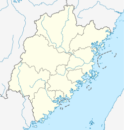 Taining Location in Fujian | |
| Coordinates: 26°54′01″N 117°10′33″E / 26.9003°N 117.1757°E | |
| Country | People's Republic of China |
| Province | Fujian |
| Prefecture-level city | Sanming |
| Area | |
| • Total | 1,535 km2 (593 sq mi) |
| Population | |
| • Total | 130,000 |
| • Density | 85/km2 (220/sq mi) |
| Time zone | UTC+8 (China Standard) |
Area: 1,535 square kilometres (593 sq mi).
Population: 130,000.[when?]
Postal Code: 354400.
The county government is located in Shancheng town.
The local dialect is a dialect of Gan Chinese, although surrounding areas speak Min Chinese.[citation needed]
Transportation edit
Climate edit
| Climate data for Taining (1991–2020 normals, extremes 1981–2010) | |||||||||||||
|---|---|---|---|---|---|---|---|---|---|---|---|---|---|
| Month | Jan | Feb | Mar | Apr | May | Jun | Jul | Aug | Sep | Oct | Nov | Dec | Year |
| Record high °C (°F) | 26.9 (80.4) |
32.1 (89.8) |
32.1 (89.8) |
34.5 (94.1) |
34.8 (94.6) |
37.3 (99.1) |
39.9 (103.8) |
39.6 (103.3) |
37.5 (99.5) |
36.3 (97.3) |
31.9 (89.4) |
27.4 (81.3) |
39.9 (103.8) |
| Mean daily maximum °C (°F) | 12.8 (55.0) |
15.3 (59.5) |
18.3 (64.9) |
23.9 (75.0) |
27.7 (81.9) |
30.1 (86.2) |
33.3 (91.9) |
33.0 (91.4) |
30.3 (86.5) |
26.1 (79.0) |
20.8 (69.4) |
15.2 (59.4) |
23.9 (75.0) |
| Daily mean °C (°F) | 6.9 (44.4) |
9.4 (48.9) |
12.6 (54.7) |
17.9 (64.2) |
21.9 (71.4) |
24.9 (76.8) |
27.2 (81.0) |
26.7 (80.1) |
24.1 (75.4) |
19.3 (66.7) |
14.0 (57.2) |
8.5 (47.3) |
17.8 (64.0) |
| Mean daily minimum °C (°F) | 3.5 (38.3) |
5.7 (42.3) |
9.1 (48.4) |
14.1 (57.4) |
18.3 (64.9) |
21.5 (70.7) |
23.0 (73.4) |
22.9 (73.2) |
20.3 (68.5) |
15.1 (59.2) |
9.9 (49.8) |
4.5 (40.1) |
14.0 (57.2) |
| Record low °C (°F) | −7.1 (19.2) |
−5.1 (22.8) |
−4.8 (23.4) |
2.0 (35.6) |
7.5 (45.5) |
11.9 (53.4) |
18.2 (64.8) |
16.2 (61.2) |
10.9 (51.6) |
2.2 (36.0) |
−3.6 (25.5) |
−10.6 (12.9) |
−10.6 (12.9) |
| Average precipitation mm (inches) | 79.5 (3.13) |
107.4 (4.23) |
228.8 (9.01) |
221.1 (8.70) |
287.8 (11.33) |
346.2 (13.63) |
160.6 (6.32) |
167.1 (6.58) |
82.7 (3.26) |
54.5 (2.15) |
79.5 (3.13) |
61.3 (2.41) |
1,876.5 (73.88) |
| Average precipitation days (≥ 0.1 mm) | 12.5 | 14.3 | 19.5 | 17.9 | 18.8 | 19.0 | 13.0 | 15.3 | 10.6 | 7.2 | 8.8 | 9.9 | 166.8 |
| Average snowy days | 1.3 | 0.9 | 0.1 | 0 | 0 | 0 | 0 | 0 | 0 | 0 | 0 | 0.4 | 2.7 |
| Average relative humidity (%) | 85 | 85 | 86 | 84 | 84 | 85 | 79 | 82 | 81 | 80 | 83 | 83 | 83 |
| Mean monthly sunshine hours | 83.6 | 80.4 | 78.4 | 95.7 | 115.1 | 115.2 | 215.4 | 187.2 | 158.6 | 154.6 | 120.4 | 114.0 | 1,518.6 |
| Percent possible sunshine | 25 | 25 | 21 | 25 | 28 | 28 | 51 | 47 | 43 | 44 | 37 | 35 | 34 |
| Source: China Meteorological Administration[1][2] | |||||||||||||

Administrative divisions edit
Towns:[3]
- Shancheng (杉城镇), Zhukou (朱口镇), Xiaqu Town (下渠镇)
Townships:
- Xinqiao Township (新桥乡), Shangqing Township (上青乡), Datian Township (大田乡), Meikou Township (梅口乡), Kaishan Township (开善乡), Dalong Township (大龙乡)
Culture edit
Due to the presence of the Wuyi Mountains, Taining County includes a number of notable parks of various types. One of them, located in the central part of the range, after having been made a World Heritage Site, and qualifying as a UNESCO National Geopark, was certified in 2004 as a UNESCO Global Geopark in the Asia Pacific regional network.
See also edit
References edit
- ^ 中国气象数据网 – WeatherBk Data (in Simplified Chinese). China Meteorological Administration. Retrieved 23 June 2023.
- ^ 中国气象数据网 (in Simplified Chinese). China Meteorological Administration. Retrieved 23 June 2023.
- ^ "三明市-行政区划网 www.xzqh.org" (in Chinese). XZQH. Retrieved 2012-05-24.
External links edit
- Official website of Taining County government