
KNOWPIA
WELCOME TO KNOWPIA

Takata Station (Kanagawa) 
Summary
Takata Station (高田駅, Takata-eki) is a metro station located in Kōhoku Ward, Yokohama, Kanagawa Prefecture, Japan. It is served by the Yokohama Municipal Subway’s Green Line (Line 4) and is 10.3 kilometers from the terminus of the Green Line at Nakayama Station.
G08 Takata Station 高田駅 | |||||||||||
|---|---|---|---|---|---|---|---|---|---|---|---|
 | |||||||||||
| General information | |||||||||||
| Location | Takada-Higashi 3-1-3, Kōhoku, Yokohama, Kanagawa (横浜市港北区高田東三丁目1-3) Japan | ||||||||||
| Operated by | Yokohama City Transportation Bureau | ||||||||||
| Line(s) | |||||||||||
| Platforms | 2 side platforms (split platform) | ||||||||||
| Tracks | 2 | ||||||||||
| Construction | |||||||||||
| Structure type | Underground | ||||||||||
| Other information | |||||||||||
| Station code | G08 | ||||||||||
| History | |||||||||||
| Opened | 30 March 2008 | ||||||||||
| Passengers | |||||||||||
| 2008 | 4,125 daily | ||||||||||
| Services | |||||||||||
| |||||||||||
| Location | |||||||||||
 Takata Station Location within Yokohama 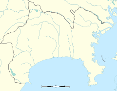 Takata Station Takata Station (Kanagawa Prefecture)  Takata Station Takata Station (Japan) | |||||||||||
History edit
Takata Station opened on March 30, 2008, when the Green Line started operation.
Lines edit
Station layout edit
Takata Station has two single underground split platforms. Platform 1 is located on the third story underground, and serves traffic in the direction of Hiyoshi. Platform 2 is located one level below, four stories underground, and serves traffic in the direction of Nakayama.
Platforms edit
| 1 | ■ Green Line | Center-Minami ・Nakayama |
| 2 | ■ Green Line | Hiyoshi |
References edit
- Harris, Ken and Clarke, Jackie. Jane's World Railways 2008-2009. Jane's Information Group (2008). ISBN 0-7106-2861-7
External links edit
- Takata Station (Japanese)
![]() Media related to Takata Station (Kanagawa) at Wikimedia Commons
Media related to Takata Station (Kanagawa) at Wikimedia Commons
35°32′58.65″N 139°37′12.49″E / 35.5496250°N 139.6201361°E