


Summary
Talayan, officially the Municipality of Talayan (Maguindanaon: Ingud nu Talayan; Iranun: Inged a Talayan; Tagalog: Bayan ng Talayan), is a 4th class municipality in the province of Maguindanao del Sur, Philippines. According to the 2020 census, it has a population of 34,156 people.[3]
Talayan | |
|---|---|
| Municipality of Talayan | |
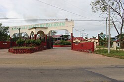 Municipal Compound | |
 Flag  Seal | |
 Map of Maguindanao del Sur with Talayan highlighted | |
OpenStreetMap .mw-parser-output .locmap .od{position:absolute}.mw-parser-output .locmap .id{position:absolute;line-height:0}.mw-parser-output .locmap .l0{font-size:0;position:absolute}.mw-parser-output .locmap .pv{line-height:110%;position:absolute;text-align:center}.mw-parser-output .locmap .pl{line-height:110%;position:absolute;top:-0.75em;text-align:right}.mw-parser-output .locmap .pr{line-height:110%;position:absolute;top:-0.75em;text-align:left}.mw-parser-output .locmap .pv>div{display:inline;padding:1px}.mw-parser-output .locmap .pl>div{display:inline;padding:1px;float:right}.mw-parser-output .locmap .pr>div{display:inline;padding:1px;float:left}html.skin-theme-clientpref-night .mw-parser-output .od,html.skin-theme-clientpref-night .mw-parser-output .od .pv>div,html.skin-theme-clientpref-night .mw-parser-output .od .pl>div,html.skin-theme-clientpref-night .mw-parser-output .od .pr>div{background:#000;color:#fff}html.skin-theme-clientpref-night .mw-parser-output .locmap{filter:grayscale(0.6)}@media(prefers-color-scheme:dark){html.skin-theme-clientpref-os .mw-parser-output .locmap{filter:grayscale(0.6)}html.skin-theme-clientpref-os .mw-parser-output .od,html.skin-theme-clientpref-os .mw-parser-output .od .pv>div,html.skin-theme-clientpref-os .mw-parser-output .od .pl>div,html.skin-theme-clientpref-os .mw-parser-output .od .pr>div{background:#000;color:#fff}}  Talayan Location within the Philippines | |
| Coordinates: 6°59′04″N 124°21′23″E / 6.98445°N 124.356383°E | |
| Country | Philippines |
| Region | Bangsamoro Autonomous Region in Muslim Mindanao |
| Province | Maguindanao del Sur |
| District | Lone district |
| Founded | September 22, 1976 |
| Barangays | 15 (see Barangays) |
| Government | |
| • Type | Sangguniang Bayan |
| • Mayor | Tungkang A. Midtimbang |
| • Vice Mayor | Datu Ali S. Midtimbang Jr. |
| • Representative | Mohamad P. Paglas Sr. |
| • Municipal Council | Members |
| • Electorate | 18,163 voters (2022) |
| Area | |
| • Total | 143.84 km2 (55.54 sq mi) |
| Elevation | 34 m (112 ft) |
| Highest elevation | 179 m (587 ft) |
| Lowest elevation | 3 m (10 ft) |
| Population (2020 census)[3] | |
| • Total | 34,156 |
| • Density | 240/km2 (620/sq mi) |
| • Households | 5,400 |
| Economy | |
| • Income class | 4th municipal income class |
| • Poverty incidence | 70.83 |
| • Revenue | ₱ 123.7 million (2020) |
| • Assets | ₱ 152.5 million (2020) |
| • Expenditure | ₱ 127.1 million (2020) |
| • Liabilities | ₱ 43 million (2020) |
| Service provider | |
| • Electricity | Maguindanao Electric Cooperative (MAGELCO) |
| Time zone | UTC+8 (PST) |
| ZIP code | 9612 |
| PSGC | 153816000 |
| IDD : area code | +63 (0)64 |
| Native languages | Maguindanao Tagalog |
| Website | www |
Talayan was created through Presidential Decree No. 1009 by then President Ferdinand Marcos on September 22, 1976.[5] It was carved from the municipalities of Datu Piang and Dinaig (now Datu Odin Sinsuat).
Datu Udzag Midtimbang was the first appointed mayor of entire Talayan now divided into 4 municipalities, Talitay, Datu Anggal, Talayan and Guindulungan. followed by a younger brother Datu Antao, and now Datu Ali. With these leaders, Talayan now and then remains as a place for everybody. Many projects now serve the public like concrete roads and lights in every home. A new public market is now being constructed under the leadership of Mayor Hadji Datu Ali.
Geography edit
Barangays edit
Talayan is politically subdivided into 15 barangays. Each barangay consists of puroks while some have sitios.
- Boboguiron
- Damablac
- Fugotan
- Fukol
- Katibpuan
- Kedati
- Lanting
- Linamunan
- Marader
- Binangga North
- Binangga South
- Talayan
- Tamar
- Tambunan I
- Timbaluan
Climate edit
| Climate data for Talayan, Maguindanao | |||||||||||||
|---|---|---|---|---|---|---|---|---|---|---|---|---|---|
| Month | Jan | Feb | Mar | Apr | May | Jun | Jul | Aug | Sep | Oct | Nov | Dec | Year |
| Mean daily maximum °C (°F) | 31 (88) |
32 (90) |
32 (90) |
32 (90) |
31 (88) |
29 (84) |
29 (84) |
29 (84) |
30 (86) |
30 (86) |
30 (86) |
31 (88) |
31 (87) |
| Mean daily minimum °C (°F) | 21 (70) |
21 (70) |
21 (70) |
23 (73) |
23 (73) |
23 (73) |
23 (73) |
23 (73) |
23 (73) |
23 (73) |
23 (73) |
22 (72) |
22 (72) |
| Average precipitation mm (inches) | 30 (1.2) |
19 (0.7) |
25 (1.0) |
24 (0.9) |
64 (2.5) |
88 (3.5) |
102 (4.0) |
105 (4.1) |
76 (3.0) |
82 (3.2) |
60 (2.4) |
26 (1.0) |
701 (27.5) |
| Average rainy days | 9.8 | 8.5 | 11.3 | 11.9 | 21.6 | 23.9 | 24.1 | 24.5 | 20.9 | 21.8 | 16.8 | 11.8 | 206.9 |
| Source: Meteoblue (modeled/calculated data, not measured locally)[6] | |||||||||||||
Demographics edit
| Year | Pop. | ±% p.a. |
|---|---|---|
| 1980 | 18,130 | — |
| 1990 | 42,327 | +8.85% |
| 1995 | 43,286 | +0.42% |
| 2000 | 33,129 | −5.57% |
| 2007 | 25,753 | −3.41% |
| 2010 | 16,042 | −15.82% |
| 2015 | 30,032 | +12.68% |
| 2020 | 34,156 | +2.56% |
| Source: Philippine Statistics Authority[7][8][9] | ||
Economy edit
References edit
- ^ Municipality of Talayan | (DILG)
- ^ "2015 Census of Population, Report No. 3 – Population, Land Area, and Population Density" (PDF). Philippine Statistics Authority. Quezon City, Philippines. August 2016. ISSN 0117-1453. Archived (PDF) from the original on May 25, 2021. Retrieved July 16, 2021.
- ^ a b Census of Population (2020). "Bangsamoro (BARMM)". Total Population by Province, City, Municipality and Barangay. Philippine Statistics Authority. Retrieved 8 July 2021.
- ^ "PSA Releases the 2018 Municipal and City Level Poverty Estimates". Philippine Statistics Authority. 15 December 2021. Retrieved 22 January 2022.
- ^ "Presidential Decree No. 1009, s. 1976 | GOVPH". 22 September 1976.
- ^ "Talayan, Maguindanao: Average Temperatures and Rainfall". Meteoblue. Retrieved 19 January 2019.
- ^ Census of Population (2015). "ARMM – Autonomous Region in Muslim Mindanao". Total Population by Province, City, Municipality and Barangay. Philippine Statistics Authority. Retrieved 20 June 2016.
- ^ Census of Population and Housing (2010). "ARMM – Autonomous Region in Muslim Mindanao" (PDF). Total Population by Province, City, Municipality and Barangay. National Statistics Office. Retrieved 29 June 2016.
- ^ Censuses of Population (1903–2007). "ARMM – Autonomous Region in Muslim Mindanao". Table 1. Population Enumerated in Various Censuses by Province/Highly Urbanized City: 1903 to 2007. National Statistics Office.
{{cite encyclopedia}}: CS1 maint: numeric names: authors list (link) - ^ "Poverty incidence (PI):". Philippine Statistics Authority. Retrieved December 28, 2020.
- ^ "Estimation of Local Poverty in the Philippines" (PDF). Philippine Statistics Authority. 29 November 2005.
- ^ "2003 City and Municipal Level Poverty Estimates" (PDF). Philippine Statistics Authority. 23 March 2009.
- ^ "City and Municipal Level Poverty Estimates; 2006 and 2009" (PDF). Philippine Statistics Authority. 3 August 2012.
- ^ "2012 Municipal and City Level Poverty Estimates" (PDF). Philippine Statistics Authority. 31 May 2016.
- ^ "Municipal and City Level Small Area Poverty Estimates; 2009, 2012 and 2015". Philippine Statistics Authority. 10 July 2019.
- ^ "PSA Releases the 2018 Municipal and City Level Poverty Estimates". Philippine Statistics Authority. 15 December 2021. Retrieved 22 January 2022.
External links edit
- Talayan Profile at the DTI Cities and Municipalities Competitive Index
- Philippine Standard Geographic Code
- 2000 Philippine Census Information
- Local Governance Performance Management System