
KNOWPIA
WELCOME TO KNOWPIA

Tambolaka 
Summary
Kota Tambolaka (Tambolaka city) is the administrative capital of the Southwest Sumba Regency (Kabupaten Sumba Barat Daya), on the island of Sumba, East Nusa Tenggara province of Indonesia. Tambolaka was in fact the name of the airport, the real former name of the city being Waitabula (sometimes written Weetabula).
Tambolaka (Waitabula) | |
|---|---|
 Tambolaka (Waitabula) Location in Indonesia 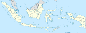 Tambolaka (Waitabula) Tambolaka (Waitabula) (Indonesia) | |
| Coordinates: 9°26′S 119°14′E / 9.433°S 119.233°E | |
| Country | Indonesia |
| Region | Lesser Sunda Islands |
| Province | East Nusa Tenggara |
| Regency | Southwest Sumba |
| Area | |
| • Total | 98.95 km2 (38.20 sq mi) |
| Population (2020 Census) | |
| • Total | 35,790 |
| • Metro density | 361.7/km2 (937/sq mi) |
| [1] | |
| Time zone | UTC+8 (WITA / UTC) |
Climate edit
Tambolaka has a tropical savanna climate (Köppen Aw) with moderate to little rainfall from May to November and heavy rainfall from December to April.
| Climate data for Tambolaka | |||||||||||||
|---|---|---|---|---|---|---|---|---|---|---|---|---|---|
| Month | Jan | Feb | Mar | Apr | May | Jun | Jul | Aug | Sep | Oct | Nov | Dec | Year |
| Mean daily maximum °C (°F) | 30.7 (87.3) |
30.1 (86.2) |
30.7 (87.3) |
31.1 (88.0) |
30.7 (87.3) |
30.2 (86.4) |
30.1 (86.2) |
30.6 (87.1) |
31.3 (88.3) |
31.9 (89.4) |
31.5 (88.7) |
30.9 (87.6) |
30.8 (87.5) |
| Daily mean °C (°F) | 25.7 (78.3) |
25.3 (77.5) |
25.7 (78.3) |
25.6 (78.1) |
25.0 (77.0) |
24.3 (75.7) |
23.6 (74.5) |
23.9 (75.0) |
24.8 (76.6) |
25.9 (78.6) |
26.3 (79.3) |
25.9 (78.6) |
25.2 (77.3) |
| Mean daily minimum °C (°F) | 20.7 (69.3) |
20.6 (69.1) |
20.7 (69.3) |
20.2 (68.4) |
19.4 (66.9) |
18.4 (65.1) |
17.2 (63.0) |
17.3 (63.1) |
18.4 (65.1) |
19.9 (67.8) |
21.2 (70.2) |
21.0 (69.8) |
19.6 (67.3) |
| Average rainfall mm (inches) | 301 (11.9) |
280 (11.0) |
233 (9.2) |
133 (5.2) |
65 (2.6) |
47 (1.9) |
19 (0.7) |
17 (0.7) |
19 (0.7) |
44 (1.7) |
70 (2.8) |
236 (9.3) |
1,464 (57.7) |
| Source: Climate-Data.org[2] | |||||||||||||
Transportation edit
The town is served by Tambolaka Airport.
References edit