


Summary
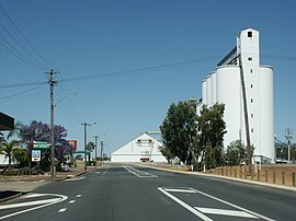
Tammin is a town in the central agricultural region of Western Australia, 184 kilometres (114 mi) east of Perth[2] and midway between the towns of Cunderdin and Kellerberrin on the Great Eastern Highway.
| Tammin Western Australia | |
|---|---|
 Tammin townsite | |
 Tammin | |
 | |
| Coordinates | 31°38′00″S 117°29′00″E / 31.63333°S 117.48333°E |
| Population | 129 (SAL 2021)[1] |
| Established | 1899 |
| Postcode(s) | 6409 |
| Elevation | 311 m (1,020 ft) |
| Area | 0.8 km2 (0.31 sq mi) |
| Location |
|
| LGA(s) | Shire of Tammin |
| State electorate(s) | Central Wheatbelt |
| Federal division(s) | Durack |
The surrounding areas produce wheat and other cereal crops. The town is a receival site for Cooperative Bulk Handling.[3]
It also serves as a stop on the Prospector and MerredinLink rural train services.
History edit
The first European to settle in the area was John Packham in 1893. The railway to Southern Cross was constructed through the area in 1894–95, and Tammin was one of the original stations when the line opened in 1895. As the surrounding area developed for agriculture, there was sufficient demand for land in the area for the government to declare a townsite, and Tammin townsite was gazetted in 1899.
Tammin is an Aboriginal name derived from the nearby Tammin Rock, a name first recorded by the explorer Charles Cooke Hunt in 1864. The rock possibly derives its name from the "Tammar", the Aboriginal name of the "black gloved wallaby", which was once found in this area. Another source records it as possibly meaning "a grandmother or a grandfather".
The local Agricultural Hall was opened in 1911 by the Minister of Agriculture.[4]
In 1932 the Wheat Pool of Western Australia announced that the town would have two grain elevators, each fitted with an engine, installed at the railway siding.[5]
Rail services edit
Transwa's MerredinLink and Prospector services stop at Tammin, at least one service each day.[6][7]
| Preceding station | Following station | |||
|---|---|---|---|---|
| Cunderdin towards East Perth
|
MerredinLink | Kellerberrin towards Merredin
| ||
| Prospector | Kellerberrin towards Kalgoorlie
| |||
References edit
- ^ Australian Bureau of Statistics (28 June 2022). "Tammin (suburb and locality)". Australian Census 2021 QuickStats. Retrieved 28 June 2022.
- ^ "Shire of Tammin Website". 2006. Retrieved 14 September 2008.
- ^ "CBH receival sites" (PDF). 2011. Archived from the original (PDF) on 18 March 2012. Retrieved 1 April 2013.
- ^ "Country". The West Australian. Perth: National Library of Australia. 22 June 1911. p. 5. Retrieved 2 October 2013.
- ^ "Country elevators". The West Australian. Perth: National Library of Australia. 6 July 1932. p. 10. Retrieved 6 April 2013.
- ^ "AvonLink and MerredinLink Timetable" (PDF). Transwa. Public Transport Authority. Archived (PDF) from the original on 13 March 2020. Retrieved 28 June 2020.
- ^ "Prospector Timetable" (PDF). Transwa. Public Transport Authority. Archived (PDF) from the original on 18 June 2020. Retrieved 28 June 2020.
"History of country town names – T". Western Australian Land Information Authority. Archived from the original on 14 March 2022. Retrieved 2 October 2008.