


Summary
Tapachula International Airport (Spanish: Aeropuerto Internacional de Tapachula) (IATA: TAP, ICAO: MMTP) is an international airport located in Tapachula, Chiapas, Mexico, near the Mexico–Guatemala border. It serves the Metropolitan Area of Tapachula and the Soconusco region, facilitating multiple domestic destinations, flight training, and general aviation activities. Operated by Grupo Aeroportuario del Sureste (ASUR), it holds the distinction of being the southernmost airport in Mexico. In 2022, it served 503,254 passengers, and this number increased to 553,744 passengers in 2023.[1]
Tapachula International Airport Aeropuerto Internacional de Tapachula | |||||||||||
|---|---|---|---|---|---|---|---|---|---|---|---|
 | |||||||||||
| Summary | |||||||||||
| Airport type | Public | ||||||||||
| Operator | Grupo Aeroportuario del Sureste | ||||||||||
| Serves | Tapachula, Chiapas, Mexico | ||||||||||
| Time zone | CST (UTC-06:00) | ||||||||||
| Elevation AMSL | 30 m / 98 ft | ||||||||||
| Coordinates | 14°47′40″N 092°22′12″W / 14.79444°N 92.37000°W | ||||||||||
| Website | www | ||||||||||
| Map | |||||||||||
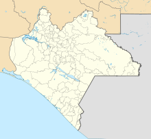 TAP Location of the airport in Chiapas 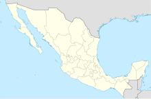 TAP TAP (Mexico) | |||||||||||
| Runways | |||||||||||
| |||||||||||
| Statistics (2023) | |||||||||||
| |||||||||||
Source: Grupo Aeroportuario del Sureste[1] | |||||||||||


Facilities edit
Tapachula Airport is situated at an elevation of 30 metres (98 ft) above sea level and features a 2,200 metres (7,200 ft) asphalt runway. With an ICAO classification of 4D, the airport has a capacity for 18 operations per hour. The apron includes 3 C-type disembarkation hardstands and 1 D-type.
The terminal spans 3,783 square metres (40,720 sq ft) within a two-level structure. The lower level houses essential services such as the check-in area, an arrivals hall with a baggage claim area, immigration and customs facilities, car rental services, taxi stands, and snack bars. Upstairs, the upper floor features a security checkpoint and the departures concourse, offering a commercial area, bars, a VIP lounge, and four gates—two of which are equipped with jet bridges. Adjacent to the terminal, additional facilities include hangars and designated spaces for general aviation.
Tapachula Airport also hosts the Tapachula Naval Air Base, situated near the threshold of runway 23. This base comprises an apron spanning 10,000 square metres (110,000 sq ft), 1 heliport, and 3 hangars. Operating from this base are the 4th Naval Patrol Air Squadron with Mil Mi-17 aircraft and the 4th Naval Air Mobility, Observation, and Transport Squadron with Maule MX-7 and Lancair ES aircraft.

Airlines and destinations edit

Passenger edit
| Airlines | Destinations |
|---|---|
| Aeroméxico | Mexico City |
| Aeroméxico Connect | Mexico City |
| Viva Aerobus | Monterrey |
| Volaris | Mexico City, Monterrey, Tijuana |
Destinations map edit
class=notpageimage| Destinations from Tapachula International Airport Red = Year-round destination Blue = Future destination Green = Seasonal destination |
Statistics edit
Passengers edit
Busiest routes edit
| Rank | City | Passengers | Ranking | Airline |
|---|---|---|---|---|
| 1 | 202,411 | Aeroméxico, Aeroméxico Connect, Volaris | ||
| 2 | 43,484 | Volaris | ||
| 3 | 31,148 | Volaris | ||
| 4 | 16,333 | Viva Aerobus, Volaris |
See also edit
References edit
External links edit
 Media related to Tapachula International Airport at Wikimedia Commons
- Official website
- Grupo Aeroportuario del Sureste ASUR
- Tapachula Airport information at Great Circle Mapper
- Aeronautical chart and airport information for MMTP at SkyVector
- Current weather for MMTP at NOAA/NWS
- Accident history for TAP at Aviation Safety Network