
KNOWPIA
WELCOME TO KNOWPIA

Terjola 
Summary
Terjola (Georgian: თერჯოლა) is a town in Imereti, Georgia, serving as an administrative center of the homonymous district.
Terjola
თერჯოლა | |
|---|---|
 Terjola sport's palace | |
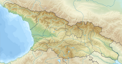 Terjola Location of Terjola in Georgia  Terjola Terjola (Imereti) | |
| Coordinates: 42°11′00″N 42°58′38″E / 42.18333°N 42.97722°E | |
| Country | |
| Mkhare | Imereti |
| District | Terjola |
| Elevation | 170 m (560 ft) |
| Population (2014) | |
| • Total | 4,644 |
| Time zone | UTC+4 (Georgian Time) |
| Climate | Cfa |
 | |
Terjola is situated in the Imereti Lowlands in western Georgia, on the right bank of the Chkhara river.[1] It lies on the Tbilisi-Zestaponi highway, 190 km northwest of Tbilisi and 14 km northwest of Zestaponi. Its population is 4,644.[2]
Terjola is first mentioned in the 17th-century sources. It acquired the status of a town in 1983.
There are a series of historical and cultural landmarks in the environs of Terjola such as the Skande fortress, the ruins of the Gogni fort and church, and the Chkhalti church complex with its numerous antiquities now displayed in the museums of Georgia.
Notable natives edit
- Mirian Giorgadze (born 1976), Greco-Roman wrestler